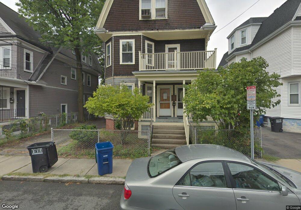
68 Pearson Ave Somerville, MA 02144
Ball Square NeighborhoodEstimated Value: $1,669,000
8
Beds
3
Baths
2,400
Sq Ft
$695/Sq Ft
Est. Value
About This Home
This home is located at 68 Pearson Ave, Somerville, MA 02144 and is currently priced at $1,669,000, approximately $695 per square foot. 68 Pearson Ave is a home located in Middlesex County with nearby schools including Somerville High School and St. Clement Elementary School.
Ownership History
Date
Name
Owned For
Owner Type
Purchase Details
Closed on
Dec 22, 2017
Sold by
Bennett Francis G Est
Bought by
Somerville 68 Pearson
Current Estimated Value
Home Financials for this Owner
Home Financials are based on the most recent Mortgage that was taken out on this home.
Original Mortgage
$1,448,500
Outstanding Balance
$1,218,247
Interest Rate
3.9%
Mortgage Type
Unknown
Purchase Details
Closed on
Aug 7, 2012
Sold by
Bennett Ft and Corrigan Roger
Bought by
Bennett Francis G
Purchase Details
Closed on
Sep 15, 2011
Sold by
Bennett Francis G and Bennett Maria G
Bought by
Bennett Ft and Corrigan Roger
Create a Home Valuation Report for This Property
The Home Valuation Report is an in-depth analysis detailing your home's value as well as a comparison with similar homes in the area
Home Values in the Area
Average Home Value in this Area
Purchase History
| Date | Buyer | Sale Price | Title Company |
|---|---|---|---|
| Somerville 68 Pearson | $1,150,000 | -- | |
| Bennett Francis G | -- | -- | |
| Bennett Ft | -- | -- |
Source: Public Records
Mortgage History
| Date | Status | Borrower | Loan Amount |
|---|---|---|---|
| Open | Somerville 68 Pearson | $1,448,500 |
Source: Public Records
Tax History
| Year | Tax Paid | Tax Assessment Tax Assessment Total Assessment is a certain percentage of the fair market value that is determined by local assessors to be the total taxable value of land and additions on the property. | Land | Improvement |
|---|---|---|---|---|
| 2023 | $14,945 | $1,445,400 | $662,100 | $783,300 |
| 2022 | $14,714 | $1,445,400 | $662,100 | $783,300 |
| 2021 | $14,729 | $1,445,400 | $662,100 | $783,300 |
| 2020 | $14,584 | $1,445,400 | $662,100 | $783,300 |
| 2019 | $10,919 | $1,014,800 | $602,800 | $412,000 |
| 2018 | $9,961 | $880,700 | $548,000 | $332,700 |
| 2017 | $9,796 | $839,400 | $516,900 | $322,500 |
| 2016 | $9,602 | $766,300 | $461,700 | $304,600 |
| 2015 | $9,121 | $723,300 | $426,400 | $296,900 |
Source: Public Records
Map
Nearby Homes
- 69 Boston Ave
- 16 Rogers Ave
- 595 Broadway Unit 302
- 595 Broadway Unit 202
- 13 Warwick St
- 32 Richardson St
- 3 Vinal St
- 156 Albion St Unit 1
- 355 Highland Ave Unit 3
- 68 Winslow Ave
- 79 Willow Ave
- 26 Warner St
- 371 Highland Ave
- 49 Cherry St Unit 1
- 118 Albion St Unit 2
- 474 Broadway Unit 26
- 496 Medford St
- 8 Albion Terrace
- 9 Norwood Ave
- 353 Summer St Unit 310
- 68 Pearson Ave Unit 1
- 68 Pearson Ave Unit 2
- 68 Pearson Ave Unit 3
- 74 Pearson Ave
- 74 Pearson Ave Unit 1
- 74 Pearson Ave Unit 2
- 66 Pearson Ave Unit 2
- 66 Pearson Ave
- 66 Pearson Ave Unit 1
- 77 Highland Rd
- 78 Pearson Ave Unit 2
- 78 Pearson Ave
- 83 Highland Rd
- 73 Highland Rd Unit 1
- 73 Highland Rd
- 67 Pearson Ave
- 67 Pearson Ave Unit 1
- 73 Pearson Ave
- 73 Pearson Ave Unit 1
- 73 Pearson Ave Unit 2
Your Personal Tour Guide
Ask me questions while you tour the home.