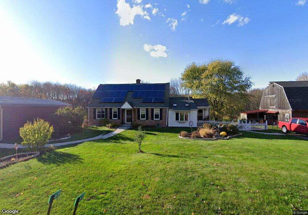
68 Taylor St Granby, MA 01033
Estimated Value: $390,000 - $461,000
4
Beds
1
Bath
1,759
Sq Ft
$234/Sq Ft
Est. Value
About This Home
This home is located at 68 Taylor St, Granby, MA 01033 and is currently estimated at $411,997, approximately $234 per square foot. 68 Taylor St is a home located in Hampshire County with nearby schools including East Meadow School, Granby Junior/Senior High School, and The MacDuffie School.
Ownership History
Date
Name
Owned For
Owner Type
Purchase Details
Closed on
Dec 5, 2025
Sold by
Constance R Quinlan Ret and Quinlan
Bought by
Quinlan John J
Current Estimated Value
Purchase Details
Closed on
May 31, 2012
Sold by
Quinlan Constance R and Quinlan Francis J
Bought by
Parker Cheryl A
Create a Home Valuation Report for This Property
The Home Valuation Report is an in-depth analysis detailing your home's value as well as a comparison with similar homes in the area
Home Values in the Area
Average Home Value in this Area
Purchase History
| Date | Buyer | Sale Price | Title Company |
|---|---|---|---|
| Quinlan John J | -- | -- | |
| Parker Cheryl A | -- | -- | |
| Constance R Quinlan Re | -- | -- | |
| Constance R Quinlan Re | -- | -- | |
| Parker Cheryl A | -- | -- |
Source: Public Records
Mortgage History
| Date | Status | Borrower | Loan Amount |
|---|---|---|---|
| Previous Owner | Constance R Quinlan Re | $150,000 | |
| Previous Owner | Constance R Quinlan Re | $40,000 | |
| Previous Owner | Constance R Quinlan Re | $70,000 |
Source: Public Records
Tax History
| Year | Tax Paid | Tax Assessment Tax Assessment Total Assessment is a certain percentage of the fair market value that is determined by local assessors to be the total taxable value of land and additions on the property. | Land | Improvement |
|---|---|---|---|---|
| 2025 | $5,249 | $341,500 | $115,900 | $225,600 |
| 2024 | $5,079 | $331,300 | $99,400 | $231,900 |
| 2023 | $4,815 | $281,400 | $89,800 | $191,600 |
| 2022 | $4,748 | $249,100 | $89,800 | $159,300 |
| 2021 | $4,687 | $236,100 | $89,800 | $146,300 |
| 2020 | $4,541 | $229,700 | $87,200 | $142,500 |
| 2019 | $4,503 | $232,600 | $106,400 | $126,200 |
| 2018 | $4,434 | $222,500 | $106,400 | $116,100 |
| 2017 | $4,027 | $222,500 | $106,400 | $116,100 |
| 2016 | $3,906 | $207,000 | $99,200 | $107,800 |
| 2015 | $3,832 | $209,300 | $99,200 | $110,100 |
Source: Public Records
Map
Nearby Homes
- 0 Kendall St Parcel G
- 0 Kendall Parcel A
- 0 Kendall Parcel E Unit 73486270
- 0 Kendall St Parcel D
- 0 Kendall St Parcel B
- 0 Kendall St Parcel F
- 0 Kendall St Parcel C
- 0 Kendall St
- 53 West St
- 75 Kendall St
- 0 E State St
- Lot 8 E State St
- 6 Jennifer Dr
- 80 R East St
- 337 Chicopee St Unit Lot 8
- 339 Chicopee St Unit Lot 7
- Lot 3 Chicopee St
- 23 Morgan St
- 289 Morgan St
- Lot 9 Old St W
Your Personal Tour Guide
Ask me questions while you tour the home.