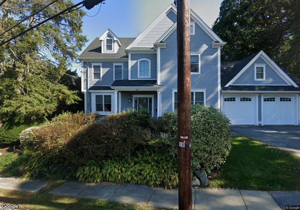
68 Tower Ave Needham Heights, MA 02494
Estimated Value: $2,320,000 - $2,727,000
5
Beds
5
Baths
1,935
Sq Ft
$1,316/Sq Ft
Est. Value
About This Home
This home is located at 68 Tower Ave, Needham Heights, MA 02494 and is currently estimated at $2,546,333, approximately $1,315 per square foot. 68 Tower Ave is a home with nearby schools including Mitchell Elementary School, High Rock Middle School, and Pollard Middle School.
Ownership History
Date
Name
Owned For
Owner Type
Purchase Details
Closed on
Jul 30, 2007
Sold by
Berg Evan B
Bought by
Nie Xiaodong and Peng Hairuo
Current Estimated Value
Purchase Details
Closed on
Jul 1, 1998
Sold by
Goldman Jeffrey W and Goldman Judith A
Bought by
Berg Evan B
Purchase Details
Closed on
Oct 1, 1997
Sold by
Antoszyk Peter J
Bought by
Goldman Judith A and Goldman Jeffrey W
Purchase Details
Closed on
Jan 10, 1991
Sold by
Peterson Alice B
Bought by
Antoszyk Peter J
Create a Home Valuation Report for This Property
The Home Valuation Report is an in-depth analysis detailing your home's value as well as a comparison with similar homes in the area
Home Values in the Area
Average Home Value in this Area
Purchase History
| Date | Buyer | Sale Price | Title Company |
|---|---|---|---|
| Nie Xiaodong | $659,000 | -- | |
| Nie Xiaodong | $659,000 | -- | |
| Berg Evan B | $360,500 | -- | |
| Goldman Judith A | $355,000 | -- | |
| Antoszyk Peter J | $255,000 | -- |
Source: Public Records
Mortgage History
| Date | Status | Borrower | Loan Amount |
|---|---|---|---|
| Closed | Antoszyk Peter J | $200,000 | |
| Closed | Antoszyk Peter J | $250,000 |
Source: Public Records
Tax History Compared to Growth
Tax History
| Year | Tax Paid | Tax Assessment Tax Assessment Total Assessment is a certain percentage of the fair market value that is determined by local assessors to be the total taxable value of land and additions on the property. | Land | Improvement |
|---|---|---|---|---|
| 2025 | $24,582 | $2,319,100 | $775,300 | $1,543,800 |
| 2024 | $25,467 | $2,034,100 | $553,800 | $1,480,300 |
| 2023 | $22,742 | $1,744,000 | $553,800 | $1,190,200 |
| 2022 | $21,538 | $1,610,900 | $486,000 | $1,124,900 |
| 2021 | $20,990 | $1,610,900 | $486,000 | $1,124,900 |
| 2020 | $19,638 | $1,572,300 | $486,000 | $1,086,300 |
| 2019 | $18,630 | $1,503,600 | $442,000 | $1,061,600 |
| 2018 | $8,188 | $689,200 | $442,000 | $247,200 |
| 2017 | $7,864 | $661,400 | $442,000 | $219,400 |
| 2016 | $7,633 | $661,400 | $442,000 | $219,400 |
| 2015 | $7,467 | $661,400 | $442,000 | $219,400 |
| 2014 | $7,139 | $613,300 | $402,000 | $211,300 |
Source: Public Records
Map
Nearby Homes
- 77 High St
- 9 Jayne Rd
- 143 Hunting Rd
- 23 Cheney St
- 36 Davenport Rd
- 556 Webster St
- 190 Brookline St
- 400 Hunnewell St Unit 103
- 403 Hunnewell St Unit 403
- 332 Hillcrest Rd
- 3 Crescent Rd
- 379 Hunnewell St Unit 379
- 7 Avery St
- 445 Hillside Ave
- 62 Evelyn Rd
- 62 Washington Ave
- 35 Andrea Cir
- 40 Otis St Unit L
- 42 Otis St Unit R
- 41 Lee Rd
- 141 Lexington Ave
- 149 Lexington Ave
- 80 Tower Ave
- 56 Tower Ave
- 56 Tower Ave Unit 56
- 61 Tower Ave
- 157 Lexington Ave
- 127 Lexington Ave
- 128 Lexington Ave
- 73 Concord St
- 37 Richdale Rd
- 81 Tower Ave
- 160 Lexington Ave
- 46 Tower Ave
- 27 Richdale Rd
- 39 Richdale Rd
- 67 Concord St
- 92 Tower Ave
- 95 Concord St
- 87 Tower Ave