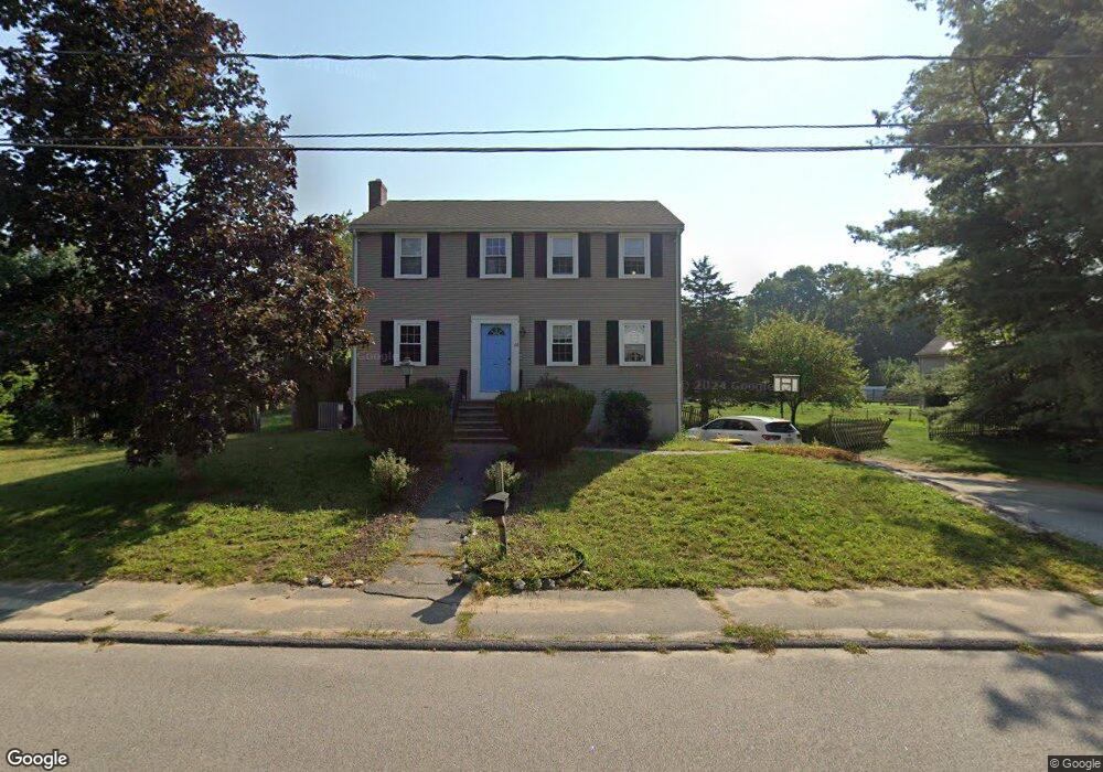
68 Wethersfield Rd Bellingham, MA 02019
Estimated Value: $541,727 - $594,000
4
Beds
2
Baths
1,664
Sq Ft
$337/Sq Ft
Est. Value
About This Home
This home is located at 68 Wethersfield Rd, Bellingham, MA 02019 and is currently estimated at $560,432, approximately $336 per square foot. 68 Wethersfield Rd is a home located in Norfolk County with nearby schools including Stall Brook Elementary School, Bellingham High School, and Bethany Christian Academy.
Ownership History
Date
Name
Owned For
Owner Type
Purchase Details
Closed on
Sep 30, 2004
Sold by
Lafond Judith J and Lafond Russell E
Bought by
Elster Lisa A and Elster Robert D
Current Estimated Value
Home Financials for this Owner
Home Financials are based on the most recent Mortgage that was taken out on this home.
Original Mortgage
$220,000
Interest Rate
5.81%
Mortgage Type
Purchase Money Mortgage
Purchase Details
Closed on
Nov 21, 1997
Sold by
Theroux Deborah B
Bought by
Lafond Russell E and Lafond Judith J
Home Financials for this Owner
Home Financials are based on the most recent Mortgage that was taken out on this home.
Original Mortgage
$155,600
Interest Rate
7.17%
Mortgage Type
Purchase Money Mortgage
Purchase Details
Closed on
Jan 31, 1992
Sold by
W J & D M Parker Rt
Bought by
Theroux Brian A and Theroux Deborah B
Create a Home Valuation Report for This Property
The Home Valuation Report is an in-depth analysis detailing your home's value as well as a comparison with similar homes in the area
Home Values in the Area
Average Home Value in this Area
Purchase History
| Date | Buyer | Sale Price | Title Company |
|---|---|---|---|
| Elster Lisa A | $352,500 | -- | |
| Lafond Russell E | $163,800 | -- | |
| Lafond Russell E | $163,800 | -- | |
| Theroux Brian A | $110,500 | -- | |
| Theroux Brian A | $110,500 | -- |
Source: Public Records
Mortgage History
| Date | Status | Borrower | Loan Amount |
|---|---|---|---|
| Open | Theroux Brian A | $232,000 | |
| Closed | Theroux Brian A | $212,500 | |
| Closed | Elster Lisa A | $220,000 | |
| Previous Owner | Theroux Brian A | $155,600 |
Source: Public Records
Tax History Compared to Growth
Tax History
| Year | Tax Paid | Tax Assessment Tax Assessment Total Assessment is a certain percentage of the fair market value that is determined by local assessors to be the total taxable value of land and additions on the property. | Land | Improvement |
|---|---|---|---|---|
| 2025 | $5,411 | $430,800 | $168,800 | $262,000 |
| 2024 | $5,185 | $403,200 | $154,100 | $249,100 |
| 2023 | $4,998 | $383,000 | $146,800 | $236,200 |
| 2022 | $4,870 | $345,900 | $122,400 | $223,500 |
| 2021 | $4,732 | $328,400 | $122,400 | $206,000 |
| 2020 | $4,469 | $314,300 | $122,400 | $191,900 |
| 2019 | $4,378 | $308,100 | $122,400 | $185,700 |
| 2018 | $4,090 | $283,800 | $117,700 | $166,100 |
| 2017 | $3,979 | $277,500 | $117,700 | $159,800 |
| 2016 | $3,793 | $265,400 | $115,700 | $149,700 |
| 2015 | $3,638 | $255,300 | $111,300 | $144,000 |
| 2014 | $3,650 | $249,000 | $108,700 | $140,300 |
Source: Public Records
Map
Nearby Homes
- 6 Lisa Ann Dr
- 49 Monique Dr
- 49 Horseshoe Dr
- 22 Roger Belanger Dr
- 0 Hartford Ave
- 108 N Main St
- 370 S Main St
- 29 Rawson Rd
- 123-125 Mendon St
- 6 Mellen St
- 270 S Main St
- 267 S Main St
- 256 S Main St
- 1136 S Main St
- 222 S Main St
- 211A S Main St
- 48 Black Bear Cir Unit 48
- 3 Black Bear Cir Unit 3
- 43 Black Bear Cir Unit 43
- 7 Black Bear Unit 7
- 64 Wethersfield Rd
- 72 Wethersfield Rd
- 69 Wethersfield Rd
- 65 Wethersfield Rd
- 73 Wethersfield Rd
- 60 Wethersfield Rd
- 61 Wethersfield Rd
- 76 Wethersfield Rd
- 83 Nason St
- 87 Nason St
- 91 Nason St
- 77 Wethersfield Rd
- 79 Nason St
- 57 Wethersfield Rd
- 56 Wethersfield Rd
- 75 Nason St
- 84 Nason St
- 95 Nason St
- 80 Nason St
- 81 Wethersfield Rd