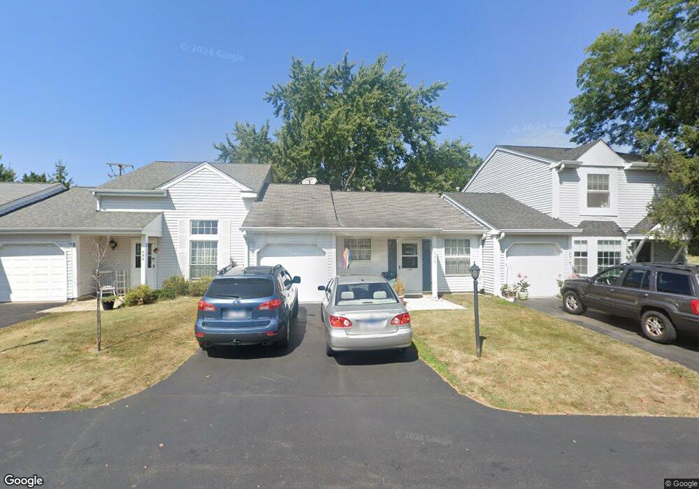
680 Brittany Ln Unit 1 Island Lake, IL 60042
West Island Lake NeighborhoodEstimated Value: $191,000 - $216,000
2
Beds
3
Baths
867
Sq Ft
$238/Sq Ft
Est. Value
About This Home
This home is located at 680 Brittany Ln Unit 1, Island Lake, IL 60042 and is currently estimated at $206,726, approximately $238 per square foot. 680 Brittany Ln Unit 1 is a home located in McHenry County with nearby schools including Cotton Creek School, Matthews Middle School, and Wauconda High School.
Ownership History
Date
Name
Owned For
Owner Type
Purchase Details
Closed on
Apr 27, 2000
Sold by
Schlitzkus Thomas W
Bought by
Wojtecki Carol
Current Estimated Value
Home Financials for this Owner
Home Financials are based on the most recent Mortgage that was taken out on this home.
Original Mortgage
$79,300
Outstanding Balance
$27,593
Interest Rate
8.24%
Estimated Equity
$179,133
Create a Home Valuation Report for This Property
The Home Valuation Report is an in-depth analysis detailing your home's value as well as a comparison with similar homes in the area
Home Values in the Area
Average Home Value in this Area
Purchase History
| Date | Buyer | Sale Price | Title Company |
|---|---|---|---|
| Wojtecki Carol | $83,500 | Plm Title Company |
Source: Public Records
Mortgage History
| Date | Status | Borrower | Loan Amount |
|---|---|---|---|
| Open | Wojtecki Carol | $79,300 |
Source: Public Records
Tax History Compared to Growth
Tax History
| Year | Tax Paid | Tax Assessment Tax Assessment Total Assessment is a certain percentage of the fair market value that is determined by local assessors to be the total taxable value of land and additions on the property. | Land | Improvement |
|---|---|---|---|---|
| 2024 | $2,486 | $47,510 | $7,605 | $39,905 |
| 2023 | $1,704 | $42,606 | $6,820 | $35,786 |
| 2022 | $2,491 | $39,587 | $6,237 | $33,350 |
| 2021 | $2,583 | $37,116 | $5,848 | $31,268 |
| 2020 | $3,036 | $36,004 | $5,673 | $30,331 |
| 2019 | $2,980 | $34,231 | $5,394 | $28,837 |
| 2018 | $2,370 | $28,246 | $5,067 | $23,179 |
| 2017 | $2,283 | $27,060 | $4,854 | $22,206 |
| 2016 | $2,206 | $25,818 | $4,631 | $21,187 |
| 2013 | -- | $28,366 | $4,407 | $23,959 |
Source: Public Records
Map
Nearby Homes
- 811 Newport Dr
- 404 Lauren Ln
- 3625 Newport Dr
- 318 David Ct
- 1040 Wimbledon Dr Unit 7
- 1125 Revere Ln
- NEC Route 176 & Westridge Dr
- 833 Dartmouth Dr Unit 7
- 3525 Southport Dr
- 0 Southport Dr
- 2610 S Thomas Ct
- Lot 12 W Northeast Shore Dr
- Lot 11 W Northeast Shore Dr
- Lot 10 W Northeast Shore Dr
- Lot 9 W Northeast Shore Dr
- Lot 8 W Northeast Shore Dr
- Lot 7 W Northeast Shore Dr
- Lot 4 W Northeast Shore Dr
- Lot 5 W Northeast Shore Dr
- Lot 6 W Northeast Shore Dr
- 684 Brittany Way Unit 684
- 684 Brittany Ln Unit 1
- 676 Brittany Ln
- 688 Brittany Ln
- 692 Brittany Ln Unit 1
- 670 Nantucket Way
- 664 Nantucket Way Unit 3
- 681 Brittany Ln
- 685 Brittany Ln Unit 1
- 700 Brittany Ln Unit 1
- 677 Brittany Way
- 677 Brittany Ln Unit 1
- 687 Brittany Ln
- 658 Nantucket Way Unit 3
- 706 Brittany Ln
- 802 W Il Route 176
- 701 Brittany Ln Unit 1
- 701 Brittany Ln Unit 701
- 712 Brittany Ln Unit 1
- 646 Nantucket Way