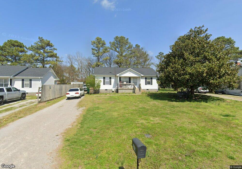
680 Crestland St Lewisburg, TN 37091
Estimated Value: $192,971 - $224,000
--
Bed
2
Baths
1,000
Sq Ft
$208/Sq Ft
Est. Value
About This Home
This home is located at 680 Crestland St, Lewisburg, TN 37091 and is currently estimated at $208,493, approximately $208 per square foot. 680 Crestland St is a home located in Marshall County with nearby schools including Marshall Elementary School, Oak Grove Elementary School, and Westhills Elementary School.
Ownership History
Date
Name
Owned For
Owner Type
Purchase Details
Closed on
Dec 13, 2013
Sold by
Cole J Kevin
Bought by
Cole J Kevin and Currier Joseph Wayne
Current Estimated Value
Purchase Details
Closed on
Dec 20, 2007
Sold by
Wells Fargo Bank
Bought by
Kevin Cole J
Home Financials for this Owner
Home Financials are based on the most recent Mortgage that was taken out on this home.
Original Mortgage
$62,161
Interest Rate
6.15%
Purchase Details
Closed on
Aug 29, 2007
Sold by
Kristie Skinner
Bought by
Wells Fargo Bank
Purchase Details
Closed on
Jun 30, 2006
Sold by
Johnny Eskew
Bought by
Kristie Skinner
Purchase Details
Closed on
Jun 1, 2004
Bought by
Eskew Johnny and Eskew Kristie
Purchase Details
Closed on
Jun 29, 2000
Bought by
Jent David
Create a Home Valuation Report for This Property
The Home Valuation Report is an in-depth analysis detailing your home's value as well as a comparison with similar homes in the area
Home Values in the Area
Average Home Value in this Area
Purchase History
| Date | Buyer | Sale Price | Title Company |
|---|---|---|---|
| Cole J Kevin | $400,000 | -- | |
| Kevin Cole J | $61,000 | -- | |
| Wells Fargo Bank | $58,255 | -- | |
| Kristie Skinner | -- | -- | |
| Eskew Johnny | $64,100 | -- | |
| Jent David | $32,000 | -- |
Source: Public Records
Mortgage History
| Date | Status | Borrower | Loan Amount |
|---|---|---|---|
| Previous Owner | Jent David | $62,161 |
Source: Public Records
Tax History Compared to Growth
Tax History
| Year | Tax Paid | Tax Assessment Tax Assessment Total Assessment is a certain percentage of the fair market value that is determined by local assessors to be the total taxable value of land and additions on the property. | Land | Improvement |
|---|---|---|---|---|
| 2024 | -- | $32,325 | $5,000 | $27,325 |
| 2023 | $1,003 | $32,325 | $5,000 | $27,325 |
| 2022 | $1,003 | $32,325 | $5,000 | $27,325 |
| 2021 | $871 | $18,725 | $2,500 | $16,225 |
| 2020 | $871 | $18,725 | $2,500 | $16,225 |
| 2019 | $843 | $18,725 | $2,500 | $16,225 |
| 2018 | $834 | $18,725 | $2,500 | $16,225 |
| 2017 | $834 | $18,725 | $2,500 | $16,225 |
| 2016 | $841 | $16,425 | $3,000 | $13,425 |
| 2015 | $767 | $16,425 | $3,000 | $13,425 |
| 2014 | $767 | $16,425 | $3,000 | $13,425 |
Source: Public Records
Map
Nearby Homes
- 755 Center St
- 224 Hardison Ave
- 301 East Ave
- 535 Clayton Ave
- 126 Armory Dr
- 125 Armory Dr
- 330 Hickory Cir
- 411 Elm Ave
- 391 Elm Ave
- 319 E Hill Ave
- 131 Isabela Dr
- 141 Isabela Dr
- 380 Baxter Ave
- 188 Trey Dr
- 416 1st Ave N
- 1351 Old Belfast Rd
- 155 Landon Ln
- 3019 Cambridge Ct
- 3021 Cambridge Ct
- 1183 Finley Beech Rd
- 682 Crestland St
- 676 Crestland St
- 670 Crestland St
- 429 Hardison Ave
- 686 Crestland St
- 427 Hardison Ave
- 690 Crestland St
- 425 Hardison Ave
- 723 Belfast St
- 691 Crestland St
- 729 Belfast St
- 717 Belfast St
- 712 Crestland St
- 511 Hardison Ave
- 647 Belfast St
- 737 Belfast St
- 693 Crestland St
- 639 Belfast St
- 720 Crestland St
- 719 Crestland St