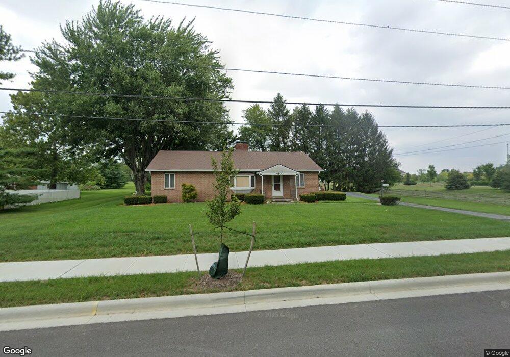
6800 Rings Rd Dublin, OH 43016
Estimated Value: $283,000 - $357,000
3
Beds
1
Bath
1,396
Sq Ft
$231/Sq Ft
Est. Value
About This Home
This home is located at 6800 Rings Rd, Dublin, OH 43016 and is currently estimated at $322,805, approximately $231 per square foot. 6800 Rings Rd is a home located in Franklin County with nearby schools including Washington Elementary School, Hilliard Tharp Sixth Grade Elementary School, and Hilliard Weaver Middle School.
Ownership History
Date
Name
Owned For
Owner Type
Purchase Details
Closed on
May 30, 2023
Sold by
Patch David W
Bought by
David W Patch Jr Revocable Trust
Current Estimated Value
Purchase Details
Closed on
Jan 5, 2004
Sold by
Patch Family Ltd Partnership
Bought by
M/I Homes Of Central Ohio Llc
Purchase Details
Closed on
Oct 1, 2003
Sold by
Patch Betty S
Bought by
Patch Family Ltd Partnership
Purchase Details
Closed on
Oct 5, 1978
Bought by
Patch Betty S Le
Create a Home Valuation Report for This Property
The Home Valuation Report is an in-depth analysis detailing your home's value as well as a comparison with similar homes in the area
Home Values in the Area
Average Home Value in this Area
Purchase History
| Date | Buyer | Sale Price | Title Company |
|---|---|---|---|
| David W Patch Jr Revocable Trust | -- | None Listed On Document | |
| M/I Homes Of Central Ohio Llc | $3,910,500 | Stewart Title Agency Of Colu | |
| Patch Family Ltd Partnership | -- | Arlington Title | |
| Patch Betty S Le | -- | -- |
Source: Public Records
Tax History
| Year | Tax Paid | Tax Assessment Tax Assessment Total Assessment is a certain percentage of the fair market value that is determined by local assessors to be the total taxable value of land and additions on the property. | Land | Improvement |
|---|---|---|---|---|
| 2025 | $4,494 | $69,720 | $14,350 | $55,370 |
| 2024 | $4,494 | $69,720 | $14,350 | $55,370 |
| 2023 | $3,231 | $69,720 | $14,350 | $55,370 |
| 2022 | $3,442 | $60,100 | $10,780 | $49,320 |
| 2021 | $3,394 | $60,100 | $10,780 | $49,320 |
| 2020 | $3,435 | $60,100 | $10,780 | $49,320 |
| 2019 | $2,920 | $46,100 | $8,610 | $37,490 |
| 2018 | $1,456 | $46,100 | $8,610 | $37,490 |
| 2017 | $2,911 | $46,100 | $8,610 | $37,490 |
| 2016 | $3,597 | $51,530 | $9,770 | $41,760 |
| 2015 | $1,697 | $51,530 | $9,770 | $41,760 |
| 2014 | $3,401 | $51,530 | $9,770 | $41,760 |
| 2013 | $1,628 | $49,070 | $9,310 | $39,760 |
Source: Public Records
Map
Nearby Homes
- 5518 Eva Loop N Unit 40
- 5523 Ballantrae Woods Dr
- 6891 Ballantrae Place
- 5688 Stearns Rd
- 5650 Wexler Rd
- 5444 Carson City Ln
- 6280 Cartwright Ln N
- 5792 Buckhannon St
- 6258 Cartwright Ln N
- 5751 Cosgray Rd
- 5819 Buckhannon St
- 5566 Spring River Ave
- 6477 Tanseyclose Ln
- 5538 Lime Creek Dr Unit 18
- 6293 Hampton Green Place Unit 12C
- 5531 Holly River Ave
- 5292 Estuary Ln
- 5296 Estuary Ln
- 5772 Passage Creek Dr
- 5844 Dunheath Loop
- 6844 Rings Rd
- 0 Rings Rd
- 6789 Rings Rd
- 6827 Rings Rd
- 6856 Rings Rd
- 6852 Rings Rd
- 6870 Rings Rd
- 6878 Rings Rd
- 6886 Rings Rd
- 5578 Cadmore Dr
- 6894 Rings Rd
- 5571 Cadmore Dr Unit Lot 1
- 5586 Alderbrook Dr
- 6844 Beltain Ln
- 6891 Rings Rd
- 6891 Rings Rd
- 6848 Beltain Ln Unit 31C
- 6910 Rings Rd
- 6852 Beltain Ln Unit 31B
- 7004 Inchcape Ln
Your Personal Tour Guide
Ask me questions while you tour the home.