Estimated Value: $359,000 - $457,000
Studio
1
Bath
1,134
Sq Ft
$354/Sq Ft
Est. Value
About This Home
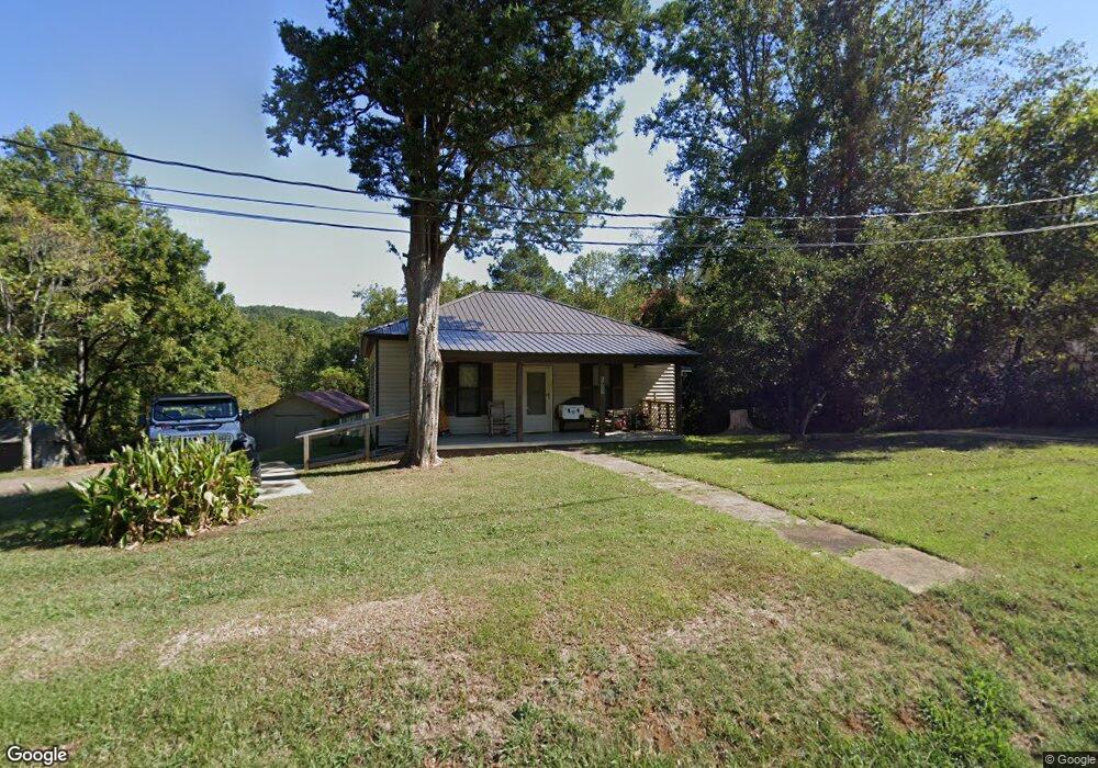
This home is located at 6802 Highway 53 E, Tate, GA 30177 and is currently estimated at $401,296, approximately $353 per square foot. 6802 Highway 53 E is a home located in Pickens County with nearby schools including Tate Elementary School, Pickens County Middle School, and Pickens County High School.
Ownership History
Date
Name
Owned For
Owner Type
Purchase Details
Closed on
Apr 11, 2025
Sold by
Norton Michael William
Bought by
Norton Michael William and Norton Elisea M
Current Estimated Value
Purchase Details
Closed on
Dec 12, 2016
Sold by
Betty Lee Estate
Bought by
Norton Michael William
Purchase Details
Closed on
Dec 17, 2007
Sold by
Norton William
Bought by
Norton William and Norton Betty
Home Financials for this Owner
Home Financials are based on the most recent Mortgage that was taken out on this home.
Original Mortgage
$48,249
Interest Rate
6.21%
Mortgage Type
New Conventional
Purchase Details
Closed on
Jan 1, 1977
Sold by
Norton William and Norton Betty
Bought by
Norton Bryan A and Norton William
Create a Home Valuation Report for This Property
The Home Valuation Report is an in-depth analysis detailing your home's value as well as a comparison with similar homes in the area
Home Values in the Area
Average Home Value in this Area
Purchase History
| Date | Buyer | Sale Price | Title Company |
|---|---|---|---|
| Norton Michael William | -- | -- | |
| Norton Michael William | -- | -- | |
| Norton William | -- | -- | |
| Norton Bryan A | -- | -- |
Source: Public Records
Mortgage History
| Date | Status | Borrower | Loan Amount |
|---|---|---|---|
| Previous Owner | Norton William | $48,249 |
Source: Public Records
Tax History
| Year | Tax Paid | Tax Assessment Tax Assessment Total Assessment is a certain percentage of the fair market value that is determined by local assessors to be the total taxable value of land and additions on the property. | Land | Improvement |
|---|---|---|---|---|
| 2025 | $2,945 | $178,993 | $23,387 | $155,606 |
| 2024 | $2,817 | $147,354 | $23,455 | $123,899 |
| 2023 | $2,895 | $147,354 | $23,455 | $123,899 |
| 2022 | $2,095 | $108,023 | $23,455 | $84,568 |
| 2021 | $1,402 | $69,337 | $7,951 | $61,386 |
| 2020 | $1,444 | $69,337 | $7,951 | $61,386 |
| 2019 | $1,592 | $69,337 | $7,951 | $61,386 |
| 2018 | $1,607 | $69,337 | $7,951 | $61,386 |
| 2017 | $1,633 | $69,337 | $7,951 | $61,386 |
| 2016 | $1,532 | $69,032 | $7,645 | $61,386 |
| 2015 | $1,508 | $69,511 | $7,645 | $61,866 |
| 2014 | $130 | $23,044 | $7,645 | $15,398 |
| 2013 | -- | $23,043 | $7,645 | $15,398 |
Source: Public Records
Map
Nearby Homes
- 53 Clinic Rd
- 163 Rabbit Town Rd
- 2 Highway 53
- 9000 State Route 53 E
- 93 Worley Dr
- 97 Crossroad Cir
- 1671 Harrington Rd
- 1584 Kennesaw Ave
- 432 Barrel Way
- 0 Cowart Mountain Tract 3 Rd
- 0 Cowart Mountain Tract 1 Rd
- 0 Cowart Mountain Tract 2 Rd
- 1025 Pickens St
- 3085 Highway 53 E
- 3049 Highway 53 E
- 204 North Ave
- 2063 Canton Rd
- 174 Cherokee Ave
- 10 Parker Ln
- 114 Nelson Ridge Dr
- 6772 Highway 53 E
- 6743 Highway 53 E
- 6771 Highway 53 E
- 6716 Highway 53 E
- 6801 Highway 53 E
- 0 Fortner Rd Unit 7044165
- 6980 Highway 53 E
- 66 Marble Block Dr
- 54 Marble Block Dr
- 6361 Highway 53 E
- 0 Highway 53 Unit 7066704
- 0 Highway 53 Unit 5122425
- 9772 Highway 53
- 7175 Highway 53 E
- 1150 Sandy Bottom Rd
- 10 Liberty Ln
- 55 Sandy Bottom Rd
- 5237 Tate Hwy NE
- oo Hwy 53
- 00 Double Branches Rd
Your Personal Tour Guide
Ask me questions while you tour the home.