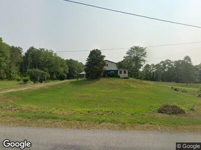
681 W Swamp Rd Unit W Middlesex, NY 14507
Estimated Value: $265,487 - $328,000
3
Beds
1
Bath
2,094
Sq Ft
$141/Sq Ft
Est. Value
About This Home
This home is located at 681 W Swamp Rd Unit W, Middlesex, NY 14507 and is currently estimated at $294,872, approximately $140 per square foot. 681 W Swamp Rd Unit W is a home located in Yates County with nearby schools including Middlesex Valley Elementary School, Gorham Elementary School, and Marcus Whitman Middle/ High School.
Ownership History
Date
Name
Owned For
Owner Type
Purchase Details
Closed on
Nov 30, 2022
Sold by
Cooper Susan M
Bought by
Hoover Landis B and Hoover Darla H
Current Estimated Value
Home Financials for this Owner
Home Financials are based on the most recent Mortgage that was taken out on this home.
Original Mortgage
$191,250
Outstanding Balance
$186,567
Interest Rate
7.08%
Mortgage Type
Purchase Money Mortgage
Estimated Equity
$117,526
Create a Home Valuation Report for This Property
The Home Valuation Report is an in-depth analysis detailing your home's value as well as a comparison with similar homes in the area
Home Values in the Area
Average Home Value in this Area
Purchase History
| Date | Buyer | Sale Price | Title Company |
|---|---|---|---|
| Hoover Landis B | $225,000 | None Available |
Source: Public Records
Mortgage History
| Date | Status | Borrower | Loan Amount |
|---|---|---|---|
| Open | Hoover Landis B | $191,250 | |
| Previous Owner | Cooper Alfred M | $1,000,000 |
Source: Public Records
Tax History Compared to Growth
Tax History
| Year | Tax Paid | Tax Assessment Tax Assessment Total Assessment is a certain percentage of the fair market value that is determined by local assessors to be the total taxable value of land and additions on the property. | Land | Improvement |
|---|---|---|---|---|
| 2024 | $5,349 | $234,500 | $34,100 | $200,400 |
| 2023 | $5,199 | $222,000 | $34,100 | $187,900 |
| 2022 | $4,224 | $154,100 | $32,100 | $122,000 |
| 2021 | $4,168 | $154,100 | $32,100 | $122,000 |
| 2020 | $3,331 | $154,100 | $32,100 | $122,000 |
| 2019 | $2,590 | $154,100 | $32,100 | $122,000 |
| 2018 | $2,590 | $108,000 | $19,000 | $89,000 |
| 2017 | $3,097 | $112,000 | $19,000 | $93,000 |
| 2016 | $2,451 | $93,000 | $19,000 | $74,000 |
| 2015 | -- | $93,000 | $19,000 | $74,000 |
| 2014 | -- | $75,400 | $13,800 | $61,600 |
Source: Public Records
Map
Nearby Homes
- 35 Gilbert St
- 40 Gilbert St
- 00 Lane Development
- 316 Gray Rd
- 1571 Emerson Rd
- 1928 N Bordwell Rd
- 1601 Emerson Rd
- 4489 W Sherman Hollow Rd
- 1436 State Route 14a
- 1890 Warren Rd
- 0 Warren Rd Unit R1582687
- 5173 County Road 11
- 5180 County Road 11
- 2462 Widow Hill Rd
- 4513 Mayflower Dr
- 4527 Wildflower Dr
- 4433 County Road 1
- 20 Grant Ave
- 21 Grant Ave
- 4618 Greenbriar Dr
- 681 W Swamp Rd Unit W
- 604 W Swamp Rd Unit W
- 815 W Swamp Rd Unit W
- 4100 Voorhees Rd
- 536 W Swamp Rd
- 830 W Swamp Rd Unit W
- 451 W Swamp Rd Unit W
- 4150 Voorhees Rd
- 839 W Swamp Rd Unit W
- 4218 Voorhees Rd
- 4233 Voorhees Rd
- 4233 Voorhees Rd
- 870 W Swamp Rd Unit W
- 4285 Bootes Rd
- 4294 Bootes Rd
- 4289 Bootes Rd
- 368 Reynolds Rd