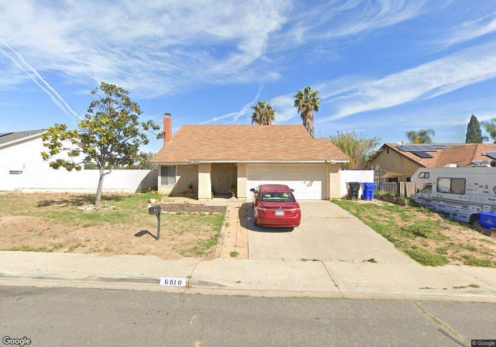
6810 Charlene Ave San Diego, CA 92114
Broadway Heights NeighborhoodEstimated Value: $886,000 - $942,000
4
Beds
3
Baths
2,541
Sq Ft
$360/Sq Ft
Est. Value
About This Home
This home is located at 6810 Charlene Ave, San Diego, CA 92114 and is currently estimated at $915,296, approximately $360 per square foot. 6810 Charlene Ave is a home located in San Diego County with nearby schools including San Miguel Elementary School, Mount Miguel High School, and Keiller Leadership Academy.
Ownership History
Date
Name
Owned For
Owner Type
Purchase Details
Closed on
Jan 5, 2000
Sold by
Waterford Charles L and Waterford Eddie M
Bought by
Thomas Anna and Thomas Angelia
Current Estimated Value
Home Financials for this Owner
Home Financials are based on the most recent Mortgage that was taken out on this home.
Original Mortgage
$185,748
Interest Rate
8.26%
Mortgage Type
FHA
Create a Home Valuation Report for This Property
The Home Valuation Report is an in-depth analysis detailing your home's value as well as a comparison with similar homes in the area
Home Values in the Area
Average Home Value in this Area
Purchase History
| Date | Buyer | Sale Price | Title Company |
|---|---|---|---|
| Thomas Anna | $188,500 | Fidelity National Title Co |
Source: Public Records
Mortgage History
| Date | Status | Borrower | Loan Amount |
|---|---|---|---|
| Previous Owner | Thomas Anna | $185,748 |
Source: Public Records
Tax History Compared to Growth
Tax History
| Year | Tax Paid | Tax Assessment Tax Assessment Total Assessment is a certain percentage of the fair market value that is determined by local assessors to be the total taxable value of land and additions on the property. | Land | Improvement |
|---|---|---|---|---|
| 2025 | $3,363 | $289,230 | $51,332 | $237,898 |
| 2024 | $3,363 | $283,560 | $50,326 | $233,234 |
| 2023 | $3,266 | $278,001 | $49,340 | $228,661 |
| 2022 | $3,245 | $272,551 | $48,373 | $224,178 |
| 2021 | $3,194 | $267,208 | $47,425 | $219,783 |
| 2020 | $3,164 | $264,469 | $46,939 | $217,530 |
| 2019 | $3,119 | $259,284 | $46,019 | $213,265 |
| 2018 | $3,050 | $254,201 | $45,117 | $209,084 |
| 2017 | $3,010 | $249,218 | $44,233 | $204,985 |
| 2016 | $2,911 | $244,332 | $43,366 | $200,966 |
| 2015 | $2,890 | $240,663 | $42,715 | $197,948 |
| 2014 | $2,768 | $235,950 | $41,879 | $194,071 |
Source: Public Records
Map
Nearby Homes
- 2425 Madroncillo St
- 6781 Pilot Way
- 0 Mallard St
- 6855 Radio Dr
- 2280 Peppermint Ln
- 7015 Lermas Ct
- 7065 Berry Park Ln
- 7083 Berry Park Ln
- 6743 Radio Dr
- 7001 Lemonwood Ln
- 7087 Russan Ln
- 6816 Central Ave Unit 20
- 2745 Mercury Dr
- 0 Dartmoor Dr Unit 1
- 6333 College Grove Way Unit 11102
- 6333 College Grove Way Unit 13106
- 2035 Paradise St
- 1935 Berry St
- 2673 Massachusetts Ave
- 2363 Mcknight Dr
- 6820 Charlene Ave
- 6792 Charlene Ave
- 6815 Panocha Ct
- 6825 Panocha Ct
- 6805 Panocha Ct
- 6815 Charlene Ave
- 6784 Charlene Ave
- 6825 Charlene Ave
- 6805 Charlene Ave
- 6791 Charlene Ave
- 6785 Charlene Ave
- 6776 Charlene Ave
- 6806 Panocha Ct
- 2405 Madroncillo St
- 2340 Madroncillo St
- 2435 Madroncillo St
- 2385 Madroncillo St
- 2320 Madroncillo St
- 2454 Madroncillo St
- 6777 Charlene Ave