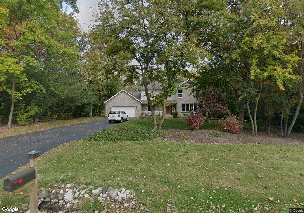
6810 Hennig Dr Marengo, IL 60152
Estimated Value: $447,000 - $570,000
4
Beds
--
Bath
2,766
Sq Ft
$182/Sq Ft
Est. Value
About This Home
This home is located at 6810 Hennig Dr, Marengo, IL 60152 and is currently estimated at $503,169, approximately $181 per square foot. 6810 Hennig Dr is a home located in McHenry County with nearby schools including Riley Community Consolidated School District 18, Marengo Community High School, and Zion Lutheran School.
Ownership History
Date
Name
Owned For
Owner Type
Purchase Details
Closed on
May 20, 2022
Sold by
Paxson Mark A and Paxson Sandra M
Bought by
Manley Cris and Manley Charlotte
Current Estimated Value
Home Financials for this Owner
Home Financials are based on the most recent Mortgage that was taken out on this home.
Original Mortgage
$319,600
Outstanding Balance
$302,210
Interest Rate
4.75%
Mortgage Type
New Conventional
Estimated Equity
$200,959
Purchase Details
Closed on
Jun 15, 1999
Sold by
Southridge Development Inc
Bought by
Paxson Mark A and Paxson Sandra M
Home Financials for this Owner
Home Financials are based on the most recent Mortgage that was taken out on this home.
Original Mortgage
$213,450
Interest Rate
7.29%
Mortgage Type
Construction
Create a Home Valuation Report for This Property
The Home Valuation Report is an in-depth analysis detailing your home's value as well as a comparison with similar homes in the area
Home Values in the Area
Average Home Value in this Area
Purchase History
| Date | Buyer | Sale Price | Title Company |
|---|---|---|---|
| Manley Cris | -- | First American Title | |
| Paxson Mark A | $63,000 | -- |
Source: Public Records
Mortgage History
| Date | Status | Borrower | Loan Amount |
|---|---|---|---|
| Open | Manley Cris | $319,600 | |
| Previous Owner | Paxson Mark A | $213,450 |
Source: Public Records
Tax History Compared to Growth
Tax History
| Year | Tax Paid | Tax Assessment Tax Assessment Total Assessment is a certain percentage of the fair market value that is determined by local assessors to be the total taxable value of land and additions on the property. | Land | Improvement |
|---|---|---|---|---|
| 2024 | $7,797 | $154,298 | $13,223 | $141,075 |
| 2023 | $9,542 | $137,496 | $11,783 | $125,713 |
| 2022 | $9,589 | $126,074 | $10,804 | $115,270 |
| 2021 | $6,826 | $116,811 | $10,010 | $106,801 |
| 2020 | $8,991 | $110,428 | $9,463 | $100,965 |
| 2019 | $9,582 | $105,693 | $9,057 | $96,636 |
| 2018 | $9,149 | $102,081 | $6,967 | $95,114 |
| 2017 | $8,989 | $98,677 | $6,735 | $91,942 |
| 2016 | $8,887 | $94,918 | $6,478 | $88,440 |
| 2013 | $4,085 | $85,038 | $18,308 | $66,730 |
Source: Public Records
Map
Nearby Homes
- 0 Ratfield Rd
- 7001 Maple St
- 6715 Meyer Rd
- 720 Cloverleaf Dr
- 730 Cloverleaf Dr
- 6211 Maple St Unit 501
- 6212 Meyer Rd
- 1210 Maplewood Dr
- 832 Oak Manor Dr
- 1200 Maplewood Dr
- Paxton Plan at Brookside Meadows
- 935 Courtney Ln
- 615 Park Dr
- 579 Johnson St
- 0 Maple St
- 479 Kennedy St
- 455 Park Dr
- 459 Kennedy St
- 422 Damen St
- 704 Echo (Lot 21) Trail
- 6802 Hennig Dr
- 6814 Hennig Dr
- 6811 Hennig Dr
- 21414 Weiss Trail
- 6817 Hennig Dr
- 6718 Hennig Dr
- 21413 Weiss Trail
- 21420 Weiss Trail
- 6811 Paulson Dr
- 6807 Paulson Dr
- 21419 Weiss Trail
- 6714 Hennig Dr
- 21302 Babs Trail
- 21516 Weiss Trail
- 21305 Babs Trail
- 6712 Hennig Dr
- 7202 Paulson Dr
- 21503 Weiss Trail
- 6708 Hennig Dr
- 21219 Babs Trail