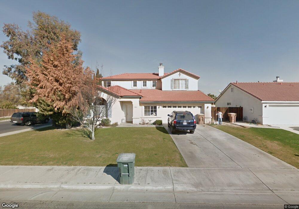
6812 Eagle Cap St Bakersfield, CA 93313
Silver Creek NeighborhoodEstimated Value: $468,000 - $475,415
4
Beds
3
Baths
1,450
Sq Ft
$325/Sq Ft
Est. Value
About This Home
This home is located at 6812 Eagle Cap St, Bakersfield, CA 93313 and is currently estimated at $471,354, approximately $325 per square foot. 6812 Eagle Cap St is a home located in Kern County with nearby schools including Donald E. Suburu School, General Shafter Elementary School, and Independence High School.
Ownership History
Date
Name
Owned For
Owner Type
Purchase Details
Closed on
Apr 16, 2007
Sold by
Luna Isael C
Bought by
Euresti Luna Irene V
Current Estimated Value
Home Financials for this Owner
Home Financials are based on the most recent Mortgage that was taken out on this home.
Original Mortgage
$146,500
Outstanding Balance
$88,578
Interest Rate
6.15%
Mortgage Type
New Conventional
Estimated Equity
$382,776
Purchase Details
Closed on
Sep 3, 1999
Sold by
Coleman Homes Inc
Bought by
Euresti Irene V
Home Financials for this Owner
Home Financials are based on the most recent Mortgage that was taken out on this home.
Original Mortgage
$142,958
Interest Rate
7.84%
Mortgage Type
FHA
Create a Home Valuation Report for This Property
The Home Valuation Report is an in-depth analysis detailing your home's value as well as a comparison with similar homes in the area
Home Values in the Area
Average Home Value in this Area
Purchase History
| Date | Buyer | Sale Price | Title Company |
|---|---|---|---|
| Euresti Luna Irene V | -- | North American Title Company | |
| Euresti Luna Irene V | -- | North American Title Company | |
| Euresti Irene V | $148,500 | First American Title Co |
Source: Public Records
Mortgage History
| Date | Status | Borrower | Loan Amount |
|---|---|---|---|
| Open | Euresti Luna Irene V | $146,500 | |
| Closed | Euresti Luna Irene V | $146,500 | |
| Previous Owner | Euresti Irene V | $142,958 |
Source: Public Records
Tax History
| Year | Tax Paid | Tax Assessment Tax Assessment Total Assessment is a certain percentage of the fair market value that is determined by local assessors to be the total taxable value of land and additions on the property. | Land | Improvement |
|---|---|---|---|---|
| 2025 | $3,227 | $228,218 | $38,413 | $189,805 |
| 2024 | $3,152 | $223,744 | $37,660 | $186,084 |
| 2023 | $3,152 | $219,358 | $36,922 | $182,436 |
| 2022 | $3,082 | $215,058 | $36,199 | $178,859 |
| 2021 | $2,981 | $210,842 | $35,490 | $175,352 |
| 2020 | $3,017 | $208,681 | $35,127 | $173,554 |
| 2019 | $2,791 | $208,681 | $35,127 | $173,554 |
| 2018 | $2,810 | $200,579 | $33,764 | $166,815 |
| 2017 | $2,776 | $196,647 | $33,102 | $163,545 |
| 2016 | $2,615 | $192,792 | $32,453 | $160,339 |
| 2015 | $2,587 | $189,897 | $31,966 | $157,931 |
| 2014 | $2,528 | $186,178 | $31,340 | $154,838 |
Source: Public Records
Map
Nearby Homes
- 5806 Arc Dome Ave
- 5825 Sky Lakes Ave
- 5912 Arc Dome Ave
- 6709 Tenstrike Dr
- 5841 Greenhorn Mountain Ct
- 6115 Cloud Peak Ct
- 5417 Sierra Caves Ave
- 4825 Shadow Stone St
- 6631 Rimridge Way
- 5201 Sierra Caves Ave
- 6213 Santo Domingo Ct
- 4906 Shadow Stone St
- 5314 Silvergate St
- 7615 Cranberry Way
- 6115 Saint Croix Dr
- 6107 Cartagena Ave
- 5000 Rogue Water Ct
- 7605 Golden Rise Ct
- 6100 Aruba Ct
- 7511 Stone Breakers Ave
- 6808 Eagle Cap St
- 6804 Eagle Cap St
- 6902 Eagle Cap St
- 6815 Eagle Cap St
- 6809 Eagle Cap St
- 6906 Eagle Cap St
- 6903 Eagle Cap St
- 6801 Eagle Cap St
- 6815 Mountain Iron Dr
- 6907 Eagle Cap St
- 6817 Mountain Iron Dr
- 6809 Mountain Iron Dr
- 6821 Mountain Iron Dr
- 5702 Sherwood Lake Ct
- 6805 Mountain Iron Dr
- 6910 Eagle Cap St
- 6911 Eagle Cap St
- 6825 Mountain Iron Dr
- 5706 Sherwood Lake Ct
- 6900 Grassy Knob St
Your Personal Tour Guide
Ask me questions while you tour the home.