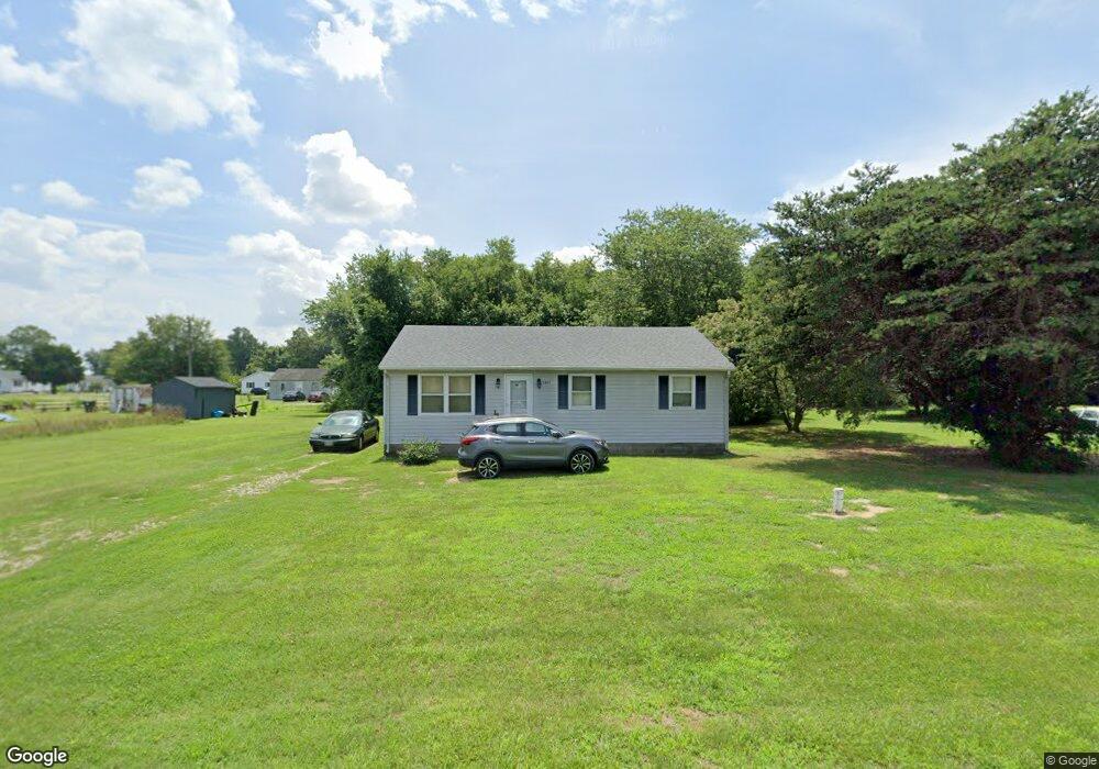
6817 Bobtown Rd Hurlock, MD 21643
Estimated Value: $80,000 - $215,000
Studio
1
Bath
1,040
Sq Ft
$130/Sq Ft
Est. Value
About This Home
This home is located at 6817 Bobtown Rd, Hurlock, MD 21643 and is currently estimated at $135,071, approximately $129 per square foot. 6817 Bobtown Rd is a home located in Dorchester County with nearby schools including Hurlock Elementary School, North Dorchester Middle School, and North Dorchester High School.
Ownership History
Date
Name
Owned For
Owner Type
Purchase Details
Closed on
May 28, 2025
Sold by
Simms Virgil E and Simms Barbara Myster
Bought by
Park Place Enterprises Llc
Current Estimated Value
Home Financials for this Owner
Home Financials are based on the most recent Mortgage that was taken out on this home.
Original Mortgage
$165,400
Interest Rate
6.63%
Mortgage Type
New Conventional
Purchase Details
Closed on
Aug 18, 2000
Sold by
B & M Properties Inc
Bought by
Simms Virgil E and Myster Barbara
Purchase Details
Closed on
Sep 28, 1990
Sold by
Tilghman William R and Tilghman Frances
Bought by
B And M Properties, Inc.
Home Financials for this Owner
Home Financials are based on the most recent Mortgage that was taken out on this home.
Original Mortgage
$20,000
Interest Rate
10.22%
Purchase Details
Closed on
Apr 22, 1981
Sold by
United States Of America
Bought by
Tilghman William R and Tilghman Frances
Create a Home Valuation Report for This Property
The Home Valuation Report is an in-depth analysis detailing your home's value as well as a comparison with similar homes in the area
Home Values in the Area
Average Home Value in this Area
Purchase History
| Date | Buyer | Sale Price | Title Company |
|---|---|---|---|
| Park Place Enterprises Llc | $85,276 | Old Republic Title | |
| Simms Virgil E | $58,500 | -- | |
| B And M Properties, Inc. | $20,000 | -- | |
| Tilghman William R | $30,000 | -- |
Source: Public Records
Mortgage History
| Date | Status | Borrower | Loan Amount |
|---|---|---|---|
| Previous Owner | Park Place Enterprises Llc | $165,400 | |
| Previous Owner | B And M Properties, Inc. | $20,000 | |
| Closed | Simms Virgil E | -- |
Source: Public Records
Tax History
| Year | Tax Paid | Tax Assessment Tax Assessment Total Assessment is a certain percentage of the fair market value that is determined by local assessors to be the total taxable value of land and additions on the property. | Land | Improvement |
|---|---|---|---|---|
| 2025 | $1,235 | $102,900 | $0 | $0 |
| 2024 | $1,100 | $94,300 | $34,200 | $60,100 |
| 2023 | $1,100 | $93,567 | $0 | $0 |
| 2022 | $2,185 | $92,833 | $0 | $0 |
| 2021 | $1,058 | $92,100 | $34,200 | $57,900 |
| 2020 | $1,058 | $89,733 | $0 | $0 |
| 2019 | $1,032 | $87,367 | $0 | $0 |
| 2018 | $1,005 | $85,000 | $34,200 | $50,800 |
| 2017 | $980 | $84,733 | $0 | $0 |
| 2016 | -- | $84,467 | $0 | $0 |
| 2015 | -- | $84,200 | $0 | $0 |
| 2014 | -- | $84,200 | $0 | $0 |
Source: Public Records
Map
Nearby Homes
- 6819 Bobtown Rd
- 4714 Payne Rd
- 4604 Payne Rd
- 6749 Bobtown Rd
- 0 Gravel Branch Rd Unit MDDO2001942
- 6720 Bobtown Rd
- 6941 Hubbard Rd
- 4907 Payne Rd
- 4445 Rolling Acres Dr
- 4942 Skinners Run Rd
- 521 Academy St
- 5035 River Rd
- 101 Commerce St
- 405 Collins Ave
- 4308 Blink Horn Rd
- 4326 Gavins Run
- 207 S Main St
- 219 S Main St
- 309 S Main St
- 311 Prospect St
Your Personal Tour Guide
Ask me questions while you tour the home.