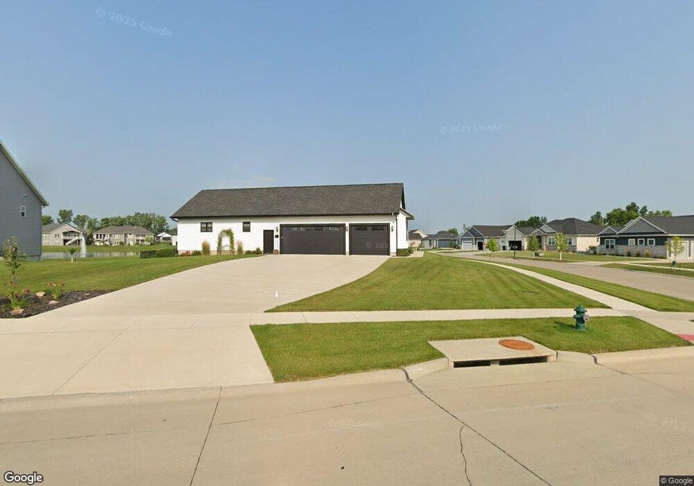
6819 Wexford Way NE Cedar Rapids, IA 52411
Estimated Value: $471,000 - $832,000
4
Beds
5
Baths
2,172
Sq Ft
$326/Sq Ft
Est. Value
About This Home
This home is located at 6819 Wexford Way NE, Cedar Rapids, IA 52411 and is currently estimated at $708,891, approximately $326 per square foot. 6819 Wexford Way NE is a home with nearby schools including Viola Gibson Elementary School, Harding Middle School, and John F. Kennedy High School.
Ownership History
Date
Name
Owned For
Owner Type
Purchase Details
Closed on
Dec 21, 2018
Sold by
B Hancock Construction Inc
Bought by
Forslund Phillip J and Forslund Jennette M
Current Estimated Value
Home Financials for this Owner
Home Financials are based on the most recent Mortgage that was taken out on this home.
Original Mortgage
$535,152
Outstanding Balance
$472,421
Interest Rate
4.9%
Mortgage Type
Future Advance Clause Open End Mortgage
Estimated Equity
$236,470
Purchase Details
Closed on
Apr 5, 2018
Sold by
Wex Inc
Bought by
B Hancock Construction Inc
Create a Home Valuation Report for This Property
The Home Valuation Report is an in-depth analysis detailing your home's value as well as a comparison with similar homes in the area
Home Values in the Area
Average Home Value in this Area
Purchase History
| Date | Buyer | Sale Price | Title Company |
|---|---|---|---|
| Forslund Phillip J | $554,000 | None Available | |
| B Hancock Construction Inc | $76,500 | None Available |
Source: Public Records
Mortgage History
| Date | Status | Borrower | Loan Amount |
|---|---|---|---|
| Open | Forslund Phillip J | $535,152 |
Source: Public Records
Tax History Compared to Growth
Tax History
| Year | Tax Paid | Tax Assessment Tax Assessment Total Assessment is a certain percentage of the fair market value that is determined by local assessors to be the total taxable value of land and additions on the property. | Land | Improvement |
|---|---|---|---|---|
| 2025 | $11,180 | $693,300 | $138,200 | $555,100 |
| 2024 | $11,766 | $682,900 | $118,900 | $564,000 |
| 2023 | $11,766 | $642,200 | $118,900 | $523,300 |
| 2022 | $11,354 | $566,700 | $96,800 | $469,900 |
| 2021 | $11,536 | $557,000 | $96,800 | $460,200 |
| 2020 | $11,536 | $531,400 | $96,800 | $434,600 |
| 2019 | $174 | $0 | $0 | $0 |
| 2018 | $0 | $0 | $0 | $0 |
Source: Public Records
Map
Nearby Homes
- 6524 Michael Dr NE
- 5843 Wells Ln
- 6712 Lauder Ln NE
- 6712 Lauder Ln
- 5854 Wells Ln
- 6421 Ascot Ln
- 6312 Casey Ln NE
- 6300 Westwind Rd
- 5515 W Mustang Rd
- 6505 Blairs Ferry Rd
- 4301 Viola St NE
- 2492 River Run Rd
- 224 Willowood Dr
- 2255 Blairsferry Crossing
- 225 Ridgewood Dr
- 5180 Chestnut Valley Rd
- 4620 Prairie Stone Dr NE
- 4408 Prairie Stone Dr NE
- 4510 Prairie Stone Dr NE
- Lot 1A Buffalo Ridge Dr NE
- 6813 Wexford Way NE
- 6009 Michael Dr NE
- 6814 Wexford Way NE
- 6807 Wexford Way NE
- 6002 Michael Dr NE
- 6101 Michael Dr NE
- 6808 Wexford Way NE
- 5906 Michael Dr NE
- 6008 Michael Dr NE
- 6801 Wexford Way NE
- 6014 Michael Dr NE
- 5900 Michael Dr NE
- 6100 Michael Dr NE
- 6802 Wexford Way NE
- 6107 Michael Dr NE
- 6711 Wexford Way NE
- 6106 Michael Dr NE
- 6712 Wexford Way NE
- 5870 Michael Dr NE
- 5870 Michael Dr