Estimated Value: $211,000 - $269,000
3
Beds
2
Baths
1,550
Sq Ft
$154/Sq Ft
Est. Value
About This Home
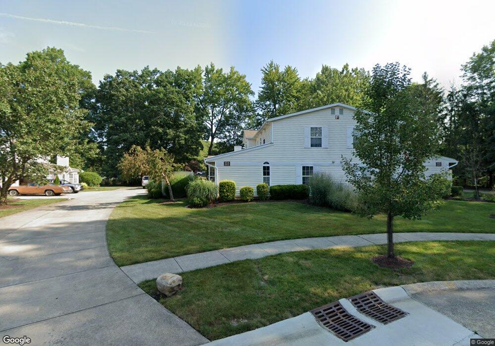
This home is located at 682 S Point Trail Unit F23, Berea, OH 44017 and is currently estimated at $238,375, approximately $153 per square foot. 682 S Point Trail Unit F23 is a home located in Cuyahoga County with nearby schools including Grindstone Elementary School, Berea-Midpark Middle School, and Berea-Midpark High School.
Ownership History
Date
Name
Owned For
Owner Type
Purchase Details
Closed on
Jul 16, 2013
Sold by
Roller Richard G
Bought by
Roller Richard and The Richard Roller Trust
Current Estimated Value
Purchase Details
Closed on
Oct 20, 2005
Sold by
Gilbert Robert L and Gilbert Ruth L
Bought by
Roller Richard G
Home Financials for this Owner
Home Financials are based on the most recent Mortgage that was taken out on this home.
Original Mortgage
$115,000
Outstanding Balance
$808
Interest Rate
5.82%
Mortgage Type
Fannie Mae Freddie Mac
Estimated Equity
$237,567
Purchase Details
Closed on
Aug 31, 1994
Sold by
Chandler Enterprises Inc
Bought by
Gilbert Robert L and Gilbert Ruth L
Home Financials for this Owner
Home Financials are based on the most recent Mortgage that was taken out on this home.
Original Mortgage
$75,900
Interest Rate
8.59%
Mortgage Type
New Conventional
Create a Home Valuation Report for This Property
The Home Valuation Report is an in-depth analysis detailing your home's value as well as a comparison with similar homes in the area
Home Values in the Area
Average Home Value in this Area
Purchase History
| Date | Buyer | Sale Price | Title Company |
|---|---|---|---|
| Roller Richard | -- | None Available | |
| Roller Richard G | $146,000 | Signature Title | |
| Gilbert Robert L | $111,900 | -- |
Source: Public Records
Mortgage History
| Date | Status | Borrower | Loan Amount |
|---|---|---|---|
| Open | Roller Richard G | $115,000 | |
| Previous Owner | Gilbert Robert L | $75,900 |
Source: Public Records
Tax History Compared to Growth
Tax History
| Year | Tax Paid | Tax Assessment Tax Assessment Total Assessment is a certain percentage of the fair market value that is determined by local assessors to be the total taxable value of land and additions on the property. | Land | Improvement |
|---|---|---|---|---|
| 2024 | $4,578 | $79,135 | $7,735 | $71,400 |
| 2023 | $4,112 | $59,540 | $5,950 | $53,590 |
| 2022 | $4,086 | $59,535 | $5,950 | $53,585 |
| 2021 | $4,047 | $59,540 | $5,950 | $53,590 |
| 2020 | $3,625 | $47,250 | $4,730 | $42,530 |
| 2019 | $3,528 | $135,000 | $13,500 | $121,500 |
| 2018 | $3,504 | $47,250 | $4,730 | $42,530 |
| 2017 | $3,184 | $39,800 | $3,640 | $36,160 |
| 2016 | $3,161 | $39,800 | $3,640 | $36,160 |
| 2015 | $3,473 | $39,800 | $3,640 | $36,160 |
| 2014 | $3,473 | $46,280 | $4,240 | $42,040 |
Source: Public Records
Map
Nearby Homes
- 84 Sprague Rd
- 104 Whitehall Dr
- 8627 Courtland Dr
- 740 Fair St
- 8036 Fair Rd
- 243 Jananna Dr
- 154 Best St
- 74 Aaron St
- 23 Hamilton St
- 9401 Pheasant Run Place
- 266 Jananna Dr
- 8902 Lincolnshire Blvd
- 585 Woodmere Dr
- 255 Fairpark Dr
- 19419 Fowles Rd
- 21292 Creekside Dr
- 458 Sprague Rd
- 147 Adams St
- 28 Crocker St
- 214 Race St
- 685 S Point Trail Unit F22
- 684 S Point Trail
- 683 S Point Trail
- 687 S Point Trail Unit G25
- 688 S Point Trail
- 686 S Point Trail
- 689 S Point Trail
- 687 S Point Trail Unit G
- 89 Ellen Dr
- 700 S Point Trail Unit 18E
- 704 S Point Trail Unit 17E
- 702 S Point Trail
- 698 S Point Trail
- 71 Manning Dr
- 61 Manning Dr
- 95 Ellen Dr
- 692 S Point Trail
- 693 S Point Trail Unit H31
- 691 S Point Trail Unit H32
- 690 S Point Trail