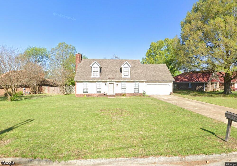
6821 Branch Rd Olive Branch, MS 38654
Estimated Value: $251,000 - $301,000
4
Beds
3
Baths
2,284
Sq Ft
$121/Sq Ft
Est. Value
About This Home
This home is located at 6821 Branch Rd, Olive Branch, MS 38654 and is currently estimated at $275,357, approximately $120 per square foot. 6821 Branch Rd is a home located in DeSoto County with nearby schools including Olive Branch Elementary School, Chickasaw Elementary School, and Olive Branch Middle School.
Ownership History
Date
Name
Owned For
Owner Type
Purchase Details
Closed on
Nov 30, 2020
Sold by
Speer Cecil E
Bought by
Sims Claudia
Current Estimated Value
Home Financials for this Owner
Home Financials are based on the most recent Mortgage that was taken out on this home.
Original Mortgage
$157,102
Outstanding Balance
$84,034
Interest Rate
2.8%
Mortgage Type
Purchase Money Mortgage
Estimated Equity
$191,323
Purchase Details
Closed on
Mar 17, 2005
Sold by
Bales Andrew E
Bought by
Speer Cecil E and Speer Lola D
Create a Home Valuation Report for This Property
The Home Valuation Report is an in-depth analysis detailing your home's value as well as a comparison with similar homes in the area
Home Values in the Area
Average Home Value in this Area
Purchase History
| Date | Buyer | Sale Price | Title Company |
|---|---|---|---|
| Sims Claudia | -- | Quality Title Group | |
| Speer Cecil E | -- | Realty Title |
Source: Public Records
Mortgage History
| Date | Status | Borrower | Loan Amount |
|---|---|---|---|
| Open | Sims Claudia | $157,102 | |
| Closed | Sims Claudia | $157,102 |
Source: Public Records
Tax History
| Year | Tax Paid | Tax Assessment Tax Assessment Total Assessment is a certain percentage of the fair market value that is determined by local assessors to be the total taxable value of land and additions on the property. | Land | Improvement |
|---|---|---|---|---|
| 2025 | $1,826 | $18,360 | $2,000 | $16,360 |
| 2024 | $1,512 | $13,275 | $2,000 | $11,275 |
| 2023 | $1,512 | $13,275 | $0 | $0 |
| 2022 | $1,512 | $13,275 | $2,000 | $11,275 |
| 2021 | $1,495 | $13,150 | $2,000 | $11,150 |
| 2020 | $646 | $12,233 | $2,000 | $10,233 |
| 2019 | $646 | $12,233 | $2,000 | $10,233 |
| 2017 | $616 | $21,976 | $11,988 | $9,988 |
| 2016 | $616 | $11,988 | $2,000 | $9,988 |
| 2015 | $1,645 | $21,976 | $11,988 | $9,988 |
| 2014 | $696 | $12,576 | $0 | $0 |
| 2013 | $1,366 | $12,576 | $0 | $0 |
Source: Public Records
Map
Nearby Homes
- 10550 Rose Ln
- 10395 Catalpa Cove
- 6741 Hacks Cross Rd
- 6716 Branch Rd S
- 10238 Cheryl Cove
- 10185 Goodman Rd
- 10874 Wiseman Dr
- 10153 Stephenson Ln
- 7338 Alexander Rd
- 6931 Maury Dr
- 6915 Maury Dr
- 6303 Oak Run Dr W
- LOT 3 Old Goodman Rd
- 10141 Fox Chase Dr
- 9919 Adina Cove
- 10668 Stark Acres Rd
- 7550 Old Highway 78
- 9737 Dogwood Ct W
- 6849 Dogwood Manor W
- 9678 Stuart Cove
- 6795 Branch Rd
- 6855 Branch Rd
- 6765 Branch Rd
- 6716 Persimmon Cove
- 10665 Loblolly St
- 6810 Branch Rd
- 10655 Loblolly St
- 6800 Branch Rd
- 6770 Branch Rd
- 6720 Persimmon Cove
- 6840 Branch Rd
- 6840 Branch Rd
- 10625 Loblolly St
- 6735 Branch Rd
- 6725 Sassafras St
- 6860 Branch Rd
- 6712 Persimmon Cove
- 6736 Sassafras St
- 10605 Loblolly St
- 10770 Loblolly St
Your Personal Tour Guide
Ask me questions while you tour the home.