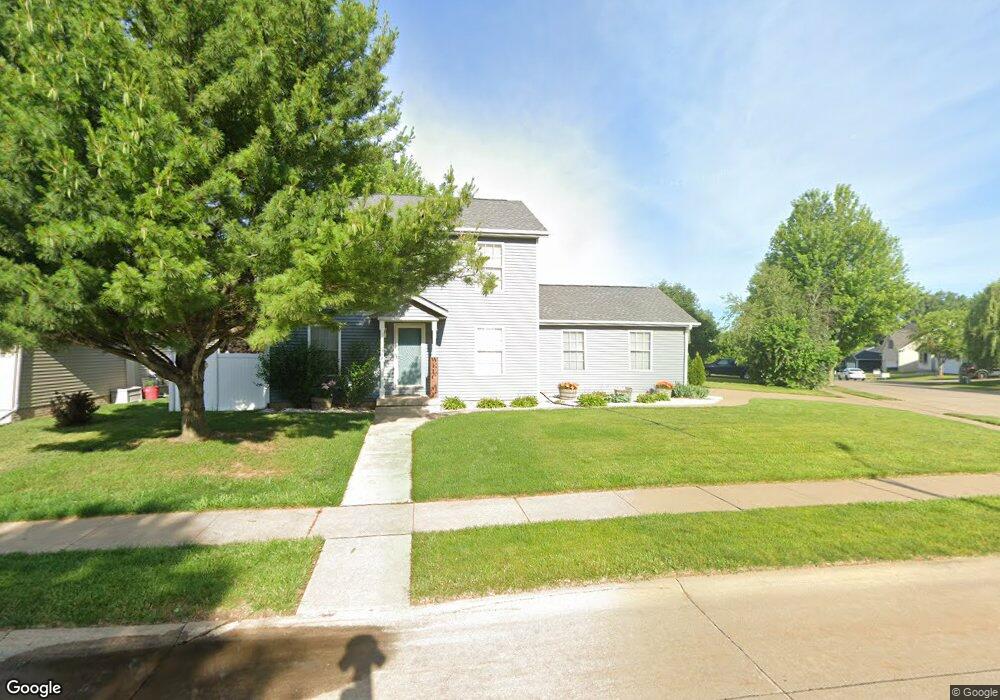
6822 Cresthill Dr Davenport, IA 52806
North Side NeighborhoodEstimated Value: $299,000 - $356,000
3
Beds
3
Baths
1,680
Sq Ft
$191/Sq Ft
Est. Value
About This Home
This home is located at 6822 Cresthill Dr, Davenport, IA 52806 and is currently estimated at $320,474, approximately $190 per square foot. 6822 Cresthill Dr is a home located in Scott County with nearby schools including Fillmore Elementary School, Wood Intermediate School, and North High School.
Ownership History
Date
Name
Owned For
Owner Type
Purchase Details
Closed on
Feb 25, 2013
Sold by
Mirfield Lucinda L and Mirfield Joseph D
Bought by
Wilmont Marie A and Wilmont Ronald G
Current Estimated Value
Home Financials for this Owner
Home Financials are based on the most recent Mortgage that was taken out on this home.
Original Mortgage
$171,500
Interest Rate
3.5%
Mortgage Type
New Conventional
Create a Home Valuation Report for This Property
The Home Valuation Report is an in-depth analysis detailing your home's value as well as a comparison with similar homes in the area
Home Values in the Area
Average Home Value in this Area
Purchase History
| Date | Buyer | Sale Price | Title Company |
|---|---|---|---|
| Wilmont Marie A | $175,000 | None Available |
Source: Public Records
Mortgage History
| Date | Status | Borrower | Loan Amount |
|---|---|---|---|
| Previous Owner | Wilmont Marie A | $171,500 |
Source: Public Records
Tax History Compared to Growth
Tax History
| Year | Tax Paid | Tax Assessment Tax Assessment Total Assessment is a certain percentage of the fair market value that is determined by local assessors to be the total taxable value of land and additions on the property. | Land | Improvement |
|---|---|---|---|---|
| 2025 | $4,968 | $314,100 | $47,680 | $266,420 |
| 2024 | $4,690 | $305,020 | $47,680 | $257,340 |
| 2023 | $5,046 | $296,630 | $47,680 | $248,950 |
| 2022 | $5,066 | $251,860 | $41,100 | $210,760 |
| 2021 | $5,066 | $251,860 | $41,100 | $210,760 |
| 2020 | $4,798 | $236,390 | $41,100 | $195,290 |
| 2019 | $4,706 | $224,790 | $41,100 | $183,690 |
| 2018 | $4,386 | $224,790 | $41,100 | $183,690 |
| 2017 | $1,159 | $215,120 | $41,100 | $174,020 |
| 2016 | $4,162 | $205,460 | $0 | $0 |
| 2015 | $4,162 | $195,970 | $0 | $0 |
| 2014 | $4,012 | $195,970 | $0 | $0 |
| 2013 | $3,934 | $0 | $0 | $0 |
| 2012 | -- | $199,470 | $37,480 | $161,990 |
Source: Public Records
Map
Nearby Homes
- Lot 55 Franklin
- 6354 High Point Ct
- 000 W 73rd St
- 2822 High Point Dr
- 2611 W 69th St
- 2714 W 66th St
- 3101 Fieldcrest Dr
- 2521 W 63rd St
- 7402 N Pine St
- 5904 Hillandale Rd
- 5824 Hillandale Rd
- 2434 W 59th St
- 2008 W 70th St
- 000 Pacific St
- 5556 N Thornwood Ave
- 5406 Hillandale Rd
- Lot 65 W 66th St
- 2203 W 59th St
- 2620 W 54th St
- 1724 W 69th St
- 6918 Cresthill Dr
- 6810 Cresthill Dr
- 6821 Brookview Ln
- 6829 Brookview Ln
- 6821 Cresthill Dr
- 6919 Cresthill Dr
- 6813 Brookview Ln
- 6813 Cresthill Dr
- 6901 Cresthill Dr
- 6925 Cresthill Dr
- 6750 Cresthill Dr
- 6911 Cresthill Dr
- 6809 Cresthill Dr
- 6931 Cresthill Dr
- 6801 Brookview Ln
- 6749 Cresthill Dr
- 6737 Brookview Ln
- 6818 Hillandale Rd
- 6812 Hillandale Rd
- 6741 Cresthill Dr