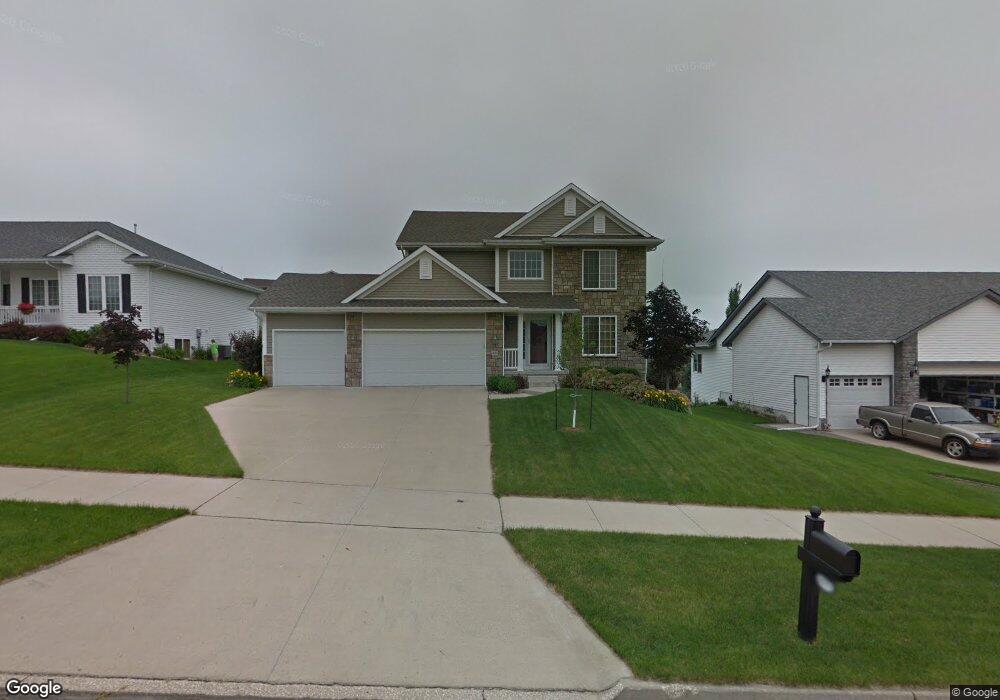
6825 Lewis Carroll Ct Johnston, IA 50131
North District NeighborhoodEstimated Value: $431,824 - $505,000
4
Beds
4
Baths
2,193
Sq Ft
$213/Sq Ft
Est. Value
About This Home
This home is located at 6825 Lewis Carroll Ct, Johnston, IA 50131 and is currently estimated at $466,206, approximately $212 per square foot. 6825 Lewis Carroll Ct is a home located in Polk County with nearby schools including Henry A. Wallace Elementary School, Johnston Middle School, and Summit Middle School.
Ownership History
Date
Name
Owned For
Owner Type
Purchase Details
Closed on
Aug 24, 2005
Sold by
Stoneridge Homes Llc
Bought by
Schroder Amy
Current Estimated Value
Home Financials for this Owner
Home Financials are based on the most recent Mortgage that was taken out on this home.
Original Mortgage
$203,000
Outstanding Balance
$107,596
Interest Rate
5.8%
Mortgage Type
Fannie Mae Freddie Mac
Estimated Equity
$358,610
Purchase Details
Closed on
Apr 22, 2005
Sold by
Johnston Commons Lc
Bought by
Stoneridge Homes Llc
Home Financials for this Owner
Home Financials are based on the most recent Mortgage that was taken out on this home.
Original Mortgage
$190,500
Interest Rate
6.06%
Mortgage Type
Construction
Create a Home Valuation Report for This Property
The Home Valuation Report is an in-depth analysis detailing your home's value as well as a comparison with similar homes in the area
Home Values in the Area
Average Home Value in this Area
Purchase History
| Date | Buyer | Sale Price | Title Company |
|---|---|---|---|
| Schroder Amy | $253,500 | -- | |
| Stoneridge Homes Llc | $42,500 | -- |
Source: Public Records
Mortgage History
| Date | Status | Borrower | Loan Amount |
|---|---|---|---|
| Open | Schroder Amy | $203,000 | |
| Previous Owner | Stoneridge Homes Llc | $190,500 |
Source: Public Records
Tax History Compared to Growth
Tax History
| Year | Tax Paid | Tax Assessment Tax Assessment Total Assessment is a certain percentage of the fair market value that is determined by local assessors to be the total taxable value of land and additions on the property. | Land | Improvement |
|---|---|---|---|---|
| 2025 | $6,238 | $443,200 | $100,000 | $343,200 |
| 2024 | $6,238 | $382,400 | $84,700 | $297,700 |
| 2023 | $6,214 | $382,400 | $84,700 | $297,700 |
| 2022 | $6,942 | $334,800 | $76,200 | $258,600 |
| 2021 | $6,986 | $334,800 | $76,200 | $258,600 |
| 2020 | $6,866 | $320,900 | $73,000 | $247,900 |
| 2019 | $6,920 | $320,900 | $73,000 | $247,900 |
| 2018 | $6,740 | $300,200 | $67,200 | $233,000 |
| 2017 | $6,062 | $300,200 | $67,200 | $233,000 |
| 2016 | $5,930 | $265,600 | $54,600 | $211,000 |
| 2015 | $5,930 | $265,600 | $54,600 | $211,000 |
| 2014 | $5,254 | $257,500 | $52,000 | $205,500 |
Source: Public Records
Map
Nearby Homes
- 6913 Lewis Carroll Ct
- 7087 Hillcrest Ct
- 7100 NW Beaver Dr
- 6925 Northglenn Way
- 5517 Kensington Cir
- 7080 Forest Dr
- 5320 NW 66th Place
- 6465 NW 56th St
- 7059 Coburn Ln
- Dahlia Plan at Hyperion Woods
- Cromwell Plan at Hyperion Woods
- Palasade Plan at Hyperion Woods
- Monterey Plan at Hyperion Woods
- Palmer Plan at Hyperion Woods
- Danbury Plan at Hyperion Woods
- Cadbury Plan at Hyperion Woods
- Lot 14 NW 54th Ct
- 6404 NW 56th St
- 6775 NW Trail Ridge Dr
- 7217 NW 107th St
- 6821 Lewis Carroll Ct
- 6901 Lewis Carroll Ct
- 5804 Charles Dickens Ct
- 6817 Lewis Carroll Ct
- 6826 Lewis Carroll Ct
- 6818 Jules Verne Ct
- 6902 Lewis Carroll Ct
- 6822 Lewis Carroll Ct
- 6813 Lewis Carroll Ct
- 6906 Lewis Carroll Ct
- 6814 Jules Verne Ct
- 6817 Jules Verne Ct
- 6818 Lewis Carroll Ct
- 6905 Lewis Carroll Ct
- 5800 Charles Dickens Ct
- 6910 Lewis Carroll Ct
- 6814 Lewis Carroll Ct
- 5801 Charles Dickens Ct
- 6809 Lewis Carroll Ct
- 6813 Jules Verne Ct