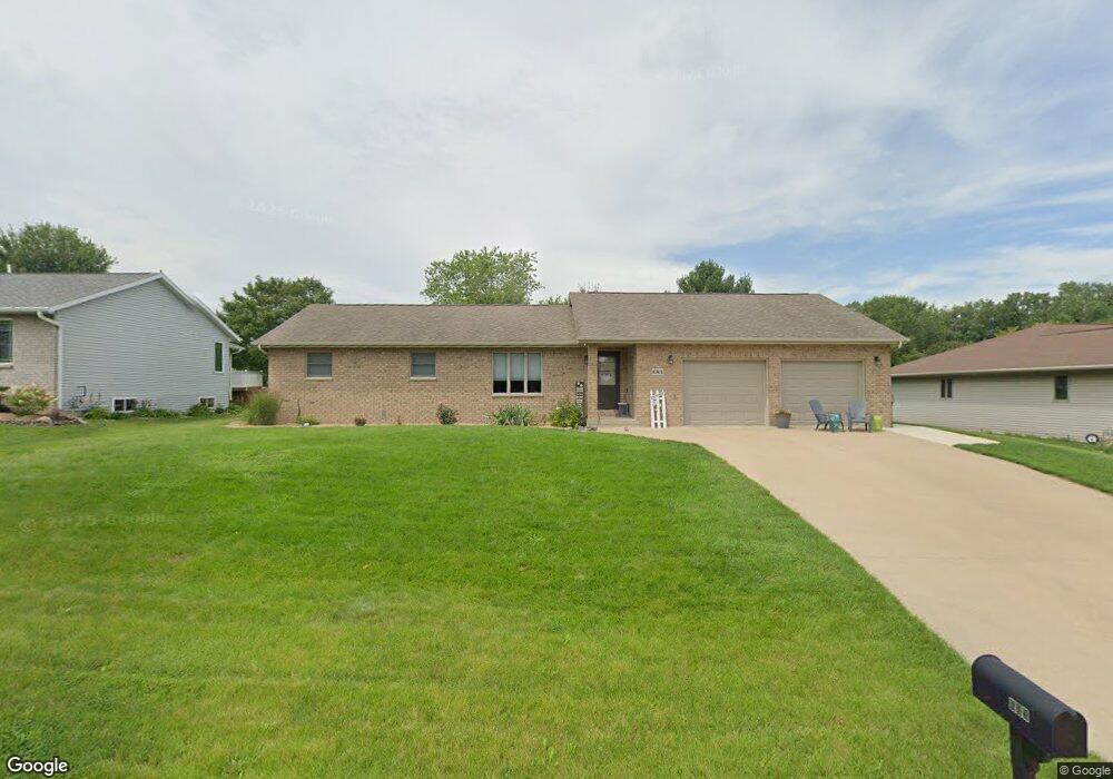
683 Birch Ridge N Peosta, IA 52068
Estimated Value: $294,000 - $396,000
3
Beds
2
Baths
1,309
Sq Ft
$258/Sq Ft
Est. Value
About This Home
This home is located at 683 Birch Ridge N, Peosta, IA 52068 and is currently estimated at $337,320, approximately $257 per square foot. 683 Birch Ridge N is a home located in Dubuque County with nearby schools including Peosta Elementary School, Drexler Middle - Intermediate School, and Western Dubuque High School.
Ownership History
Date
Name
Owned For
Owner Type
Purchase Details
Closed on
Apr 28, 2017
Sold by
Mcquillen Judith A
Bought by
Soppe Amy K
Current Estimated Value
Home Financials for this Owner
Home Financials are based on the most recent Mortgage that was taken out on this home.
Original Mortgage
$148,000
Outstanding Balance
$122,922
Interest Rate
4.14%
Mortgage Type
New Conventional
Estimated Equity
$214,398
Create a Home Valuation Report for This Property
The Home Valuation Report is an in-depth analysis detailing your home's value as well as a comparison with similar homes in the area
Home Values in the Area
Average Home Value in this Area
Purchase History
| Date | Buyer | Sale Price | Title Company |
|---|---|---|---|
| Soppe Amy K | -- | None Available |
Source: Public Records
Mortgage History
| Date | Status | Borrower | Loan Amount |
|---|---|---|---|
| Open | Soppe Amy K | $148,000 |
Source: Public Records
Tax History Compared to Growth
Tax History
| Year | Tax Paid | Tax Assessment Tax Assessment Total Assessment is a certain percentage of the fair market value that is determined by local assessors to be the total taxable value of land and additions on the property. | Land | Improvement |
|---|---|---|---|---|
| 2025 | $3,310 | $267,500 | $43,500 | $224,000 |
| 2024 | $3,310 | $248,600 | $43,500 | $205,100 |
| 2023 | $3,190 | $248,600 | $43,500 | $205,100 |
| 2022 | $2,844 | $199,140 | $43,500 | $155,640 |
| 2021 | $2,844 | $199,140 | $43,500 | $155,640 |
| 2020 | $2,722 | $183,660 | $39,150 | $144,510 |
| 2019 | $2,652 | $183,660 | $39,150 | $144,510 |
| 2018 | $2,602 | $170,740 | $27,670 | $143,070 |
| 2017 | $2,454 | $170,740 | $27,670 | $143,070 |
| 2016 | $2,424 | $163,040 | $26,100 | $136,940 |
| 2015 | $2,424 | $163,040 | $26,100 | $136,940 |
| 2014 | $2,426 | $157,620 | $26,100 | $131,520 |
Source: Public Records
Map
Nearby Homes
- 7630 Kaia Dr
- Lot 60 Hugo Dr
- Lot 64 Hugo Dr
- 9391 Cashel Dr E
- 8165 Hugo Dr
- 8202 Hugo Dr
- 8122 Hugo Dr
- 8166 Tegan Dr
- 175 Bryn Dr
- Lot 20 Ginger Dr
- Lot 90 Ginger Dr
- Lot 45 Gretel Ct
- Lot 29 Ginger Dr
- Lot 28 Ginger Dr
- Lot 25 Ginger Dr
- Lot 24 Ginger Dr
- Lot 19 Ginger Dr
- Lot 36 Ginger Dr
- Lot 35 Ginger Dr
- Lot 34 Ginger Dr
- 665 Birch Ridge N
- 665 Birch Ridge N
- 701 Birch Ridge N
- 682 Maple Ridge St
- 664 Maple Ridge St
- 715 Birch Ridge N
- 649 Birch Ridge N
- 649 Birch Ridge N
- 700 Maple Ridge St
- 682 Birch Ridge N
- 700 Birch Ridge N
- 650 Maple Ridge St
- 652 Birch Ridge S
- 718 Birch Ridge N
- 729 Birch Ridge N
- 715 Maple Ridge St
- 634 Birch Ridge S
- 625 Birch Ridge S
- 7985 Kalb Ridge St
- 675 Maple Ridge St