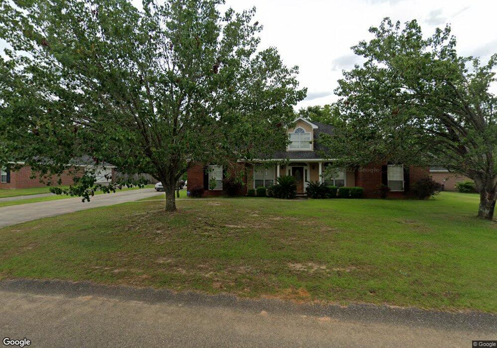
6835 Browder Dr Theodore, AL 36582
Westfield NeighborhoodEstimated Value: $271,000 - $323,000
5
Beds
3
Baths
3,013
Sq Ft
$98/Sq Ft
Est. Value
About This Home
This home is located at 6835 Browder Dr, Theodore, AL 36582 and is currently estimated at $295,124, approximately $97 per square foot. 6835 Browder Dr is a home located in Mobile County with nearby schools including Nan Gray Davis Elementary School, Katherine H Hankins Middle School, and Theodore High School.
Ownership History
Date
Name
Owned For
Owner Type
Purchase Details
Closed on
Aug 30, 2011
Sold by
Copeland Robert and Copeland Renea
Bought by
Berry Donald W and Berry Shaunta M
Current Estimated Value
Home Financials for this Owner
Home Financials are based on the most recent Mortgage that was taken out on this home.
Original Mortgage
$155,846
Outstanding Balance
$106,931
Interest Rate
4.53%
Mortgage Type
FHA
Estimated Equity
$188,193
Create a Home Valuation Report for This Property
The Home Valuation Report is an in-depth analysis detailing your home's value as well as a comparison with similar homes in the area
Home Values in the Area
Average Home Value in this Area
Purchase History
| Date | Buyer | Sale Price | Title Company |
|---|---|---|---|
| Berry Donald W | $160,346 | None Available |
Source: Public Records
Mortgage History
| Date | Status | Borrower | Loan Amount |
|---|---|---|---|
| Open | Berry Donald W | $155,846 |
Source: Public Records
Tax History
| Year | Tax Paid | Tax Assessment Tax Assessment Total Assessment is a certain percentage of the fair market value that is determined by local assessors to be the total taxable value of land and additions on the property. | Land | Improvement |
|---|---|---|---|---|
| 2025 | $1,049 | $21,570 | $2,400 | $19,170 |
| 2024 | $1,049 | $19,190 | $2,200 | $16,990 |
| 2023 | $984 | $18,880 | $2,400 | $16,480 |
| 2022 | $877 | $19,440 | $2,000 | $17,440 |
| 2021 | $730 | $16,420 | $2,000 | $14,420 |
| 2020 | $784 | $17,510 | $2,250 | $15,260 |
| 2019 | $814 | $18,160 | $0 | $0 |
| 2018 | $834 | $18,580 | $0 | $0 |
| 2017 | $866 | $19,240 | $0 | $0 |
| 2016 | $799 | $17,860 | $0 | $0 |
| 2013 | $758 | $16,820 | $0 | $0 |
Source: Public Records
Map
Nearby Homes
- 6840 Highmont Dr
- 6776 Barneswood Dr
- 6760 Barneswood Dr
- 6750 Barneswood Dr
- 6738 Barneswood Dr
- 7078 Westfield Rd
- 6654 Destinee Nicole Dr
- 7665 Oakmont Dr E
- 6521 Barnes Rd
- 6611 Madison Arras Ct
- 6561 Apache Run
- 6293 Woodside Dr S
- 6292 Woodside Dr S
- 7520 Oak Dr W
- 6675 Oak Dr E
- 6157 Magnolia Trace N
- 7264 Broadview Dr W
- 6178 Sperry Rd
- 7610 Havenwood Dr
- 6320 Highway 90
- 6825 Browder Dr
- 6845 Browder Dr
- 6815 Browder Dr
- 6820 Browder Dr
- 6810 Browder Dr
- 6810 Browder Dr Unit 7
- 6830 Browder Dr
- 6840 Browder Dr
- 6850 Browder Dr
- 6797 Austin Ave
- 6792 Austin Ave Unit 1
- 6792 Austin Ave
- 6795 Browder Dr
- 6775 Browder Dr Unit 19
- 6775 Browder Dr
- 6795 Austin Ave
- 0 Austin Ave Unit 623514
- 0 Austin Ave Unit 641636
- 0 Austin Ave Unit 5 0607332
- 0 Austin Ave Unit 5 0529269
Your Personal Tour Guide
Ask me questions while you tour the home.