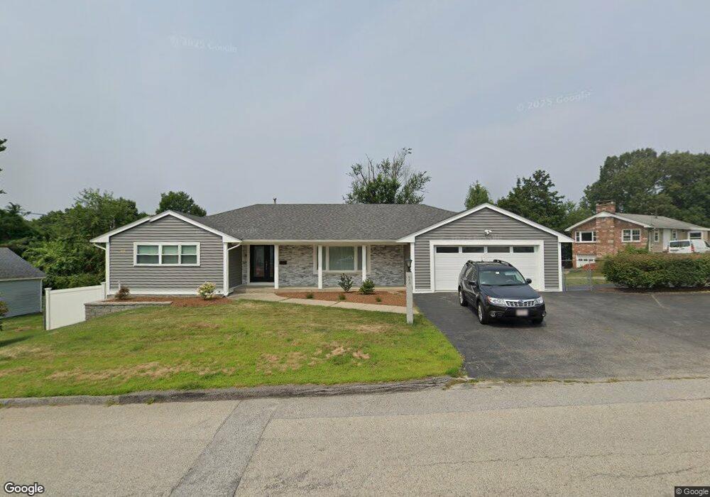
684 Burncoat St Worcester, MA 01606
Burncoat NeighborhoodEstimated Value: $443,000 - $590,000
3
Beds
3
Baths
1,396
Sq Ft
$363/Sq Ft
Est. Value
About This Home
This home is located at 684 Burncoat St, Worcester, MA 01606 and is currently estimated at $506,555, approximately $362 per square foot. 684 Burncoat St is a home located in Worcester County with nearby schools including Norrback Avenue Elementary School, Jacob Hiatt Magnet School, and Chandler Magnet.
Create a Home Valuation Report for This Property
The Home Valuation Report is an in-depth analysis detailing your home's value as well as a comparison with similar homes in the area
Home Values in the Area
Average Home Value in this Area
Tax History
| Year | Tax Paid | Tax Assessment Tax Assessment Total Assessment is a certain percentage of the fair market value that is determined by local assessors to be the total taxable value of land and additions on the property. | Land | Improvement |
|---|---|---|---|---|
| 2025 | $6,226 | $472,000 | $118,800 | $353,200 |
| 2024 | $6,060 | $440,700 | $118,800 | $321,900 |
| 2023 | $5,898 | $411,300 | $103,300 | $308,000 |
| 2022 | $5,254 | $345,400 | $82,700 | $262,700 |
| 2021 | $5,516 | $338,800 | $66,100 | $272,700 |
| 2020 | $5,253 | $309,000 | $66,100 | $242,900 |
| 2019 | $4,934 | $274,100 | $59,600 | $214,500 |
| 2018 | $4,748 | $251,100 | $59,600 | $191,500 |
| 2017 | $4,824 | $251,000 | $59,600 | $191,400 |
| 2016 | $4,825 | $234,100 | $43,900 | $190,200 |
| 2015 | $4,698 | $234,100 | $43,900 | $190,200 |
| 2014 | $4,574 | $234,100 | $43,900 | $190,200 |
Source: Public Records
Map
Nearby Homes
- 12 Beale St
- 10 Beale St
- 55 Apthorp St
- 69 Santoro Rd
- 71 Hillside Village Dr
- 1110 W Boylston St Unit A
- 48 Whispering Pine Cir Unit 48
- 31 Danielles Way
- 22 Danielles Way
- 26 Danielles Way
- 53 Collins St
- 20 Highland Ave
- 1 Highland Ave
- 6 Meadowbrook Dr
- 39 Mountainshire Dr
- 30 Osgood Ave
- 38 Juniper Ln
- 12 Pinecroft Ave
- 30 Danielles Way
- 18 Danielles Way
Your Personal Tour Guide
Ask me questions while you tour the home.