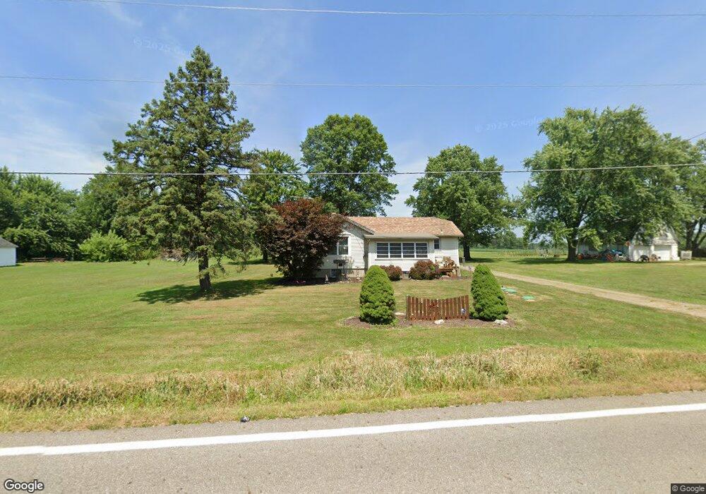
6841 State Route 305 Fowler, OH 44418
Estimated Value: $152,000 - $216,000
3
Beds
1
Bath
1,052
Sq Ft
$163/Sq Ft
Est. Value
About This Home
This home is located at 6841 State Route 305, Fowler, OH 44418 and is currently estimated at $171,340, approximately $162 per square foot. 6841 State Route 305 is a home located in Trumbull County with nearby schools including Badger Elementary School, Badger Middle School, and Badger High School.
Ownership History
Date
Name
Owned For
Owner Type
Purchase Details
Closed on
Jun 24, 2025
Sold by
Walker James H
Bought by
Walker Christina L
Current Estimated Value
Purchase Details
Closed on
Sep 12, 2002
Sold by
Hunkus Peter M and Hunkus Kristine R
Bought by
Walker James H and Walker Christina L
Home Financials for this Owner
Home Financials are based on the most recent Mortgage that was taken out on this home.
Original Mortgage
$69,825
Interest Rate
6.54%
Mortgage Type
New Conventional
Purchase Details
Closed on
Jan 21, 1994
Sold by
Kahler Edward H
Bought by
Kristine Peter M and Hu S Kristine R
Purchase Details
Closed on
Jan 1, 1990
Bought by
Dorothy G Kahler
Create a Home Valuation Report for This Property
The Home Valuation Report is an in-depth analysis detailing your home's value as well as a comparison with similar homes in the area
Home Values in the Area
Average Home Value in this Area
Purchase History
| Date | Buyer | Sale Price | Title Company |
|---|---|---|---|
| Walker Christina L | -- | None Listed On Document | |
| Walker James H | $73,500 | -- | |
| Kristine Peter M | $45,000 | -- | |
| Dorothy G Kahler | -- | -- |
Source: Public Records
Mortgage History
| Date | Status | Borrower | Loan Amount |
|---|---|---|---|
| Previous Owner | Walker James H | $69,825 |
Source: Public Records
Tax History Compared to Growth
Tax History
| Year | Tax Paid | Tax Assessment Tax Assessment Total Assessment is a certain percentage of the fair market value that is determined by local assessors to be the total taxable value of land and additions on the property. | Land | Improvement |
|---|---|---|---|---|
| 2024 | $1,614 | $37,740 | $4,100 | $33,640 |
| 2023 | $1,614 | $37,740 | $4,100 | $33,640 |
| 2022 | $1,270 | $26,820 | $3,750 | $23,070 |
| 2021 | $1,270 | $26,820 | $3,750 | $23,070 |
| 2020 | $1,279 | $26,820 | $3,750 | $23,070 |
| 2019 | $1,192 | $23,530 | $3,470 | $20,060 |
| 2018 | $1,195 | $23,530 | $3,470 | $20,060 |
| 2017 | $1,192 | $23,530 | $3,470 | $20,060 |
| 2016 | $1,127 | $22,370 | $3,430 | $18,940 |
| 2015 | $1,081 | $22,370 | $3,430 | $18,940 |
| 2014 | $1,081 | $22,370 | $3,430 | $18,940 |
| 2013 | $1,134 | $22,370 | $3,430 | $18,940 |
Source: Public Records
Map
Nearby Homes
- 3164 Ohio 7
- 4016 State Route 7
- 7131 Drake Stateline Rd NE
- 7155 Drake State Line Rd
- 7974 Thompson Sharpsville Rd
- 8038 Thompson Sharpsville Rd
- 8084 State Route 609
- 1921 Custer Orangeville Rd
- 8274 Thompson Sharpsville Rd
- 2486 Waynewood Dr NE
- 5329 Tamarack Dr
- 7529 State Line
- 2728 Sodom Hutchings Rd
- 2701 Orangeville Rd
- 2601 Orangeville Rd
- 4875 Cadwallader-Sonk Rd
- 0 Albright McKay Rd NE
- 571 Buckeye Dr
- 1212 State Route 7 NE
- 2009 Sodom Hutchings Rd NE
- 6813 State Route 305
- 6830 State Route 305
- 6869 Wilson Sharpsville
- 6789 State Route 305
- 6804 State Route 305
- 6953 Wilson Sharpsville Rd
- 6881 Ohio 305
- 6779 State Route 305
- 6888 State Route 305
- 0 Sr 305 (Wilson Sharpsv
- 6755 State Route 305
- 6739 State Route 305
- 9999 Wilson Sharpsville Rd
- 8284 Wilson Sharpsville Rd
- 8372 Wilson Sharpsville Rd
- 7611 Wilson Sharpsville Rd
- 1 Ohio 305
- 6729 State Route 305
- 7017 State Route 305 Rd
- 6719 State Route 305