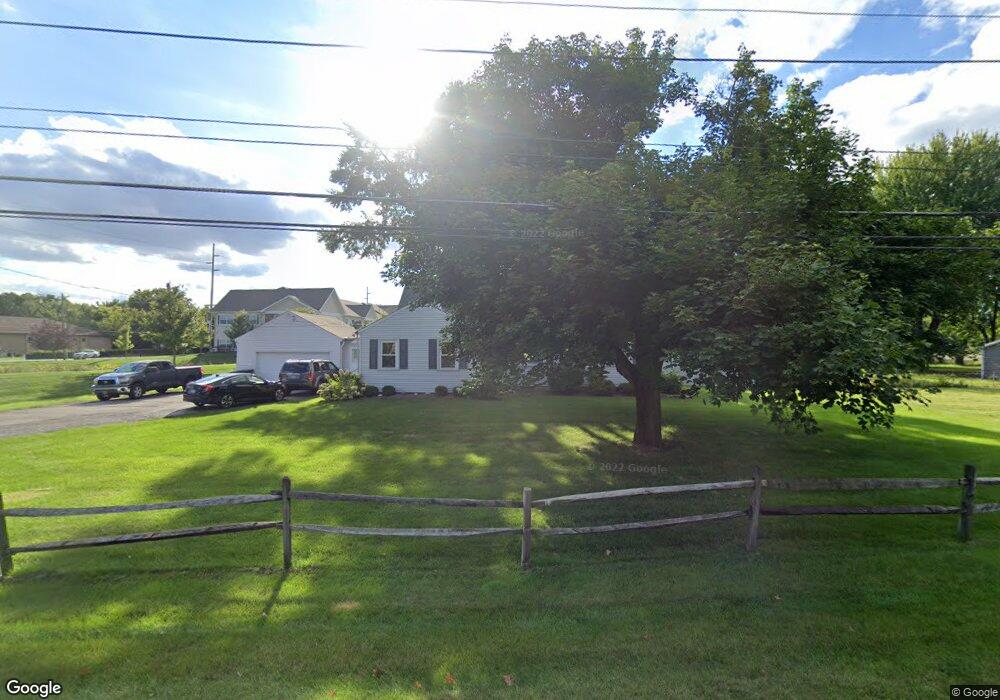
6847 Smoky Row Rd Columbus, OH 43235
Brookside Colony NeighborhoodEstimated Value: $410,000 - $488,812
3
Beds
3
Baths
2,202
Sq Ft
$203/Sq Ft
Est. Value
About This Home
This home is located at 6847 Smoky Row Rd, Columbus, OH 43235 and is currently estimated at $447,203, approximately $203 per square foot. 6847 Smoky Row Rd is a home located in Franklin County with nearby schools including Gables Elementary School, Ridgeview Middle School, and Centennial High School.
Ownership History
Date
Name
Owned For
Owner Type
Purchase Details
Closed on
Feb 18, 2025
Sold by
Albanese Kathryn L
Bought by
Michael W Waugh Irrevocable Trust and Albanese
Current Estimated Value
Purchase Details
Closed on
Dec 19, 2024
Sold by
Waugh Family Irrevocable Trust and Albanese Kathryn L
Bought by
Albanese Kathryn L
Purchase Details
Closed on
Nov 29, 2023
Sold by
Waugh Michael Wayne and Waugh Teresa L
Bought by
Waugh Family Irrevocable Trust and Albanese
Purchase Details
Closed on
Nov 21, 2023
Sold by
Waugh Michael Wayne and Waugh Teresa L
Bought by
Waugh Family Irrevocable Trust and Albanese
Purchase Details
Closed on
Aug 23, 1977
Bought by
Waugh Michael W
Create a Home Valuation Report for This Property
The Home Valuation Report is an in-depth analysis detailing your home's value as well as a comparison with similar homes in the area
Home Values in the Area
Average Home Value in this Area
Purchase History
| Date | Buyer | Sale Price | Title Company |
|---|---|---|---|
| Michael W Waugh Irrevocable Trust | -- | None Listed On Document | |
| Albanese Kathryn L | -- | None Listed On Document | |
| Albanese Kathryn L | -- | None Listed On Document | |
| Waugh Family Irrevocable Trust | -- | None Listed On Document | |
| Waugh Family Irrevocable Trust | -- | None Listed On Document | |
| Waugh Michael W | -- | -- |
Source: Public Records
Tax History Compared to Growth
Tax History
| Year | Tax Paid | Tax Assessment Tax Assessment Total Assessment is a certain percentage of the fair market value that is determined by local assessors to be the total taxable value of land and additions on the property. | Land | Improvement |
|---|---|---|---|---|
| 2024 | $5,474 | $121,980 | $47,780 | $74,200 |
| 2023 | $5,404 | $121,980 | $47,780 | $74,200 |
| 2022 | $4,620 | $89,080 | $19,110 | $69,970 |
| 2021 | $4,628 | $89,080 | $19,110 | $69,970 |
| 2020 | $4,634 | $89,080 | $19,110 | $69,970 |
| 2019 | $4,413 | $72,740 | $15,930 | $56,810 |
| 2018 | $2,202 | $72,740 | $15,930 | $56,810 |
| 2017 | $4,410 | $72,740 | $15,930 | $56,810 |
| 2016 | $4,414 | $66,640 | $14,350 | $52,290 |
| 2015 | $2,004 | $66,640 | $14,350 | $52,290 |
| 2014 | $4,017 | $66,640 | $14,350 | $52,290 |
| 2013 | $1,981 | $66,640 | $14,350 | $52,290 |
Source: Public Records
Map
Nearby Homes
- 2687 Snouffer Rd
- 6921 Spruce Pine Dr
- 1721 Worthington Run Dr Unit 1721-1731
- 1930 Shallowford Ave
- 1620 Park Row Dr Unit A
- 1637 Park Row Dr Unit F
- 2056 Fincastle Ct
- 7164 Durness Place
- 2161 Heatherfield Ave
- 1380 Tiehack Ct
- 1889 Slaton Ct Unit 1889
- 2001 Sawbury Blvd Unit 2001
- 6550 Winston Ct E
- 1828 Gardenstone Dr
- 7373 Palmleaf Ln
- 2074 Hard Rd
- 1307 Lakeside Ct
- 2220 Surreygate Dr
- 1041 Rosebank Dr
- 2392 Dunsworth Dr
- 6851 Smoky Row Rd
- 7213 Pebble Way Ct
- 7205 Pebble Way Ct
- 1761 Rushing Way
- 7197 Pebble Way Ct
- 20 Snouffer Rd
- 7191 Pebble Way Ct
- 2870 Snouffer Rd
- 1768 Rushing Way
- 6853 Mcvey Blvd
- 7204 Pebble Way Ct
- 1739 Rushing Way
- 1760 Rushing Way
- 7185 Pebble Way Ct
- 1752 Rushing Way
- 1731 Rushing Way
- 7188 Pebble Way Ct
- 1744 Rushing Way
- 7179 Pebble Way Ct
- 6847 Mcvey Blvd