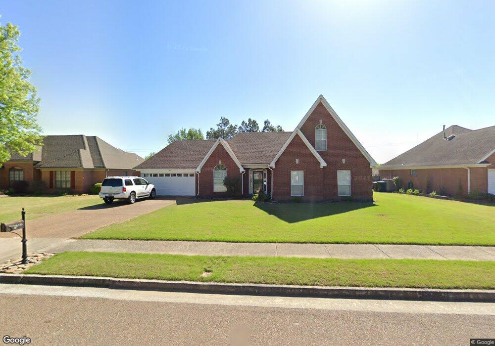
6848 Forrest Cir Memphis, TN 38135
Estimated Value: $342,511 - $367,000
4
Beds
3
Baths
2,792
Sq Ft
$127/Sq Ft
Est. Value
About This Home
This home is located at 6848 Forrest Cir, Memphis, TN 38135 and is currently estimated at $353,378, approximately $126 per square foot. 6848 Forrest Cir is a home located in Shelby County with nearby schools including Altruria Elementary School, Elmore Park Middle School, and Bartlett High School.
Ownership History
Date
Name
Owned For
Owner Type
Purchase Details
Closed on
Dec 29, 2008
Sold by
Handley Anglia M
Bought by
Rye Christy M
Current Estimated Value
Home Financials for this Owner
Home Financials are based on the most recent Mortgage that was taken out on this home.
Original Mortgage
$155,448
Outstanding Balance
$102,224
Interest Rate
5.95%
Mortgage Type
FHA
Estimated Equity
$251,154
Purchase Details
Closed on
Apr 15, 2003
Sold by
Burks Douglas E and Burks Lisa K
Bought by
Handley Anglia M
Home Financials for this Owner
Home Financials are based on the most recent Mortgage that was taken out on this home.
Original Mortgage
$149,200
Interest Rate
4.62%
Mortgage Type
Unknown
Purchase Details
Closed on
Aug 26, 1994
Bought by
Burks Douglas E and Burks Lisa K
Create a Home Valuation Report for This Property
The Home Valuation Report is an in-depth analysis detailing your home's value as well as a comparison with similar homes in the area
Home Values in the Area
Average Home Value in this Area
Purchase History
| Date | Buyer | Sale Price | Title Company |
|---|---|---|---|
| Rye Christy M | $157,500 | None Available | |
| Handley Anglia M | $186,500 | -- | |
| Burks Douglas E | $148,500 | -- |
Source: Public Records
Mortgage History
| Date | Status | Borrower | Loan Amount |
|---|---|---|---|
| Open | Rye Christy M | $155,448 | |
| Previous Owner | Handley Anglia M | $149,200 | |
| Closed | Handley Anglia M | $37,300 |
Source: Public Records
Tax History
| Year | Tax Paid | Tax Assessment Tax Assessment Total Assessment is a certain percentage of the fair market value that is determined by local assessors to be the total taxable value of land and additions on the property. | Land | Improvement |
|---|---|---|---|---|
| 2025 | $1,931 | $87,625 | $17,200 | $70,425 |
| 2024 | $1,931 | $56,975 | $12,350 | $44,625 |
| 2023 | $2,917 | $56,975 | $12,350 | $44,625 |
| 2022 | $2,917 | $56,975 | $12,350 | $44,625 |
| 2021 | $2,963 | $56,975 | $12,350 | $44,625 |
| 2020 | $2,720 | $46,250 | $11,975 | $34,275 |
| 2019 | $2,720 | $46,250 | $11,975 | $34,275 |
| 2018 | $2,720 | $46,250 | $11,975 | $34,275 |
| 2017 | $1,901 | $46,250 | $11,975 | $34,275 |
| 2016 | $1,894 | $43,350 | $0 | $0 |
| 2014 | $1,894 | $43,350 | $0 | $0 |
Source: Public Records
Map
Nearby Homes
- 3574 Stonehenge Cove S
- 6885 Tiffany Oaks Cove
- 6895 Tiffany Oaks Cove
- 6736 Forrest Cir
- 6957 Andrews Rd
- 6774 Oakmoor Cir S
- 6613 Baird Cove
- 6631 Morningsgate Cove
- 3618 Sunray Cove
- 6593 Woodpark Ln
- 6569 Woodpark Cove
- 3466 Stone Chase Cove
- 6644 Bright Star Ln
- 6561 Deermont Dr
- 6963 Fairhill Ln
- 3334 Oak Rd
- 6465 Eastbrier Dr
- 3262 W Earhart Dr
- 7185 Deerfield Rd
- 3255 Oak Cove
- 6840 Forrest Cir
- 6858 Forrest Cir
- 6832 Forrest Cir
- 6790 Stonetrace Dr
- 6851 Forrest Cir
- 6863 Forrest Cir
- 6831 Forrest Cir
- 6824 Forrest Cir
- 6765 Stone Break Cove
- 6827 Jody Cove
- 6778 Stonetrace Dr
- 6830 Jody Cove
- 6823 Forrest Cir
- 6816 Forrest Cir
- 6824 Nicole Cove
- 6755 Stone Break Cove
- 6772 Stonetrace Dr
- 6762 Stone Break Cove
- 6831 Jody Cove
- 3549 Tiffany Oaks Ln
Your Personal Tour Guide
Ask me questions while you tour the home.