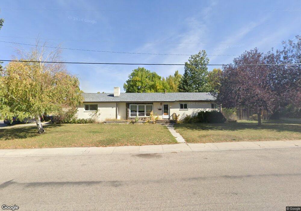
685 Cedar St Unit Bellvue Lander, WY 82520
Estimated Value: $342,000 - $384,000
5
Beds
2
Baths
1,337
Sq Ft
$272/Sq Ft
Est. Value
About This Home
This home is located at 685 Cedar St Unit Bellvue, Lander, WY 82520 and is currently estimated at $363,113, approximately $271 per square foot. 685 Cedar St Unit Bellvue is a home located in Fremont County with nearby schools including Lander Valley High School, Lander Christian Academy, and Elevation Academy.
Ownership History
Date
Name
Owned For
Owner Type
Purchase Details
Closed on
Jun 25, 2024
Sold by
Granthem Paul
Bought by
Daskiewicz Marissa
Current Estimated Value
Home Financials for this Owner
Home Financials are based on the most recent Mortgage that was taken out on this home.
Original Mortgage
$263,200
Outstanding Balance
$260,074
Interest Rate
7.02%
Mortgage Type
New Conventional
Estimated Equity
$103,039
Create a Home Valuation Report for This Property
The Home Valuation Report is an in-depth analysis detailing your home's value as well as a comparison with similar homes in the area
Home Values in the Area
Average Home Value in this Area
Purchase History
| Date | Buyer | Sale Price | Title Company |
|---|---|---|---|
| Daskiewicz Marissa | -- | None Listed On Document |
Source: Public Records
Mortgage History
| Date | Status | Borrower | Loan Amount |
|---|---|---|---|
| Open | Daskiewicz Marissa | $263,200 |
Source: Public Records
Tax History
| Year | Tax Paid | Tax Assessment Tax Assessment Total Assessment is a certain percentage of the fair market value that is determined by local assessors to be the total taxable value of land and additions on the property. | Land | Improvement |
|---|---|---|---|---|
| 2025 | $2,401 | $24,445 | $4,446 | $19,999 |
| 2024 | $2,401 | $31,112 | $5,927 | $25,185 |
| 2023 | $2,295 | $29,970 | $5,754 | $24,216 |
| 2022 | $1,896 | $25,307 | $5,754 | $19,553 |
| 2021 | $1,813 | $23,424 | $5,754 | $17,670 |
| 2020 | $1,589 | $20,569 | $5,754 | $14,815 |
| 2019 | $1,506 | $19,178 | $4,838 | $14,340 |
| 2018 | $1,497 | $18,865 | $4,838 | $14,027 |
| 2017 | $1,429 | $17,959 | $4,838 | $13,121 |
| 2016 | $1,452 | $18,273 | $4,838 | $13,435 |
| 2015 | $1,483 | $18,873 | $4,838 | $14,035 |
| 2014 | $1,548 | $19,732 | $4,838 | $14,894 |
Source: Public Records
Map
Nearby Homes
- 685 Cedar St
- 400 S 1st St
- 348 Del St
- 2 Dale Dr
- 108 Canyon St
- 316 Del St
- 275 Cascade St
- 975 S 2nd St
- 0 E Main (17 1 + - Acres) Unit 20256293
- 625 Cottonwood Ln
- 1100 Pronghorn Dr
- 617 Main St Unit LotWP001
- 1520 Rodeo Dr
- 1072 Pronghorn Dr
- 1062 Pronghorn Dr
- 442 Eugene St
- 106 Rail Ln
- 835 Garfield St
- 764 N 4th St
- 537 Market St
- 480 Bellvue Ave
- 665 Cedar St
- 665 Cedar St Unit Bellvue Ave
- 665 Cedar St Unit Buena Vista
- 670 Cedar St
- 670 Cedar St Unit Bellvue
- 460 Bellvue Ave
- 635 Cedar St
- 735 Cedar St
- 485 Bellvue Ave
- 440 Bellvue Ave
- 660 Bonnie Brae St
- 475 Bellvue Ave
- 540 Bellvue Ave
- 720 Cedar St
- 720 Cedar St Unit Buena Vista
- 615 Cedar St
- 615 Cedar St Unit Buena Vista
- 640 Bonnie Brae St
- 545 Wind River Ave
Your Personal Tour Guide
Ask me questions while you tour the home.