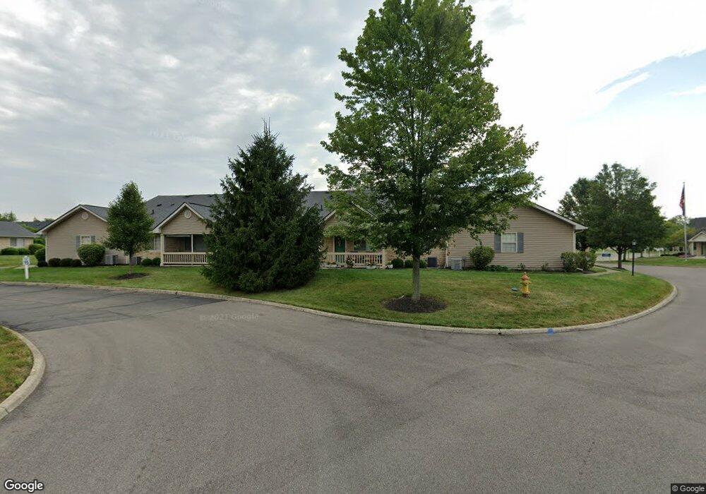
685 Fox Run Cir N Newark, OH 43055
Estimated Value: $203,000 - $263,000
2
Beds
2
Baths
1,265
Sq Ft
$179/Sq Ft
Est. Value
About This Home
This home is located at 685 Fox Run Cir N, Newark, OH 43055 and is currently estimated at $226,220, approximately $178 per square foot. 685 Fox Run Cir N is a home located in Licking County with nearby schools including Legend Elementary School, Liberty Middle School, and Newark High School.
Ownership History
Date
Name
Owned For
Owner Type
Purchase Details
Closed on
May 16, 2023
Sold by
Mazur Paul and Mazur Deborah
Bought by
Kinser Roberta
Current Estimated Value
Home Financials for this Owner
Home Financials are based on the most recent Mortgage that was taken out on this home.
Original Mortgage
$166,250
Outstanding Balance
$161,534
Interest Rate
6.28%
Mortgage Type
New Conventional
Estimated Equity
$64,686
Purchase Details
Closed on
May 31, 2018
Sold by
Dixon Wanda L
Bought by
Mazur Paul and Mazur Deborah
Purchase Details
Closed on
Apr 9, 2015
Sold by
Fox Run C Llc
Bought by
Dixon Wanda L
Purchase Details
Closed on
Mar 22, 2011
Sold by
Mid Ohio Development-Fox Run Condominium
Bought by
Fox Run C Llc
Create a Home Valuation Report for This Property
The Home Valuation Report is an in-depth analysis detailing your home's value as well as a comparison with similar homes in the area
Home Values in the Area
Average Home Value in this Area
Purchase History
| Date | Buyer | Sale Price | Title Company |
|---|---|---|---|
| Kinser Roberta | $175,000 | None Listed On Document | |
| Mazur Paul | $134,000 | None Available | |
| Dixon Wanda L | $134,250 | None Available | |
| Fox Run C Llc | $1,200,000 | Stewart Title |
Source: Public Records
Mortgage History
| Date | Status | Borrower | Loan Amount |
|---|---|---|---|
| Open | Kinser Roberta | $166,250 |
Source: Public Records
Tax History Compared to Growth
Tax History
| Year | Tax Paid | Tax Assessment Tax Assessment Total Assessment is a certain percentage of the fair market value that is determined by local assessors to be the total taxable value of land and additions on the property. | Land | Improvement |
|---|---|---|---|---|
| 2024 | $2,246 | $56,770 | $19,250 | $37,520 |
| 2023 | $2,283 | $56,770 | $19,250 | $37,520 |
| 2022 | $1,655 | $37,100 | $7,350 | $29,750 |
| 2021 | $1,731 | $37,100 | $7,350 | $29,750 |
| 2020 | $1,766 | $37,100 | $7,350 | $29,750 |
| 2019 | $1,807 | $36,270 | $6,130 | $30,140 |
| 2018 | $1,366 | $0 | $0 | $0 |
| 2017 | $1,659 | $0 | $0 | $0 |
| 2016 | $1,469 | $0 | $0 | $0 |
| 2015 | $2,003 | $0 | $0 | $0 |
| 2014 | $2,477 | $0 | $0 | $0 |
| 2013 | $1,911 | $0 | $0 | $0 |
Source: Public Records
Map
Nearby Homes
- 734 Whitetail Loop
- 763 Whitetail Loop
- 750 Whitetail Loop
- 752 Whitetail Loop
- 1684 Churchill Downs Rd
- 681 Woods Edge Ln
- 505 Courtney Dr
- 1831 Churchill Downs Rd
- 1518 Constitution Ct
- 714 Olde Creek Dr
- 1345 Sherwood Downs Rd W
- 1495 Kenarbre Dr
- 336 Myrtle Ave
- 437 Hunters Ct
- 267 Goosepond Rd Unit A
- 259 Goosepond Rd Unit C
- 261 Goosepond Rd Unit D
- 139 Aqueduct Ave
- 1670 Naughtingham Rd
- 4444 Price Rd NE
- 685 Fox Run Cir S
- 685 Fox Run Cir
- 687 Fox Run Cir Unit 687
- 687 Fox Run Cir S
- 687 Fox Run Cir N
- 683 Fox Run Cir Unit 683
- 681 Fox Run Cir S
- 681 Fox Run Cir Unit 681
- 667 Fox Run Cir Unit 667
- 665 Fox Run Cir Unit 665
- 665 Fox Run Cir S
- 663 Fox Run Cir
- 661 Fox Run Cir
- 661 Fox Run Cir S
- 695 Fox Run Cir S
- 695 Fox Run Cir Unit 695
- 682 Fox Run Cir N
- 682 Fox Run Cir
- 682 Fox Run Cir S
- 697 Fox Run Cir Unit 697