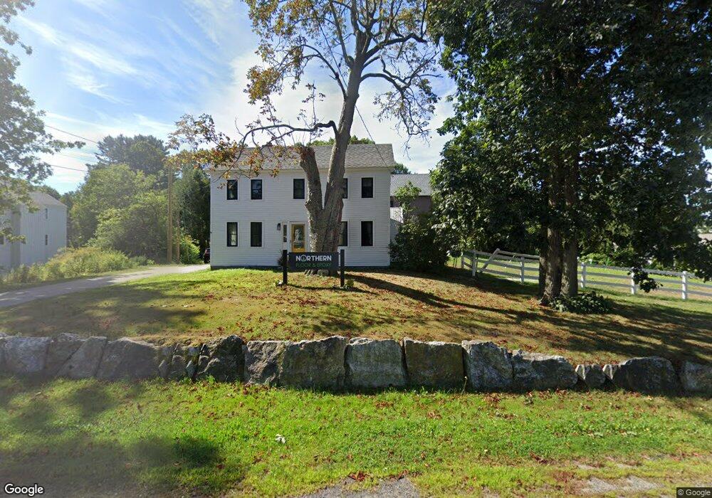
685 Portsmouth Ave Greenland, NH 03840
Estimated Value: $442,000 - $539,000
2
Beds
1
Bath
1,184
Sq Ft
$421/Sq Ft
Est. Value
About This Home
This home is located at 685 Portsmouth Ave, Greenland, NH 03840 and is currently estimated at $498,245, approximately $420 per square foot. 685 Portsmouth Ave is a home located in Rockingham County with nearby schools including Greenland Central School, The Cornerstone School, and Rye Country Day School.
Ownership History
Date
Name
Owned For
Owner Type
Purchase Details
Closed on
Mar 4, 2022
Sold by
Carol A Pugh Ret and Pugh
Bought by
Coyle Kevin L and Coyle Kathryn
Current Estimated Value
Purchase Details
Closed on
Feb 15, 2021
Sold by
Pugh Carol A
Bought by
Carol A Pugh Ret and Pugh
Purchase Details
Closed on
Jun 1, 1992
Bought by
Pugh Carol
Create a Home Valuation Report for This Property
The Home Valuation Report is an in-depth analysis detailing your home's value as well as a comparison with similar homes in the area
Home Values in the Area
Average Home Value in this Area
Purchase History
| Date | Buyer | Sale Price | Title Company |
|---|---|---|---|
| Coyle Kevin L | $340,000 | None Available | |
| Coyle Kevin L | $340,000 | None Available | |
| Carol A Pugh Ret | -- | None Available | |
| Carol A Pugh Ret | -- | None Available | |
| Pugh Carol | -- | -- |
Source: Public Records
Tax History Compared to Growth
Tax History
| Year | Tax Paid | Tax Assessment Tax Assessment Total Assessment is a certain percentage of the fair market value that is determined by local assessors to be the total taxable value of land and additions on the property. | Land | Improvement |
|---|---|---|---|---|
| 2024 | $5,074 | $390,600 | $274,400 | $116,200 |
| 2023 | $6,198 | $505,100 | $425,800 | $79,300 |
| 2022 | $5,078 | $280,700 | $209,300 | $71,400 |
| 2021 | $5,255 | $280,700 | $209,300 | $71,400 |
| 2020 | $4,654 | $280,700 | $209,300 | $71,400 |
| 2019 | $4,587 | $279,700 | $209,300 | $70,400 |
| 2018 | $4,088 | $291,400 | $209,300 | $82,100 |
| 2017 | $4,093 | $245,800 | $174,500 | $71,300 |
| 2016 | $4,093 | $245,800 | $174,500 | $71,300 |
| 2015 | $4,156 | $245,800 | $174,500 | $71,300 |
| 2014 | $3,956 | $248,500 | $174,500 | $74,000 |
| 2013 | $3,852 | $248,500 | $174,500 | $74,000 |
Source: Public Records
Map
Nearby Homes
- 64 Boxwood Path Unit 64
- 36 Downs Ave
- 12 Founders Square Unit A
- 14 Balmoral Dr
- 13 Dearborn Rd
- Unit 25 Summerwind Place Unit 25
- Unit 1 Summerwind Place Unit 1
- Unit 3 Summerwind Place Unit 3
- Unit 31 Summerwind Place Unit 31
- Unit 15 Summerwind Place Unit 15
- 16 Summerwind Place Unit 16
- 60 Ocean Rd
- Unit 13 Summerwind Place Unit 13
- 41 Newington Rd
- 638 Post Rd
- 24 Great Bay Rd
- 00 Lovell Rd Unit 22
- 141 Dearborn Rd
- 540 Ocean Rd
- 445 Ocean Rd Unit 4
- 3 Riverside Dr
- 29 Riverside Dr
- 692 Portsmouth Ave
- 696 Portsmouth Ave
- 667 Portsmouth Ave
- 24 Riverside Dr
- 36 Sunset Dr
- 32 Sunset Dr
- 30 Riverside **For Lease** Dr
- 30 Riverside Dr
- 26 Sunset Dr
- 670 Portsmouth Ave
- 38 Riverside Dr
- 22 Sunset Dr
- 655 Portsmouth Ave
- 655 Portsmouth Ave Unit 3
- 655 Portsmouth Ave Unit A-11
- 655 Portsmouth Ave Unit 1
- 655 Portsmouth Ave Unit 2
- 694 Portsmouth Ave