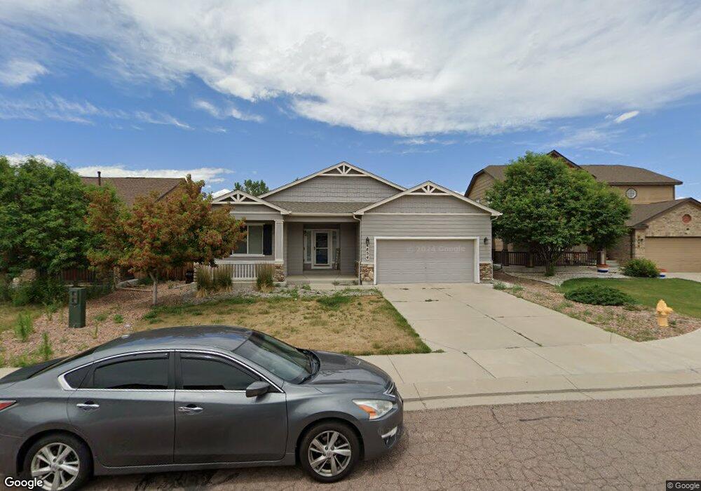
6854 Alliance Loop Colorado Springs, CO 80925
Widefield NeighborhoodEstimated Value: $476,279 - $504,000
4
Beds
2
Baths
3,178
Sq Ft
$155/Sq Ft
Est. Value
About This Home
This home is located at 6854 Alliance Loop, Colorado Springs, CO 80925 and is currently estimated at $493,820, approximately $155 per square foot. 6854 Alliance Loop is a home located in El Paso County with nearby schools including Grand Mountain School, Mesa Ridge High School, and Valley Christian Academy.
Ownership History
Date
Name
Owned For
Owner Type
Purchase Details
Closed on
May 18, 2021
Sold by
Spivak Jordan Marie and Tanner Julie
Bought by
Hp Colorado Llc
Current Estimated Value
Purchase Details
Closed on
Aug 21, 2018
Sold by
Huser David and Huser Pamela
Bought by
Spivak Jordan Marie and Tanner Julie
Home Financials for this Owner
Home Financials are based on the most recent Mortgage that was taken out on this home.
Original Mortgage
$342,202
Interest Rate
4.5%
Mortgage Type
VA
Purchase Details
Closed on
Nov 15, 2013
Sold by
Elite Properties Of America Inc
Bought by
Huser David and Huser Pamela
Home Financials for this Owner
Home Financials are based on the most recent Mortgage that was taken out on this home.
Original Mortgage
$277,877
Interest Rate
4.28%
Mortgage Type
VA
Purchase Details
Closed on
Sep 20, 2012
Sold by
Lorson Llc
Bought by
Elite Properties Of America Inc
Create a Home Valuation Report for This Property
The Home Valuation Report is an in-depth analysis detailing your home's value as well as a comparison with similar homes in the area
Home Values in the Area
Average Home Value in this Area
Purchase History
| Date | Buyer | Sale Price | Title Company |
|---|---|---|---|
| Hp Colorado Llc | $460,000 | Realtech Title Llc | |
| Spivak Jordan Marie | $335,000 | Unified Title Co | |
| Huser David | $269,000 | None Available | |
| Elite Properties Of America Inc | $53,000 | Heritage Title |
Source: Public Records
Mortgage History
| Date | Status | Borrower | Loan Amount |
|---|---|---|---|
| Previous Owner | Spivak Jordan Marie | $342,202 | |
| Previous Owner | Huser David | $277,877 |
Source: Public Records
Tax History Compared to Growth
Tax History
| Year | Tax Paid | Tax Assessment Tax Assessment Total Assessment is a certain percentage of the fair market value that is determined by local assessors to be the total taxable value of land and additions on the property. | Land | Improvement |
|---|---|---|---|---|
| 2025 | $4,602 | $33,150 | -- | -- |
| 2024 | $4,560 | $34,290 | $6,040 | $28,250 |
| 2022 | $3,385 | $24,450 | $4,810 | $19,640 |
| 2021 | $3,525 | $25,160 | $4,950 | $20,210 |
| 2020 | $3,319 | $23,440 | $4,330 | $19,110 |
| 2019 | $3,308 | $23,440 | $4,330 | $19,110 |
| 2018 | $2,931 | $20,450 | $4,360 | $16,090 |
| 2017 | $2,993 | $20,450 | $4,360 | $16,090 |
| 2016 | $2,760 | $21,330 | $4,380 | $16,950 |
| 2015 | $2,908 | $21,330 | $4,380 | $16,950 |
| 2014 | $2,982 | $21,970 | $4,290 | $17,680 |
Source: Public Records
Map
Nearby Homes
- 6572 Justice Way
- 10405 Abrams Dr
- 10670 Abrams Dr
- 10634 Abrams Dr
- 10394 Abrams Dr
- 10442 Abrams Dr
- 10202 Abrams Dr
- 10604 Deer Meadow Cir
- 10525 Abrams Dr
- 10568 Kalama Dr
- 10208 Abrams Dr
- 10179 Seawolf Dr
- 10732 Deer Meadow Cir
- 10250 Intrepid Way
- 6868 Alsea Dr
- 10868 Deer Meadow Cir
- 10648 Desert Bloom Way
- 6579 Lamine Dr
- 10721 Yuba Dr
- 6225 Laurel Grass Range Trail
- 6846 Alliance Loop
- 6862 Alliance Loop
- 6838 Alliance Loop
- 10365 Declaration Dr
- 10359 Declaration Dr
- 10371 Declaration Dr
- 6870 Alliance Loop
- 10353 Declaration Dr
- 6853 Alliance Loop
- 10377 Declaration Dr
- 6830 Alliance Loop
- 6861 Alliance Loop
- 10347 Declaration Dr
- 6822 Alliance Loop
- 6869 Alliance Loop
- 10383 Declaration Dr
- 10341 Declaration Dr
- 6877 Alliance Loop
- 6522 Justice Way
- 6542 Justice Way