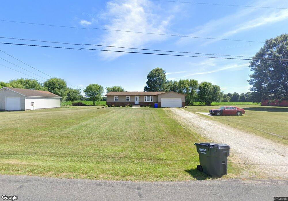
6854 Virginia Rd Atwater, OH 44201
Estimated Value: $199,000 - $231,133
3
Beds
1
Bath
1,384
Sq Ft
$156/Sq Ft
Est. Value
About This Home
This home is located at 6854 Virginia Rd, Atwater, OH 44201 and is currently estimated at $215,783, approximately $155 per square foot. 6854 Virginia Rd is a home located in Portage County with nearby schools including Waterloo Elementary School, Waterloo Middle School, and Waterloo High School.
Ownership History
Date
Name
Owned For
Owner Type
Purchase Details
Closed on
Aug 4, 2016
Sold by
Thompson James W and Thompson Katherine S
Bought by
Thompson Ii Kevin C
Current Estimated Value
Home Financials for this Owner
Home Financials are based on the most recent Mortgage that was taken out on this home.
Original Mortgage
$127,070
Outstanding Balance
$101,648
Interest Rate
3.56%
Mortgage Type
New Conventional
Estimated Equity
$114,135
Purchase Details
Closed on
Mar 24, 2000
Sold by
Winters Edwin E
Bought by
Thompson James W and Thompson Katherine S
Home Financials for this Owner
Home Financials are based on the most recent Mortgage that was taken out on this home.
Original Mortgage
$114,750
Interest Rate
8.39%
Purchase Details
Closed on
Jul 19, 1993
Bought by
Winters Edwin E
Create a Home Valuation Report for This Property
The Home Valuation Report is an in-depth analysis detailing your home's value as well as a comparison with similar homes in the area
Home Values in the Area
Average Home Value in this Area
Purchase History
| Date | Buyer | Sale Price | Title Company |
|---|---|---|---|
| Thompson Ii Kevin C | $131,000 | Bennett Land Title Agency | |
| Thompson James W | $135,000 | Union Title Company | |
| Winters Edwin E | $85,000 | -- |
Source: Public Records
Mortgage History
| Date | Status | Borrower | Loan Amount |
|---|---|---|---|
| Open | Thompson Ii Kevin C | $127,070 | |
| Previous Owner | Thompson James W | $114,750 |
Source: Public Records
Tax History Compared to Growth
Tax History
| Year | Tax Paid | Tax Assessment Tax Assessment Total Assessment is a certain percentage of the fair market value that is determined by local assessors to be the total taxable value of land and additions on the property. | Land | Improvement |
|---|---|---|---|---|
| 2024 | $2,502 | $68,390 | $10,010 | $58,380 |
| 2023 | $2,257 | $53,280 | $7,530 | $45,750 |
| 2022 | $2,314 | $53,280 | $7,530 | $45,750 |
| 2021 | $2,289 | $53,280 | $7,530 | $45,750 |
| 2020 | $2,032 | $45,650 | $7,530 | $38,120 |
| 2019 | $2,034 | $45,650 | $7,530 | $38,120 |
| 2018 | $2,060 | $45,120 | $7,530 | $37,590 |
| 2017 | $2,060 | $45,120 | $7,530 | $37,590 |
| 2016 | $2,054 | $45,120 | $7,530 | $37,590 |
| 2015 | $2,077 | $45,120 | $7,530 | $37,590 |
| 2014 | $2,140 | $45,120 | $7,530 | $37,590 |
| 2013 | $2,118 | $45,120 | $7,530 | $37,590 |
Source: Public Records
Map
Nearby Homes
- 7374 Virginia Rd
- 6727 Waterloo Rd
- 90 N Jefferson St
- 6453 Waterloo Rd
- 1015 Stroup Rd
- 14920 Mccallum Ave NE
- 1440 Porter Rd
- 1454 Hillcrest Dr
- 1452 Stroup Rd
- 5615 Laubert Rd
- 5457 Waterloo Rd
- 5296 Eberly Rd
- 14265 Reeder Ave NE
- 12415 Snode St NE
- 0 Industry Rd
- 0 New Milford Rd Unit 5119787
- 0 Knoll St NE
- 2171 Alliance Rd
- 0 Smith Northwest Rd
- 4829 Laubert Rd
- 6816 Virginia Rd
- 6798 Virginia Rd
- 568 State Route 183
- 668 State Route 183
- 597 State Route 183
- 611 State Route 183
- 637 State Route 183
- 508 State Route 183
- 537 State Route 183
- 665 State Route 183
- 677 State Route 183
- 494 State Route 183
- 740 State Route 183
- 535 State Route 183
- 721 State Route 183
- 501 State Route 183
- 478 State Route 183
- 737 State Route 183
- 452 State Route 183
- 7033 Virginia Rd