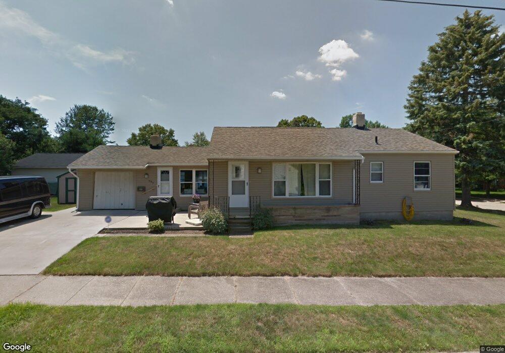
686 Bridge Rd Akron, OH 44312
Ellet NeighborhoodEstimated Value: $106,000 - $188,000
2
Beds
1
Bath
1,040
Sq Ft
$150/Sq Ft
Est. Value
About This Home
This home is located at 686 Bridge Rd, Akron, OH 44312 and is currently estimated at $156,156, approximately $150 per square foot. 686 Bridge Rd is a home located in Summit County with nearby schools including Ellet High School, Summit Academy Akron Elementary School, and Hatton Community Learning Center.
Ownership History
Date
Name
Owned For
Owner Type
Purchase Details
Closed on
Apr 6, 1998
Sold by
Walker Gregory F
Bought by
Beal David L Cyndy L
Current Estimated Value
Home Financials for this Owner
Home Financials are based on the most recent Mortgage that was taken out on this home.
Original Mortgage
$94,860
Outstanding Balance
$17,991
Interest Rate
7.09%
Mortgage Type
VA
Estimated Equity
$138,165
Create a Home Valuation Report for This Property
The Home Valuation Report is an in-depth analysis detailing your home's value as well as a comparison with similar homes in the area
Home Values in the Area
Average Home Value in this Area
Purchase History
| Date | Buyer | Sale Price | Title Company |
|---|---|---|---|
| Beal David L Cyndy L | $93,000 | -- |
Source: Public Records
Mortgage History
| Date | Status | Borrower | Loan Amount |
|---|---|---|---|
| Open | Beal David L Cyndy L | $94,860 |
Source: Public Records
Tax History
| Year | Tax Paid | Tax Assessment Tax Assessment Total Assessment is a certain percentage of the fair market value that is determined by local assessors to be the total taxable value of land and additions on the property. | Land | Improvement |
|---|---|---|---|---|
| 2024 | $2,600 | $45,175 | $10,980 | $34,195 |
| 2023 | $2,600 | $45,175 | $10,980 | $34,195 |
| 2022 | $2,352 | $31,812 | $7,732 | $24,080 |
| 2021 | $2,354 | $31,812 | $7,732 | $24,080 |
| 2020 | $2,322 | $31,810 | $7,730 | $24,080 |
| 2019 | $2,497 | $31,320 | $7,730 | $23,590 |
| 2018 | $2,467 | $31,320 | $7,730 | $23,590 |
| 2017 | $2,504 | $31,320 | $7,730 | $23,590 |
| 2016 | $2,506 | $31,320 | $7,730 | $23,590 |
| 2015 | $2,504 | $31,320 | $7,730 | $23,590 |
| 2014 | $2,485 | $31,320 | $7,730 | $23,590 |
| 2013 | $2,262 | $28,840 | $7,730 | $21,110 |
Source: Public Records
Map
Nearby Homes
- 2226 Quayle Dr
- 2138 Forest Oak Dr
- 640 Plainfield Rd
- 581 Stanley Rd
- 805 Utica Ave
- 586 Hillman Rd
- 2511 Ogden Ave
- 545 Fulmer Ave
- 472 Stephens Rd
- 1876 Harding Ave
- 443 Fulmer Ave
- 1863 Harding Ave
- 2323 Mingo Trail
- 931 Crestline Dr
- 2077 Coleman Ave
- 961 Crestline Dr
- 2616 Terrace Ave
- 260 Prairie Dr
- 1832 Springfield Center Rd
- 572 Cora Ave
- 2164 Quayle Dr
- 2180 Quayle Dr
- 696 Bridge Rd
- 2156 Quayle Dr
- 2192 Quayle Dr
- 695 Bridge Rd
- 706 Bridge Rd
- 665 Bridge Rd
- 666 Bridge Rd
- 703 Bridge Rd
- 679 Woodstock Rd
- 2189 Quayle Dr
- 2189 Quayle Dr
- 667 Woodstock Rd
- 667 Woodstock Rd
- 677 Woodstock Rd
- 677 Woodstock Rd
- 2161 Quayle Dr
- 683 Woodstock Rd
- 712 Bridge Rd
Your Personal Tour Guide
Ask me questions while you tour the home.