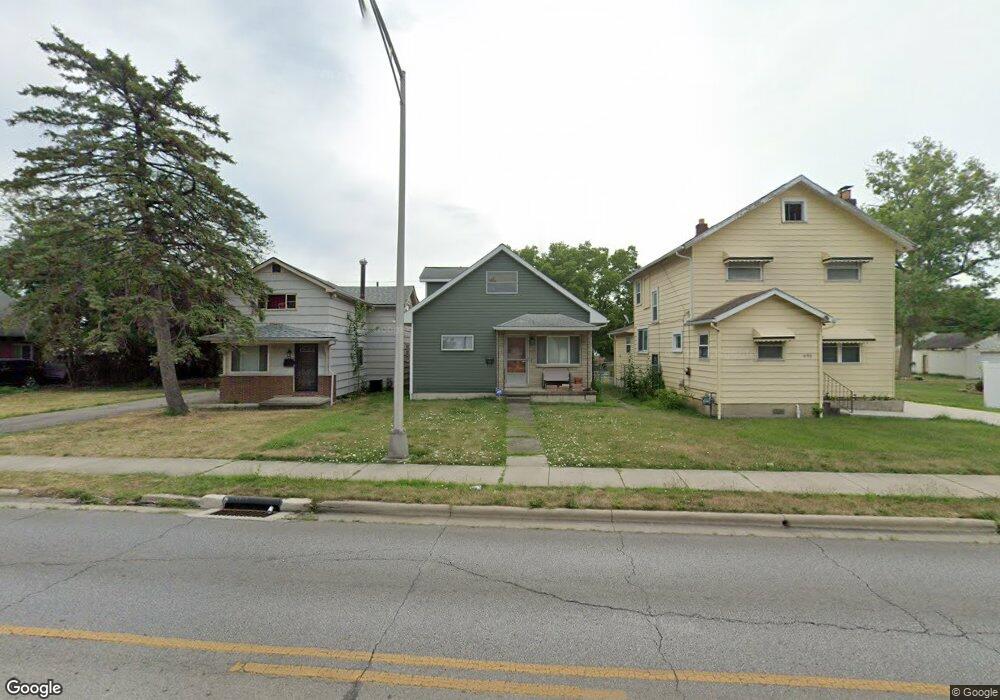
686 Demorest Rd Columbus, OH 43204
Southwest Hilltop NeighborhoodEstimated Value: $163,045 - $200,000
3
Beds
2
Baths
1,208
Sq Ft
$150/Sq Ft
Est. Value
About This Home
This home is located at 686 Demorest Rd, Columbus, OH 43204 and is currently estimated at $181,261, approximately $150 per square foot. 686 Demorest Rd is a home located in Franklin County with nearby schools including West Franklin Elementary School, Franklin Woods Intermediate School, and Finland Middle School.
Ownership History
Date
Name
Owned For
Owner Type
Purchase Details
Closed on
Jan 5, 2021
Sold by
Hopkins Lonnie L
Bought by
Hopkins Joanna
Current Estimated Value
Purchase Details
Closed on
Mar 17, 1993
Bought by
Hopkins Lonnie
Create a Home Valuation Report for This Property
The Home Valuation Report is an in-depth analysis detailing your home's value as well as a comparison with similar homes in the area
Home Values in the Area
Average Home Value in this Area
Purchase History
| Date | Buyer | Sale Price | Title Company |
|---|---|---|---|
| Hopkins Joanna | -- | None Available | |
| Hopkins Lonnie | -- | -- |
Source: Public Records
Tax History
| Year | Tax Paid | Tax Assessment Tax Assessment Total Assessment is a certain percentage of the fair market value that is determined by local assessors to be the total taxable value of land and additions on the property. | Land | Improvement |
|---|---|---|---|---|
| 2025 | $1,518 | $41,620 | $12,110 | $29,510 |
| 2024 | $1,518 | $41,620 | $12,110 | $29,510 |
| 2023 | $1,491 | $41,615 | $12,110 | $29,505 |
| 2022 | $1,360 | $27,860 | $4,480 | $23,380 |
| 2021 | $1,387 | $27,860 | $4,480 | $23,380 |
| 2020 | $1,379 | $27,860 | $4,480 | $23,380 |
| 2019 | $1,227 | $21,880 | $3,750 | $18,130 |
| 2018 | $1,185 | $21,880 | $3,750 | $18,130 |
| 2017 | $1,182 | $21,880 | $3,750 | $18,130 |
| 2016 | $1,148 | $18,980 | $2,630 | $16,350 |
| 2015 | $1,148 | $18,980 | $2,630 | $16,350 |
| 2014 | $1,149 | $18,980 | $2,630 | $16,350 |
| 2013 | $670 | $22,295 | $3,080 | $19,215 |
Source: Public Records
Map
Nearby Homes
- 695 Demorest Rd
- 781 Stephen Dr W
- 814 Miriam Dr W
- 840 Mark Place
- 408 Derrer Rd
- 3551 Glorious Rd
- 6280 Renner Park Dr
- 3318 Miriam Dr S
- 793 Binns Blvd
- 894 Binns Blvd
- 277 Josephine Ave
- 415 S Huron Ave Unit 417
- 638 Binns Blvd
- 3866 Eakin Rd
- 253 Powhatan Ave
- 3860 Briggs Rd
- 0 S Brinker Ave
- 227 S Sylvan Ave
- 3859 Briggs Rd
- 3029 Rosedale Ave
- 690 Demorest Rd
- 680 Demorest Rd
- 700 Demorest Rd
- 668 Demorest Rd
- 683 Dexter Ave
- 689 Dexter Ave
- 662 Demorest Rd
- 679 Dexter Ave
- 673 Dexter Ave
- 699 Dexter Ave
- 681 Demorest Rd
- 658 Demorest Rd
- 675 Demorest Rd
- 689 Demorest Rd
- 669 Dexter Ave
- 705 Dexter Ave
- 669 Demorest Rd
- 720 Demorest Rd
- 712 Demorest Rd
- 0 Dexter Ave