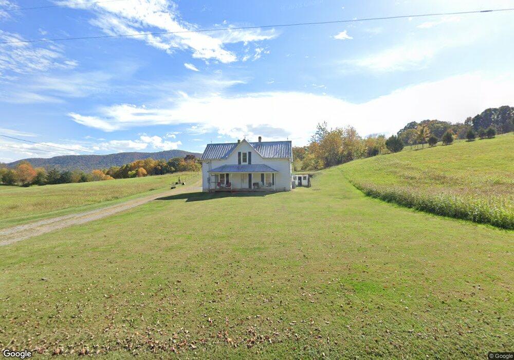
686 Taylor Bridge Rd Jonesborough, TN 37659
Estimated Value: $139,699 - $303,000
--
Bed
1
Bath
1,632
Sq Ft
$142/Sq Ft
Est. Value
About This Home
This home is located at 686 Taylor Bridge Rd, Jonesborough, TN 37659 and is currently estimated at $231,675, approximately $141 per square foot. 686 Taylor Bridge Rd is a home located in Washington County with nearby schools including Lamar Elementary School and David Crockett High School.
Ownership History
Date
Name
Owned For
Owner Type
Purchase Details
Closed on
Nov 3, 2014
Sold by
Blankenship Lucille and Blankenship Ruby
Bought by
Blankenship Rick Wayne
Current Estimated Value
Purchase Details
Closed on
Mar 8, 2013
Sold by
Blankenship Lucille and Blankenship Ruby
Bought by
Blankenship Lucille and Blankenship Ruby
Purchase Details
Closed on
Oct 9, 2006
Sold by
Mae Blankenship Ruby
Bought by
Wayne Blankenship Rick
Home Financials for this Owner
Home Financials are based on the most recent Mortgage that was taken out on this home.
Original Mortgage
$19,000
Interest Rate
6.45%
Create a Home Valuation Report for This Property
The Home Valuation Report is an in-depth analysis detailing your home's value as well as a comparison with similar homes in the area
Home Values in the Area
Average Home Value in this Area
Purchase History
| Date | Buyer | Sale Price | Title Company |
|---|---|---|---|
| Blankenship Rick Wayne | -- | -- | |
| Blankenship Lucille | -- | -- | |
| Wayne Blankenship Rick | $19,000 | -- |
Source: Public Records
Mortgage History
| Date | Status | Borrower | Loan Amount |
|---|---|---|---|
| Previous Owner | Wayne Blankenship Rick | $19,000 |
Source: Public Records
Tax History Compared to Growth
Tax History
| Year | Tax Paid | Tax Assessment Tax Assessment Total Assessment is a certain percentage of the fair market value that is determined by local assessors to be the total taxable value of land and additions on the property. | Land | Improvement |
|---|---|---|---|---|
| 2024 | $484 | $28,300 | $6,075 | $22,225 |
| 2022 | $359 | $16,675 | $4,175 | $12,500 |
| 2021 | $359 | $16,675 | $4,175 | $12,500 |
| 2020 | $359 | $16,675 | $4,175 | $12,500 |
| 2019 | $372 | $16,675 | $4,175 | $12,500 |
| 2018 | $372 | $15,650 | $4,175 | $11,475 |
| 2017 | $372 | $15,650 | $4,175 | $11,475 |
| 2016 | $372 | $15,650 | $4,175 | $11,475 |
| 2015 | $310 | $15,650 | $4,175 | $11,475 |
| 2014 | $310 | $15,650 | $4,175 | $11,475 |
Source: Public Records
Map
Nearby Homes
- Tbd Treadway Trail
- 313 Treadway Trail
- 1109 Tennessee 107
- Tract 1 Treadway Trail
- Tract 2 Treadway Trail
- 337 Highway 107
- 255 Tennessee 107
- 121 Dee Runion Rd
- 269 Oklahoma Rd
- 542 Telford New Victory Rd
- 161 Jay Barnett Rd
- 3102 Highway 81 S
- 293 Miller Rd
- 195 Cecil White Dr
- 266 Miller Rd
- 201 Hartsell Rd
- 117 Maverick Rd
- 302 Arrowood Rd
- 3926 Highway 81 S
- 205 Clyde Miller Dr
- 664 Taylor Bridge Rd
- 0 Taylor Bridge Rd Unit 121578
- 0 Taylor Bridge Rd Unit 247551
- 0 Taylor Bridge Rd Unit 223794
- 715-1 Taylor Bridge Rd
- XX Taylor Bridge Rd
- 0 Taylor Bridge Rd Unit 147148
- 0 Taylor Bridge Rd Unit 124372
- 0 Taylor Bridge Rd Unit 102718
- 00 Taylor Bridge Rd
- Tbd Taylor Bridge Rd
- 0 Taylor Bridge Rd Unit 416164
- 648 Taylor Bridge Rd
- 715 Taylor Bridge Rd
- 646 Taylor Bridge Rd
- 606 Taylor Bridge Rd
- 629 Taylor Bridge Rd
- 358 Taylor Bridge Rd
- 740 Taylor Bridge Rd
- 583 Taylor Bridge Rd