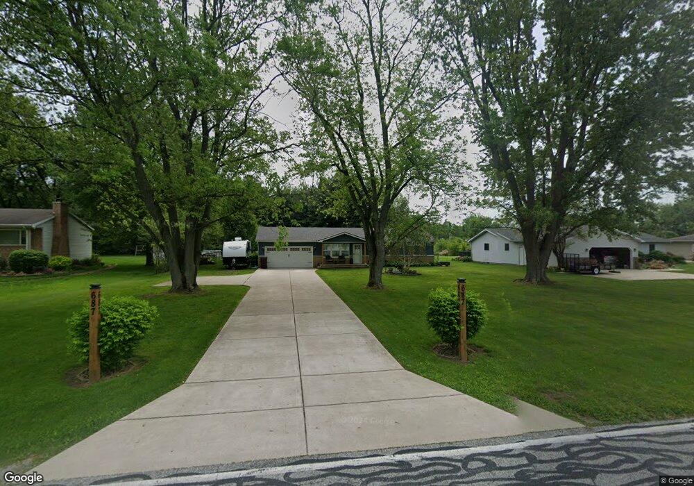
687 Baums Bridge Rd Kouts, IN 46347
Porter County NeighborhoodEstimated Value: $253,574 - $306,000
3
Beds
2
Baths
1,188
Sq Ft
$240/Sq Ft
Est. Value
About This Home
This home is located at 687 Baums Bridge Rd, Kouts, IN 46347 and is currently estimated at $285,394, approximately $240 per square foot. 687 Baums Bridge Rd is a home located in Porter County with nearby schools including Kouts Elementary School, Kouts Middle/High School, and Midwest Academy.
Ownership History
Date
Name
Owned For
Owner Type
Purchase Details
Closed on
Sep 13, 2014
Sold by
Nimtz Joseph R
Bought by
Brian
Current Estimated Value
Home Financials for this Owner
Home Financials are based on the most recent Mortgage that was taken out on this home.
Original Mortgage
$138,380
Outstanding Balance
$104,316
Interest Rate
4.12%
Mortgage Type
FHA
Estimated Equity
$181,078
Purchase Details
Closed on
May 10, 2013
Sold by
Anderson Robert R and Anderson Judith F
Bought by
Nimtz Joseph R and Nimtz Maryann
Purchase Details
Closed on
Jun 30, 2011
Sold by
Howard Robert E and Howard Lynn C
Bought by
Anderson Robert R and Anderson Judith F
Home Financials for this Owner
Home Financials are based on the most recent Mortgage that was taken out on this home.
Original Mortgage
$80,000
Interest Rate
4.56%
Mortgage Type
New Conventional
Create a Home Valuation Report for This Property
The Home Valuation Report is an in-depth analysis detailing your home's value as well as a comparison with similar homes in the area
Home Values in the Area
Average Home Value in this Area
Purchase History
| Date | Buyer | Sale Price | Title Company |
|---|---|---|---|
| Brian | $150,000 | -- | |
| Poitras Brian L | -- | Chicago Title Company Llc | |
| Nimtz Joseph R | -- | Northwest Indiana Title | |
| Anderson Robert R | -- | Community Title Company |
Source: Public Records
Mortgage History
| Date | Status | Borrower | Loan Amount |
|---|---|---|---|
| Open | Poitras Brian L | $138,380 | |
| Previous Owner | Anderson Robert R | $80,000 |
Source: Public Records
Tax History
| Year | Tax Paid | Tax Assessment Tax Assessment Total Assessment is a certain percentage of the fair market value that is determined by local assessors to be the total taxable value of land and additions on the property. | Land | Improvement |
|---|---|---|---|---|
| 2025 | $1,273 | $184,600 | $33,200 | $151,400 |
| 2024 | $1,277 | $195,100 | $26,600 | $168,500 |
| 2023 | $1,137 | $189,600 | $25,500 | $164,100 |
| 2022 | $1,096 | $174,000 | $25,500 | $148,500 |
| 2021 | $1,047 | $148,200 | $25,500 | $122,700 |
| 2020 | $1,016 | $145,100 | $22,200 | $122,900 |
| 2019 | $1,004 | $140,600 | $22,200 | $118,400 |
| 2018 | $895 | $131,400 | $22,200 | $109,200 |
| 2017 | $878 | $131,200 | $22,200 | $109,000 |
| 2016 | $823 | $126,200 | $22,500 | $103,700 |
| 2014 | $782 | $124,700 | $22,000 | $102,700 |
| 2013 | -- | $121,900 | $22,900 | $99,000 |
Source: Public Records
Map
Nearby Homes
- 157 E 700 S
- 645 S 150 E
- 829 S Baums Bridge Rd
- 103 Mckinley St
- Lot B4-5 St Road 8
- 204 N Main St
- 702 W Jefferson St
- 708 S Main St
- 805 Sunset Dr
- 0 Vanessa Way Unit GNR544729
- 0 Sharyn St Unit GNR544743
- 0 Sharyn St Unit GNR544737
- 0 Sharyn St Unit GNR544741
- 308 E Ross Ave
- B1-3 State Road 8
- 0-Lot B6-7 State Road 8
- 124 S Smoke Rd
- 0 E 995 S
- 6775 E 103rd Ln
- 354 W 550 S
- 687 S Baums Bridge Rd
- 689 Baums Bridge Rd
- 685 Baums Bridge Rd
- 691 Baums Bridge Rd
- 691 S Baums Bridge Rd
- 688 Baums Bridge Rd
- 682 S Baums Bridge Rd
- 682 Baums Bridge Rd
- 692 S Baums Bridge Rd
- 692 Baums Bridge Rd
- 685-1 Baums Bridge Rd
- 693 S Baums Bridge Rd
- 693 Baums Bridge Rd
- 683 Baums Bridge Rd
- 685 S 150 E
- 687 S 150 E
- 695 Baums Bridge Rd
- 677 Baums Bridge Rd
- 681 S 150 E
- 677 S Baums Bridge Rd
Your Personal Tour Guide
Ask me questions while you tour the home.