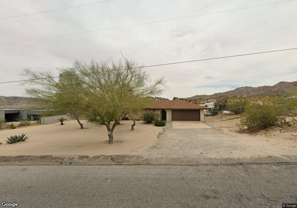
6875 Mount Shasta Ave Joshua Tree, CA 92252
Estimated Value: $284,000 - $501,000
3
Beds
2
Baths
1,107
Sq Ft
$368/Sq Ft
Est. Value
About This Home
This home is located at 6875 Mount Shasta Ave, Joshua Tree, CA 92252 and is currently estimated at $407,549, approximately $368 per square foot. 6875 Mount Shasta Ave is a home located in San Bernardino County with nearby schools including Oasis Elementary School, Twentynine Palms Junior High School, and Twentynine Palms High School.
Ownership History
Date
Name
Owned For
Owner Type
Purchase Details
Closed on
Sep 24, 1999
Sold by
Samora Kathleen Marie
Bought by
Lesueur Lyndon and Lesueur Michelle
Current Estimated Value
Home Financials for this Owner
Home Financials are based on the most recent Mortgage that was taken out on this home.
Original Mortgage
$56,000
Outstanding Balance
$16,526
Interest Rate
7.76%
Mortgage Type
Purchase Money Mortgage
Estimated Equity
$391,023
Purchase Details
Closed on
Jul 23, 1997
Sold by
Hale Ronnie L
Bought by
Hale Ronnie Lee and Samora Kathleen Marie
Create a Home Valuation Report for This Property
The Home Valuation Report is an in-depth analysis detailing your home's value as well as a comparison with similar homes in the area
Purchase History
| Date | Buyer | Sale Price | Title Company |
|---|---|---|---|
| Lesueur Lyndon | $70,000 | Fidelity National Title Co | |
| Samora Kathleen Marie | -- | Fidelity National Title Co | |
| Hale Ronnie Lee | -- | -- |
Source: Public Records
Mortgage History
| Date | Status | Borrower | Loan Amount |
|---|---|---|---|
| Open | Lesueur Lyndon | $56,000 |
Source: Public Records
Tax History Compared to Growth
Tax History
| Year | Tax Paid | Tax Assessment Tax Assessment Total Assessment is a certain percentage of the fair market value that is determined by local assessors to be the total taxable value of land and additions on the property. | Land | Improvement |
|---|---|---|---|---|
| 2025 | $1,508 | $107,591 | $9,221 | $98,370 |
| 2024 | $1,508 | $105,481 | $9,040 | $96,441 |
| 2023 | $1,480 | $103,413 | $8,863 | $94,550 |
| 2022 | $1,451 | $101,385 | $8,689 | $92,696 |
| 2021 | $1,434 | $99,397 | $8,519 | $90,878 |
| 2020 | $1,421 | $98,378 | $8,432 | $89,946 |
| 2019 | $1,490 | $96,449 | $8,267 | $88,182 |
| 2018 | $1,318 | $94,558 | $8,105 | $86,453 |
| 2017 | $1,306 | $92,704 | $7,946 | $84,758 |
| 2016 | $1,285 | $90,886 | $7,790 | $83,096 |
| 2015 | $1,240 | $89,521 | $7,673 | $81,848 |
| 2014 | $1,269 | $87,768 | $7,523 | $80,245 |
Source: Public Records
Map
Nearby Homes
- 6710 Sierra Ave
- 7030 Mile Square Rd
- 7084 Mount Lassen Ave
- 66075 Foothill Dr
- 0 Cactus Dr
- 66154 Sullivan Rd
- 7215 Mt Lassen Ave
- 7125 Old Copper Mountain Rd
- 64755 Foothill Dr
- 66058 Foothill Dr
- 64647 Foothill Dr
- 0 Fran Lou Ln Unit HD25267066
- 7190 Lawrence Ave
- 0 Twentynine Palms Hwy Unit JT25200350
- 0 Twentynine Palms Hwy Unit TR24192659
- 29 Palms
- 29 Palms Unit 1
- 64806 Chollita Rd
- 0 Sunfair Rd Unit 25552033PS
- 0 Sunfair Rd Unit SB24059460
- 6917 Mount Shasta Ave
- 6859 Mount Shasta Ave
- 1234 Mount Shasta Ave
- 6835 Mount Shasta Ave
- 6817 Mount Shasta Ave
- 6940 Mount Shasta Ave
- 6940 Mount Shasta Ave Unit A
- 6815 Mount Shasta Ave
- 6836 Sierra Ave
- 6816 Mount Shasta Ave
- 6968 Mount Shasta Ave
- 6881 Mount Lassen Ave
- 6806 Sierra Ave
- 6991 Mount Shasta Ave
- 65910 Cottonwood Dr
- 5710 Sierra Ave
- 6782 Mount Shasta Ave
- 4 Mount Lassen Ave
- 6900 Mount Lassen Ave
- 0 Mount Lassen Ave
