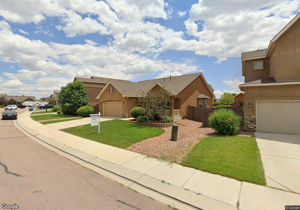
6877 Alliance Loop Colorado Springs, CO 80925
Widefield NeighborhoodEstimated Value: $456,000 - $478,000
4
Beds
2
Baths
1,373
Sq Ft
$340/Sq Ft
Est. Value
About This Home
This home is located at 6877 Alliance Loop, Colorado Springs, CO 80925 and is currently estimated at $467,356, approximately $340 per square foot. 6877 Alliance Loop is a home located in El Paso County with nearby schools including Grand Mountain School, Mesa Ridge High School, and Valley Christian Academy.
Ownership History
Date
Name
Owned For
Owner Type
Purchase Details
Closed on
Jul 20, 2021
Sold by
Zastrow John M and Zastrow Dawn M
Bought by
Plaza Tyrone J and Plaza Jacqueline S
Current Estimated Value
Home Financials for this Owner
Home Financials are based on the most recent Mortgage that was taken out on this home.
Original Mortgage
$353,680
Outstanding Balance
$321,203
Interest Rate
2.96%
Mortgage Type
New Conventional
Estimated Equity
$146,153
Purchase Details
Closed on
Feb 15, 2018
Sold by
Brown Adam L and Brown Erin M
Bought by
Zastrow John M and Zastrow Dawn M
Purchase Details
Closed on
Sep 28, 2012
Sold by
Elite Properties Of America Inc
Bought by
Brown Adam L and Brown Erin M
Home Financials for this Owner
Home Financials are based on the most recent Mortgage that was taken out on this home.
Original Mortgage
$261,401
Interest Rate
3.66%
Mortgage Type
VA
Create a Home Valuation Report for This Property
The Home Valuation Report is an in-depth analysis detailing your home's value as well as a comparison with similar homes in the area
Home Values in the Area
Average Home Value in this Area
Purchase History
| Date | Buyer | Sale Price | Title Company |
|---|---|---|---|
| Plaza Tyrone J | $442,100 | Land Title Guarantee Company | |
| Zastrow John M | $293,500 | Guardian Title | |
| Brown Adam L | $257,909 | Cb Title |
Source: Public Records
Mortgage History
| Date | Status | Borrower | Loan Amount |
|---|---|---|---|
| Open | Plaza Tyrone J | $353,680 | |
| Previous Owner | Brown Adam L | $261,401 |
Source: Public Records
Tax History Compared to Growth
Tax History
| Year | Tax Paid | Tax Assessment Tax Assessment Total Assessment is a certain percentage of the fair market value that is determined by local assessors to be the total taxable value of land and additions on the property. | Land | Improvement |
|---|---|---|---|---|
| 2025 | $4,372 | $31,680 | -- | -- |
| 2024 | $4,327 | $32,770 | $6,040 | $26,730 |
| 2022 | $3,231 | $23,340 | $4,810 | $18,530 |
| 2021 | $3,364 | $24,010 | $4,950 | $19,060 |
| 2020 | $3,058 | $21,600 | $4,330 | $17,270 |
| 2019 | $3,048 | $21,600 | $4,330 | $17,270 |
| 2018 | $2,827 | $19,720 | $4,360 | $15,360 |
| 2017 | $2,886 | $19,720 | $4,360 | $15,360 |
| 2016 | $2,539 | $19,620 | $4,380 | $15,240 |
| 2015 | $2,675 | $19,620 | $4,380 | $15,240 |
| 2014 | $2,662 | $19,610 | $4,290 | $15,320 |
Source: Public Records
Map
Nearby Homes
- 6572 Justice Way
- 10202 Abrams Dr
- 10208 Abrams Dr
- 10179 Seawolf Dr
- 10405 Abrams Dr
- 10394 Abrams Dr
- 10250 Intrepid Way
- 10732 Deer Meadow Cir
- 10868 Deer Meadow Cir
- 10670 Abrams Dr
- 10634 Abrams Dr
- 10442 Abrams Dr
- 10604 Deer Meadow Cir
- 10568 Kalama Dr
- 6868 Alsea Dr
- 10525 Abrams Dr
- 6225 Laurel Grass Range Trail
- 6562 Phantom Way
- 6961 Maidford Dr
- 6672 Kearsarge Dr
- 6885 Alliance Loop
- 6869 Alliance Loop
- 6901 Alliance Loop
- 6861 Alliance Loop
- 10362 Valor Ct
- 6909 Alliance Loop
- 6870 Alliance Loop
- 6886 Alliance Loop
- 6853 Alliance Loop
- 6894 Alliance Loop
- 10346 Valor Ct
- 10378 Valor Ct
- 6862 Alliance Loop
- 6917 Alliance Loop
- 6902 Alliance Loop
- 10392 Valor Ct
- 6557 Alliance Loop
- 6910 Alliance Loop
- 6854 Alliance Loop
- 6565 Alliance Loop