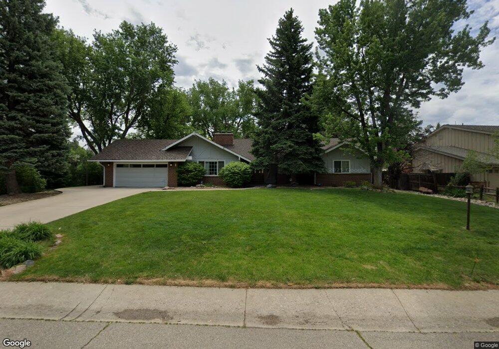
6878 Frying Pan Rd Boulder, CO 80301
Gunbarrel NeighborhoodEstimated Value: $1,104,247 - $1,478,000
5
Beds
3
Baths
2,318
Sq Ft
$555/Sq Ft
Est. Value
About This Home
This home is located at 6878 Frying Pan Rd, Boulder, CO 80301 and is currently estimated at $1,287,312, approximately $555 per square foot. 6878 Frying Pan Rd is a home located in Boulder County with nearby schools including Heatherwood Elementary School, Nevin Platt Middle School, and Boulder High School.
Ownership History
Date
Name
Owned For
Owner Type
Purchase Details
Closed on
Jun 27, 1994
Sold by
Benjamin Arthur and Benjamin June H
Bought by
Fox Ronald Steven
Current Estimated Value
Home Financials for this Owner
Home Financials are based on the most recent Mortgage that was taken out on this home.
Original Mortgage
$155,000
Interest Rate
3.65%
Purchase Details
Closed on
Feb 4, 1975
Bought by
Fox Ronald Steven and Fox Ann Straus
Create a Home Valuation Report for This Property
The Home Valuation Report is an in-depth analysis detailing your home's value as well as a comparison with similar homes in the area
Home Values in the Area
Average Home Value in this Area
Purchase History
| Date | Buyer | Sale Price | Title Company |
|---|---|---|---|
| Fox Ronald Steven | $255,000 | Commonwealth Land Title Ins | |
| Fox Ronald Steven | $69,900 | -- |
Source: Public Records
Mortgage History
| Date | Status | Borrower | Loan Amount |
|---|---|---|---|
| Closed | Fox Ronald Steven | $155,000 |
Source: Public Records
Tax History Compared to Growth
Tax History
| Year | Tax Paid | Tax Assessment Tax Assessment Total Assessment is a certain percentage of the fair market value that is determined by local assessors to be the total taxable value of land and additions on the property. | Land | Improvement |
|---|---|---|---|---|
| 2025 | $5,438 | $64,169 | $35,431 | $28,738 |
| 2024 | $5,438 | $64,169 | $35,431 | $28,738 |
| 2023 | $5,348 | $65,459 | $38,391 | $30,753 |
| 2022 | $4,357 | $51,548 | $28,578 | $22,970 |
| 2021 | $4,155 | $53,032 | $29,401 | $23,631 |
| 2020 | $3,666 | $47,161 | $25,740 | $21,421 |
| 2019 | $3,610 | $47,161 | $25,740 | $21,421 |
| 2018 | $3,583 | $46,476 | $21,456 | $25,020 |
| 2017 | $3,477 | $51,382 | $23,721 | $27,661 |
| 2016 | $2,902 | $39,744 | $19,741 | $20,003 |
| 2015 | $2,756 | $35,661 | $18,547 | $17,114 |
| 2014 | $2,676 | $35,661 | $18,547 | $17,114 |
Source: Public Records
Map
Nearby Homes
- 6972 Roaring Fork Trail
- 6809 Harvest Rd
- 4985 Twin Lakes Rd Unit 94
- 4945 Twin Lakes Rd Unit 39
- 7134 Cedarwood Cir
- 5110 Williams Fork Trail Unit 102
- 7088 Indian Peaks Trail
- 4872 Country Club Way
- 7126 Cedarwood Cir
- 5302 Pinehurst Dr
- 5459 Indian Summer Ct
- 4848 Idylwild Trail
- 5120 Williams Fork Trail Unit 213
- 5531 High Country Ct
- 5122 Williams Fork Trail Unit 108
- 7309 Windsor Dr
- 7264 Siena Way Unit C
- 7329 Windsor Dr
- 7028 Indian Peaks Trail
- 4993 Clubhouse Ct
- 6890 Frying Pan Rd
- 6862 Frying Pan Rd
- 5085 Cottonwood Dr
- 5093 Cottonwood Dr
- 6861 Frying Pan Rd
- 6873 Frying Pan Rd
- 6902 Frying Pan Rd
- 6845 Frying Pan Rd
- 5112 Idylwild Trail
- 5081 Cottonwood Dr
- 6831 Frying Pan Rd
- 5086 Cottonwood Dr
- 6862 Roaring Fork Trail
- 5084 Cottonwood Dr
- 6903 Frying Pan Rd
- 5160 Idylwild Trail
- 5098 Cottonwood Dr
- 6878 Roaring Fork Trail
- 5082 Cottonwood Dr
- 6830 Roaring Fork Trail