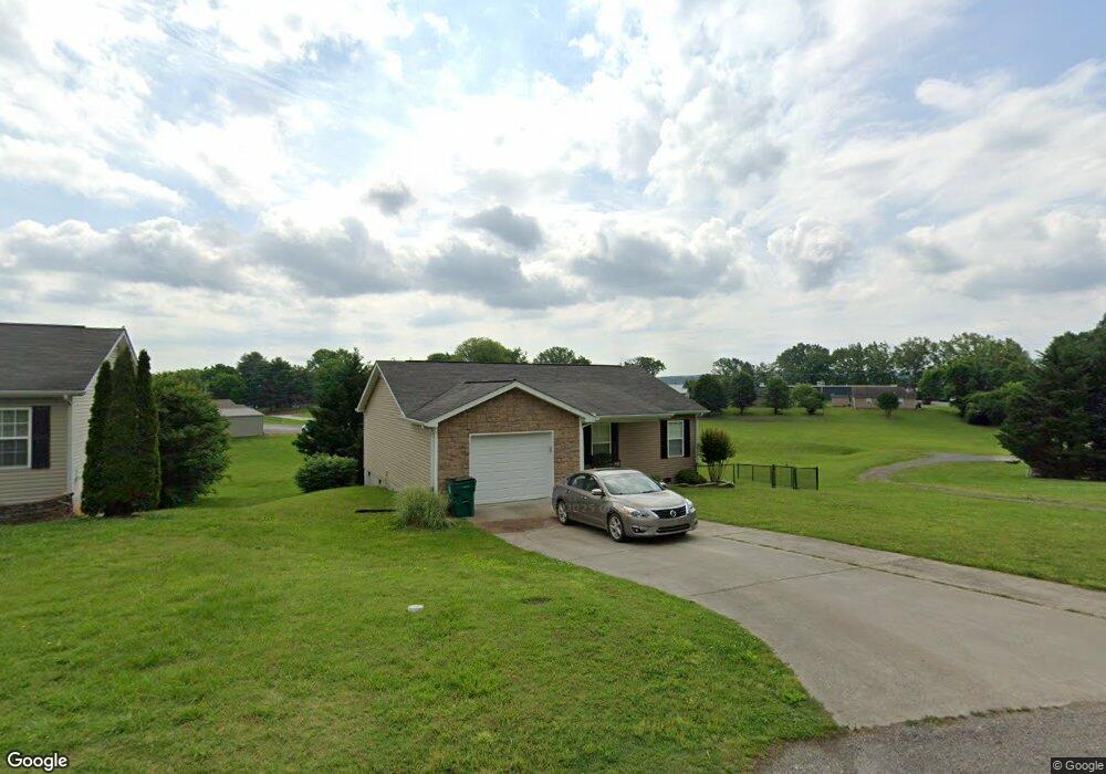
688 N Haun Dr Unit S/D MAPLE BEND Morristown, TN 37814
Estimated Value: $237,000 - $267,000
3
Beds
2
Baths
1,072
Sq Ft
$238/Sq Ft
Est. Value
About This Home
This home is located at 688 N Haun Dr Unit S/D MAPLE BEND, Morristown, TN 37814 and is currently estimated at $255,076, approximately $237 per square foot. 688 N Haun Dr Unit S/D MAPLE BEND is a home located in Hamblen County with nearby schools including John Hay Elementary School, Meadowview Middle School, and Morristown East High School.
Ownership History
Date
Name
Owned For
Owner Type
Purchase Details
Closed on
Jul 28, 2022
Sold by
Caughorn Stacey K
Bought by
Moore Connie
Current Estimated Value
Home Financials for this Owner
Home Financials are based on the most recent Mortgage that was taken out on this home.
Original Mortgage
$110,900
Outstanding Balance
$106,249
Interest Rate
5.78%
Mortgage Type
New Conventional
Estimated Equity
$148,827
Purchase Details
Closed on
May 20, 2019
Sold by
Good Jamie N Berg and Good Alexander T
Bought by
Caughorn Stacey K
Home Financials for this Owner
Home Financials are based on the most recent Mortgage that was taken out on this home.
Original Mortgage
$103,520
Interest Rate
4%
Mortgage Type
New Conventional
Purchase Details
Closed on
May 30, 2017
Sold by
Gillett Jessica D
Bought by
Berg Jamie N
Home Financials for this Owner
Home Financials are based on the most recent Mortgage that was taken out on this home.
Original Mortgage
$116,844
Interest Rate
4.25%
Mortgage Type
FHA
Purchase Details
Closed on
Apr 29, 2015
Sold by
Long-Arnold Amber N
Bought by
Gillett Jessica D and Gillett Devon R
Home Financials for this Owner
Home Financials are based on the most recent Mortgage that was taken out on this home.
Original Mortgage
$110,204
Interest Rate
3.8%
Mortgage Type
New Conventional
Purchase Details
Closed on
Apr 13, 2012
Sold by
Anglea Larry
Bought by
Long Amber N
Home Financials for this Owner
Home Financials are based on the most recent Mortgage that was taken out on this home.
Original Mortgage
$100,583
Interest Rate
3.75%
Mortgage Type
FHA
Purchase Details
Closed on
Feb 21, 2004
Bought by
Rogers Blanche & Rogers Clinton L Test Cr Sh
Purchase Details
Closed on
May 26, 1973
Bought by
Rogers Clinton L and Rogers Helen
Purchase Details
Closed on
Nov 28, 1962
Bought by
Rogers Clinton L and Rogers Helen
Purchase Details
Closed on
Aug 12, 1955
Bought by
Rogers Clinton
Create a Home Valuation Report for This Property
The Home Valuation Report is an in-depth analysis detailing your home's value as well as a comparison with similar homes in the area
Home Values in the Area
Average Home Value in this Area
Purchase History
| Date | Buyer | Sale Price | Title Company |
|---|---|---|---|
| Moore Connie | $225,900 | Colonial Title Group | |
| Caughorn Stacey K | $129,900 | Colonial Title Group Inc | |
| Berg Jamie N | $119,000 | -- | |
| Gillett Jessica D | $108,000 | -- | |
| Long Amber N | $103,200 | -- | |
| Rogers Blanche & Rogers Clinton L Test Cr Sh | -- | -- | |
| Rogers Clinton L | -- | -- | |
| Rogers Clinton L | -- | -- | |
| Rogers Clinton | -- | -- |
Source: Public Records
Mortgage History
| Date | Status | Borrower | Loan Amount |
|---|---|---|---|
| Open | Moore Connie | $110,900 | |
| Previous Owner | Caughorn Stacey K | $103,520 | |
| Previous Owner | Berg Jamie N | $116,844 | |
| Previous Owner | Gillett Jessica D | $110,204 | |
| Previous Owner | Long Amber N | $100,583 |
Source: Public Records
Tax History Compared to Growth
Tax History
| Year | Tax Paid | Tax Assessment Tax Assessment Total Assessment is a certain percentage of the fair market value that is determined by local assessors to be the total taxable value of land and additions on the property. | Land | Improvement |
|---|---|---|---|---|
| 2024 | $531 | $30,150 | $3,650 | $26,500 |
| 2023 | $531 | $30,150 | $0 | $0 |
| 2022 | $953 | $30,150 | $3,650 | $26,500 |
| 2021 | $953 | $30,150 | $3,650 | $26,500 |
| 2020 | $952 | $30,150 | $3,650 | $26,500 |
| 2019 | $878 | $25,825 | $2,950 | $22,875 |
| 2018 | $814 | $25,825 | $2,950 | $22,875 |
| 2017 | $801 | $25,825 | $2,950 | $22,875 |
| 2016 | $765 | $25,825 | $2,950 | $22,875 |
| 2015 | $711 | $25,825 | $2,950 | $22,875 |
| 2014 | -- | $25,825 | $2,950 | $22,875 |
| 2013 | -- | $27,800 | $0 | $0 |
Source: Public Records
Map
Nearby Homes
- 0 Morelock Rd N
- 1250 N Liberty Hill Rd
- 2405 Southern Dr
- 345 Belle Meade Cir
- 2320 Southern Dr
- Lot 2 Morelock Rd
- 3003 Eloise Dr
- 1643 Meadowview Ln
- 1635 Meadowview Ln
- 3115 Eloise Dr
- 512 Cliff St
- 1250 N Liberty Hill Dr
- 517 Cliff St
- 3113 Berna Way
- Lot 1 E Andrew Johnson Hwy
- 1710 Morningside Dr
- 1932 Eastern Ave
- 542 Cliff St
- 2998 Nicole Cir
- 2035 Reese St