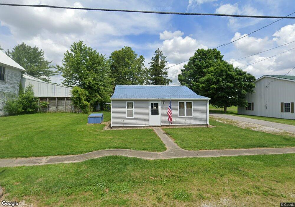
6883 Leesville Rd Crestline, OH 44827
Estimated Value: $74,000 - $153,000
2
Beds
1
Bath
656
Sq Ft
$182/Sq Ft
Est. Value
About This Home
This home is located at 6883 Leesville Rd, Crestline, OH 44827 and is currently estimated at $119,544, approximately $182 per square foot. 6883 Leesville Rd is a home located in Crawford County with nearby schools including Hannah Crawford Elementary School (PK-2), Hannah Crawford Elementary School (3 - 5), and William Crawford Intermediate School.
Ownership History
Date
Name
Owned For
Owner Type
Purchase Details
Closed on
Feb 17, 2023
Sold by
Hockenberry Family Preservation Trust
Bought by
Campo Guy C and Hockenberry Gary
Current Estimated Value
Purchase Details
Closed on
Mar 26, 2018
Sold by
Hockenberry Daniel L and Hockenberry Daniel C
Bought by
Campo Guy C and The Hockenberry Family Trust
Purchase Details
Closed on
Apr 18, 2005
Sold by
Biglin James C
Bought by
Hockenberry Daniel L
Create a Home Valuation Report for This Property
The Home Valuation Report is an in-depth analysis detailing your home's value as well as a comparison with similar homes in the area
Home Values in the Area
Average Home Value in this Area
Purchase History
| Date | Buyer | Sale Price | Title Company |
|---|---|---|---|
| Campo Guy C | $125 | -- | |
| Campo Guy C | -- | None Available | |
| Hockenberry Daniel L | -- | -- |
Source: Public Records
Tax History
| Year | Tax Paid | Tax Assessment Tax Assessment Total Assessment is a certain percentage of the fair market value that is determined by local assessors to be the total taxable value of land and additions on the property. | Land | Improvement |
|---|---|---|---|---|
| 2024 | $884 | $24,590 | $1,650 | $22,940 |
| 2023 | $892 | $14,130 | $1,190 | $12,940 |
| 2022 | $238 | $14,130 | $1,190 | $12,940 |
| 2021 | $245 | $14,130 | $1,190 | $12,940 |
| 2020 | $185 | $12,480 | $1,190 | $11,290 |
| 2019 | $192 | $12,480 | $1,190 | $11,290 |
| 2018 | $192 | $12,480 | $1,190 | $11,290 |
| 2017 | $214 | $13,630 | $1,190 | $12,440 |
| 2016 | $206 | $13,630 | $1,190 | $12,440 |
| 2015 | $202 | $13,630 | $1,190 | $12,440 |
| 2014 | $207 | $13,630 | $1,190 | $12,440 |
| 2013 | $207 | $13,630 | $1,190 | $12,440 |
Source: Public Records
Map
Nearby Homes
- 2291 Lake Galion Rd E
- 655 W Thrush Ave
- 6784 Remlinger Rd
- 352 N Wiley St
- 702 Union St
- 0 Heiser Ct
- 1500 N Market St
- 416 S Pearl St
- 601 N Thoman St
- 1405 State Route 598
- 204 W Arnold St
- 0 State Route 61
- 0 Knorr Rd Unit 9070148
- 127 N Pierce St
- 515 S Seltzer St
- 0.2 Bibich Ct
- 0.3 Bibich Ct
- 0.1 Bibich Ct
- 115 S Pierce St
- 0000 Swisher Rd
- 6886 Leesville Rd
- 6862 Leesville Rd
- 6867 Leesville Rd
- 6885 Leesville Rd
- 2507 State Route 598
- 6887 Leesville Rd
- 6888 Leesville Rd
- 6891 Leesville Rd
- 6858 Leesville Rd
- 2500 State Route 598
- 2500 State Route 598
- 6855 Leesville Rd
- 6850 Leesville Rd
- 6895 Leesville Rd
- 2525 State Route 598
- 2523 State Route 598
- 6880 Leesville Rd
- 6903 Leesville Rd
- 6846 Leesville Rd
- 2524 State Route 598