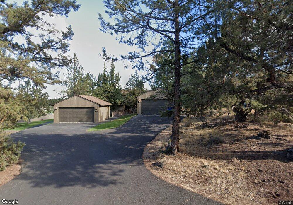
6888 Robin Ct Redmond, OR 97756
Estimated Value: $436,000 - $461,000
2
Beds
2
Baths
1,168
Sq Ft
$382/Sq Ft
Est. Value
About This Home
This home is located at 6888 Robin Ct, Redmond, OR 97756 and is currently estimated at $446,484, approximately $382 per square foot. 6888 Robin Ct is a home located in Deschutes County with nearby schools including Tumalo Community School, Obsidian Middle School, and Ridgeview High School.
Ownership History
Date
Name
Owned For
Owner Type
Purchase Details
Closed on
May 20, 2019
Sold by
Levinson Gay and Levinson Linda
Bought by
Levinson Gary Allen and Levinson Linda Marie
Current Estimated Value
Purchase Details
Closed on
Feb 15, 2019
Sold by
Bloomer William H and Bloomer Sherian D
Bought by
Levinson Gary and Levinson Linda
Home Financials for this Owner
Home Financials are based on the most recent Mortgage that was taken out on this home.
Original Mortgage
$228,000
Outstanding Balance
$199,218
Interest Rate
4.3%
Mortgage Type
New Conventional
Estimated Equity
$247,266
Create a Home Valuation Report for This Property
The Home Valuation Report is an in-depth analysis detailing your home's value as well as a comparison with similar homes in the area
Home Values in the Area
Average Home Value in this Area
Purchase History
| Date | Buyer | Sale Price | Title Company |
|---|---|---|---|
| Levinson Gary Allen | -- | Accommodation | |
| Levinson Gary | $285,000 | Amerititle |
Source: Public Records
Mortgage History
| Date | Status | Borrower | Loan Amount |
|---|---|---|---|
| Open | Levinson Gary | $228,000 |
Source: Public Records
Tax History Compared to Growth
Tax History
| Year | Tax Paid | Tax Assessment Tax Assessment Total Assessment is a certain percentage of the fair market value that is determined by local assessors to be the total taxable value of land and additions on the property. | Land | Improvement |
|---|---|---|---|---|
| 2025 | $4,867 | $287,800 | -- | -- |
| 2024 | $4,652 | $279,420 | -- | -- |
| 2023 | $4,435 | $271,290 | $0 | $0 |
| 2022 | $3,949 | $255,720 | $0 | $0 |
| 2021 | $3,948 | $248,280 | $0 | $0 |
| 2020 | $3,702 | $248,280 | $0 | $0 |
| 2019 | $3,516 | $241,050 | $0 | $0 |
| 2018 | $3,495 | $234,030 | $0 | $0 |
| 2017 | $3,249 | $227,220 | $0 | $0 |
| 2016 | $2,986 | $204,980 | $0 | $0 |
| 2015 | $2,868 | $197,270 | $0 | $0 |
| 2014 | $2,668 | $182,990 | $0 | $0 |
Source: Public Records
Map
Nearby Homes
- 1824 Redtail Hawk Dr Unit RV61F
- 1830 Redtail Hawk Dr Unit RV59J
- 1830 Redtail Hawk Dr Unit RV59E
- 1836 Redtail Hawk Dr Unit RV57G
- 1850 Redtail Hawk Dr Unit RV53K
- 1850 Redtail Hawk Dr Unit RV53B
- 1856 Redtail Hawk Dr Unit RVVE 51-H
- 1927 Mountain Quail Dr
- 1916 Redtail Hawk Dr Unit RV45B
- 1936 Redtail Hawk Dr Unit RV39A
- 1930 Redtail Hawk Dr Unit 41-J
- 1987 Redtail Hawk Dr Unit RV16C
- 2210 Condor Dr
- 1974 Redtail Hawk Dr Unit RV23C
- 1978 Redtail Hawk Dr Unit 21 I
- 1986 Redtail Hawk Dr Unit RV 17-I
- 1990 Redtail Hawk Dr Unit RV15E
- 2200 Snowgoose Dr Unit RV1E
- 2447 Osprey Dr Unit Lot
- 2250 Snowgoose Dr Unit RV4E
- 6888 Robin Ct Unit 14
- 6890 Robin Ct
- 6886 Robin Ct
- 6884 Robin Ct Unit 16D5
- 6884 Robin Ct Unit 16
- 6901 Robin Ct
- 6901 Robin Ct Unit 12A
- 6901 Robin Ct Unit 12
- 6933 Robin Ct
- 6882 Robin Ct
- 6880 Robin Ct
- 6880 SW Robin Ct
- 6900 Robin Ct Unit FV19B
- 6900 Robin Ct
- 6900 Robin Ct Unit 19-E
- 6900 Robin Ct Unit FV19E
- 6920 Robin Ct
- 6920 Robin Ct Unit FV20
- 6920 Robin Ct Unit 20B
- 6969 Robin Ct