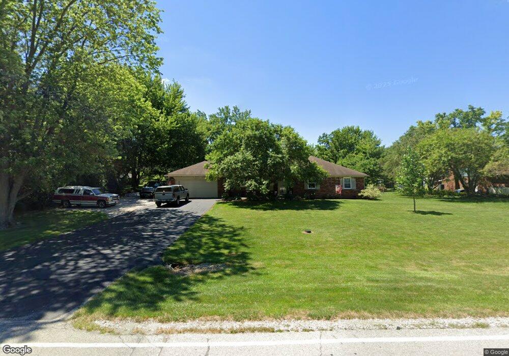
6889 E County Road 350 N Brownsburg, IN 46112
Estimated Value: $311,000 - $340,000
3
Beds
3
Baths
1,686
Sq Ft
$195/Sq Ft
Est. Value
About This Home
This home is located at 6889 E County Road 350 N, Brownsburg, IN 46112 and is currently estimated at $328,020, approximately $194 per square foot. 6889 E County Road 350 N is a home located in Hendricks County with nearby schools including White Lick Elementary School, Brownsburg West Middle School, and Brownsburg High School.
Ownership History
Date
Name
Owned For
Owner Type
Purchase Details
Closed on
May 12, 2021
Sold by
Linder Thomas C and Linder Susan K
Bought by
Mckinney Rickie and Hodge Mckinney Linda
Current Estimated Value
Home Financials for this Owner
Home Financials are based on the most recent Mortgage that was taken out on this home.
Original Mortgage
$266,000
Outstanding Balance
$241,062
Interest Rate
3.1%
Mortgage Type
New Conventional
Estimated Equity
$86,958
Create a Home Valuation Report for This Property
The Home Valuation Report is an in-depth analysis detailing your home's value as well as a comparison with similar homes in the area
Home Values in the Area
Average Home Value in this Area
Purchase History
| Date | Buyer | Sale Price | Title Company |
|---|---|---|---|
| Mckinney Rickie | $280,000 | None Available |
Source: Public Records
Mortgage History
| Date | Status | Borrower | Loan Amount |
|---|---|---|---|
| Open | Mckinney Rickie | $266,000 |
Source: Public Records
Tax History Compared to Growth
Tax History
| Year | Tax Paid | Tax Assessment Tax Assessment Total Assessment is a certain percentage of the fair market value that is determined by local assessors to be the total taxable value of land and additions on the property. | Land | Improvement |
|---|---|---|---|---|
| 2024 | $2,541 | $254,100 | $32,300 | $221,800 |
| 2023 | $2,399 | $240,700 | $30,800 | $209,900 |
| 2022 | $2,274 | $229,500 | $29,400 | $200,100 |
| 2021 | $1,904 | $196,700 | $29,400 | $167,300 |
| 2020 | $1,867 | $192,400 | $29,400 | $163,000 |
| 2019 | $1,692 | $180,500 | $27,900 | $152,600 |
| 2018 | $1,637 | $174,600 | $27,900 | $146,700 |
| 2017 | $1,549 | $166,000 | $26,800 | $139,200 |
| 2016 | $1,477 | $160,900 | $26,800 | $134,100 |
| 2014 | $1,532 | $161,200 | $26,500 | $134,700 |
Source: Public Records
Map
Nearby Homes
- 4472 Yellowwood Ave
- 4476 Yellowwood Ave
- 4411 Tolleston Ave
- 4419 Tolleston Ave Unit 67
- 4481 Yellowwood Ave
- 4475 Yellowwood Ave
- 4504 Yellowwood Ave
- 4508 Yellowwood Ave
- 4407 Tolleston Ave
- 4415 Tolleston Ave
- 6908 Collisi Place
- T1500 Plan at Trailside
- T1800 Plan at Trailside
- T1600 Plan at Trailside
- 4531 Tolleston Ave
- 6620 E County Road 350 N
- 2251 Hanover Rd
- 2337 Hanover Rd
- 6 Rosecrans Ct
- 2712 Odell St
- 6905 E County Road 350 N
- 6855 E County Road 350 N
- 6870 Norena Ct
- 6904 Norena Ct
- 6860 E County Road 350 N
- 6840 Norena Ct
- 6943 E County Road 350 N
- 3241 Sunny Dr
- 3203 Sunny Dr
- 6903 Norena Ct
- 6942 Norena Ct
- 6965 E County Road 350 N
- 6815 E County Road 350 N
- 6842 E County Road 350 N
- 6943 Norena Ct
- 6873 Norena Ct
- 3147 Sunny Dr
- 3170 N State Road 267
- 6847 Norena Ct
- 6997 E County Road 350 N