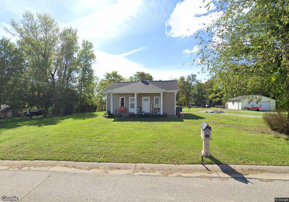
689 Hogreffe Rd Independence, KY 41051
Estimated Value: $127,000 - $290,000
2
Beds
1
Bath
920
Sq Ft
$220/Sq Ft
Est. Value
About This Home
This home is located at 689 Hogreffe Rd, Independence, KY 41051 and is currently estimated at $202,698, approximately $220 per square foot. 689 Hogreffe Rd is a home located in Kenton County with nearby schools including Beechgrove Elementary School, Twenhofel Middle School, and Simon Kenton High School.
Ownership History
Date
Name
Owned For
Owner Type
Purchase Details
Closed on
Feb 14, 2025
Sold by
Ramsey Billy J and Ramsey Shannon R
Bought by
Rocky Point Homes Llc
Current Estimated Value
Purchase Details
Closed on
Mar 4, 2024
Sold by
Meade Kenneth and Meade Diana
Bought by
Ramsey Billy J and Ramsey Shannon R
Home Financials for this Owner
Home Financials are based on the most recent Mortgage that was taken out on this home.
Original Mortgage
$116,000
Interest Rate
5.76%
Mortgage Type
Seller Take Back
Purchase Details
Closed on
Oct 3, 2014
Sold by
Parman Billy Sue
Bought by
Meade Kenneth and Meade Diana
Create a Home Valuation Report for This Property
The Home Valuation Report is an in-depth analysis detailing your home's value as well as a comparison with similar homes in the area
Home Values in the Area
Average Home Value in this Area
Purchase History
| Date | Buyer | Sale Price | Title Company |
|---|---|---|---|
| Rocky Point Homes Llc | $120,000 | Kentucky Land Title | |
| Rocky Point Homes Llc | $120,000 | Kentucky Land Title | |
| Ramsey Billy J | $116,000 | None Listed On Document | |
| Ramsey Billy J | $116,000 | None Listed On Document | |
| Meade Kenneth | $99,000 | None Available |
Source: Public Records
Mortgage History
| Date | Status | Borrower | Loan Amount |
|---|---|---|---|
| Previous Owner | Ramsey Billy J | $116,000 |
Source: Public Records
Tax History Compared to Growth
Tax History
| Year | Tax Paid | Tax Assessment Tax Assessment Total Assessment is a certain percentage of the fair market value that is determined by local assessors to be the total taxable value of land and additions on the property. | Land | Improvement |
|---|---|---|---|---|
| 2024 | $1,425 | $116,300 | $25,000 | $91,300 |
| 2023 | $1,508 | $116,300 | $25,000 | $91,300 |
| 2022 | $1,534 | $116,300 | $25,000 | $91,300 |
| 2021 | $1,556 | $116,300 | $25,000 | $91,300 |
| 2020 | $1,363 | $99,000 | $20,000 | $79,000 |
| 2019 | $1,367 | $99,000 | $20,000 | $79,000 |
| 2018 | $1,374 | $99,000 | $20,000 | $79,000 |
| 2017 | $1,337 | $99,000 | $20,000 | $79,000 |
| 2015 | $1,293 | $99,000 | $20,000 | $79,000 |
| 2014 | $686 | $87,000 | $20,000 | $67,000 |
Source: Public Records
Map
Nearby Homes
- 10690 Melbury Ct Unit 305GL
- 10694 Melbury Ct Unit 306GL
- The Westchester Plan at The Greens of Glenhurst
- The Ella Marie Plan at The Greens of Glenhurst
- The Jefferson Plan at The Greens of Glenhurst
- The Leighann Plan at The Greens of Glenhurst
- The Waterson Plan at The Greens of Glenhurst
- The Lancaster Plan at The Greens of Glenhurst
- The Austin Plan at The Greens of Glenhurst
- The Morgan Plan at The Greens of Glenhurst
- The Marietta Plan at The Greens of Glenhurst
- The Camden Plan at The Greens of Glenhurst
- The Lincoln Plan at The Greens of Glenhurst
- The Bristol Plan at The Greens of Glenhurst
- The Livingston Plan at The Greens of Glenhurst
- The Madison Plan at The Greens of Glenhurst
- The Verona Plan at The Greens of Glenhurst
- The Courtney Plan at The Greens of Glenhurst
- The Avalon Plan at The Greens of Glenhurst
- The Rosewood Plan at The Greens of Glenhurst
- 689 Hogrefe Rd
- 681 Hogrefe Rd
- 707 Hogreffe Rd
- 680 Hogrefe Rd
- 690 Hogrefe Rd
- 673 Hogrefe Rd
- 672 Hogrefe Rd
- 700 Hogrefe Rd
- 10651 Blooming Ct
- 10655 Blooming Ct
- 668 Hogrefe Rd
- 680 Hogreffe Rd
- 10659 Blooming Ct
- 665 Hogrefe Rd
- 715 Hogrefe Rd
- 715 Hogrefe Rd
- 664 Hogrefe Rd
- 10663 Blooming Ct
- 672 Hogreffe Rd
- 657 Hogrefe Rd