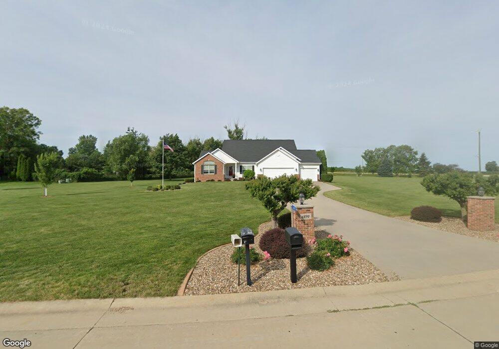
6890 White Gate Ct Marion, IA 52302
Estimated Value: $484,000 - $573,748
5
Beds
3
Baths
2,312
Sq Ft
$227/Sq Ft
Est. Value
About This Home
This home is located at 6890 White Gate Ct, Marion, IA 52302 and is currently estimated at $525,187, approximately $227 per square foot. 6890 White Gate Ct is a home located in Linn County with nearby schools including Novak Elementary School, Excelsior Middle School, and Linn-Mar High School.
Ownership History
Date
Name
Owned For
Owner Type
Purchase Details
Closed on
Dec 5, 2002
Sold by
Midwest Development Co
Bought by
Callahan Steven J and Callahan Mary J
Current Estimated Value
Home Financials for this Owner
Home Financials are based on the most recent Mortgage that was taken out on this home.
Original Mortgage
$285,645
Outstanding Balance
$122,610
Interest Rate
6.23%
Estimated Equity
$402,577
Purchase Details
Closed on
Aug 15, 2002
Sold by
Kleis Ank and Kleis Susan M
Bought by
Midwest Development Co
Purchase Details
Closed on
Mar 31, 2000
Sold by
Blackford Farms Inc
Bought by
Kleis Ank and Kleis Susan M
Create a Home Valuation Report for This Property
The Home Valuation Report is an in-depth analysis detailing your home's value as well as a comparison with similar homes in the area
Home Values in the Area
Average Home Value in this Area
Purchase History
| Date | Buyer | Sale Price | Title Company |
|---|---|---|---|
| Callahan Steven J | $317,000 | -- | |
| Midwest Development Co | $48,000 | -- | |
| Kleis Ank | $50,000 | -- |
Source: Public Records
Mortgage History
| Date | Status | Borrower | Loan Amount |
|---|---|---|---|
| Open | Callahan Steven J | $285,645 |
Source: Public Records
Tax History Compared to Growth
Tax History
| Year | Tax Paid | Tax Assessment Tax Assessment Total Assessment is a certain percentage of the fair market value that is determined by local assessors to be the total taxable value of land and additions on the property. | Land | Improvement |
|---|---|---|---|---|
| 2025 | $6,274 | $494,500 | $96,000 | $398,500 |
| 2024 | $6,624 | $477,100 | $96,000 | $381,100 |
| 2023 | $6,624 | $477,100 | $96,000 | $381,100 |
| 2022 | $6,408 | $430,600 | $116,000 | $314,600 |
| 2021 | $6,398 | $430,600 | $116,000 | $314,600 |
| 2020 | $6,398 | $401,100 | $87,500 | $313,600 |
| 2019 | $5,988 | $376,600 | $87,500 | $289,100 |
| 2018 | $5,720 | $376,600 | $87,500 | $289,100 |
| 2017 | $5,804 | $369,800 | $87,500 | $282,300 |
| 2016 | $5,795 | $369,800 | $87,500 | $282,300 |
| 2015 | $5,839 | $369,800 | $87,500 | $282,300 |
| 2014 | $5,702 | $366,400 | $87,500 | $278,900 |
| 2013 | $5,422 | $366,400 | $87,500 | $278,900 |
Source: Public Records
Map
Nearby Homes
- 1605 Valentine Dr
- 1789 Glen Rock Cir
- 1823 Glen Rock Cir
- 1727 Hunters Creek Way Unit 1727
- 1845 Hunters Creek Way Unit 1845
- 2070 Royal Oak Ridge Rd
- 2239 Royal Oak Ridge Rd
- 2027 Royal Oak Ridge Rd
- 2069 Royal Oak Ridge Rd
- 2155 Royal Oak Ridge Rd
- 1600 Hunters Creek Way Unit 1600
- 1562 Hunters Creek Way Unit 1562
- 5524 Cimarron Ct
- 1350 Huntington Hills Dr
- 5510 Hunters Ridge Ct
- 5936 Cedar Ridge Dr
- 2970 Covey Run Ct
- 2995 Royal Oak Ridge Rd
- 2935 Clubhouse Dr
- 2933 Clubhouse Dr and 2935
- 6684 White Gate Ct
- 6925 White Gate Ct
- 6843 White Gate Ct
- 6763 White Gate Ct
- 6691 White Gate Ct
- 6550 White Gate Ct
- 6600 N 10th St
- 6601 White Gate Ct
- 6500 White Gate Ct
- 6551 White Gate Ct
- 6501 White Gate Ct
- 7000 N 10th St
- 6404 N 10th St
- 6450 White Gate Ct
- 6451 White Gate Ct
- 6400 White Gate Ct
- 6310 N 10th St
- 6401 White Gate Ct
- 7106 N 10th St
- 6300 White Gate Ct