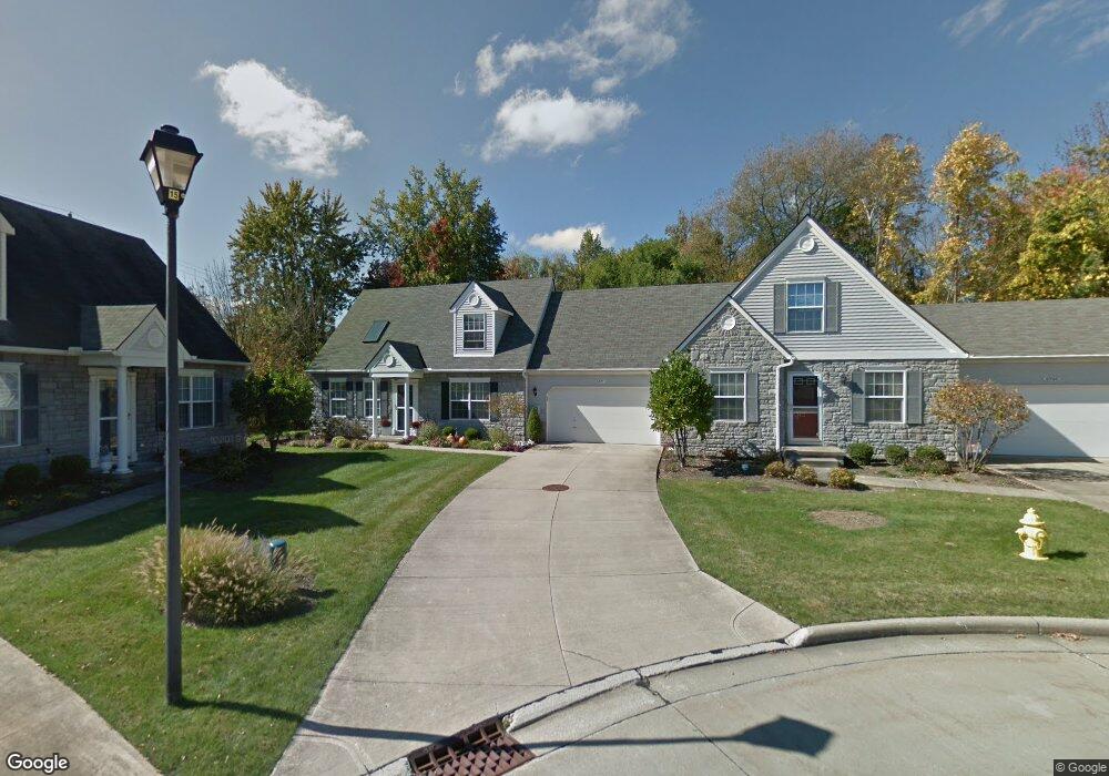
6895 Arbor Ct Unit I20 Cleveland, OH 44134
Estimated Value: $254,000 - $271,000
2
Beds
2
Baths
1,405
Sq Ft
$186/Sq Ft
Est. Value
About This Home
This home is located at 6895 Arbor Ct Unit I20, Cleveland, OH 44134 and is currently estimated at $261,436, approximately $186 per square foot. 6895 Arbor Ct Unit I20 is a home located in Cuyahoga County with nearby schools including Green Valley Elementary School, Normandy High School, and Hillside Middle School.
Ownership History
Date
Name
Owned For
Owner Type
Purchase Details
Closed on
Dec 27, 2022
Sold by
Murphy Family Revocable Living Trust
Bought by
John T Carlin Revocable Trust and Carlin
Current Estimated Value
Purchase Details
Closed on
Feb 3, 2004
Sold by
Murphy Patrick J and Murphy Barbara Ann
Bought by
Murphy Patrick J and Murphy Barbara Ann
Purchase Details
Closed on
Jun 8, 1999
Sold by
Whitlatch & Co
Bought by
Murphy Patrick J and Murphy Barbara Ann
Home Financials for this Owner
Home Financials are based on the most recent Mortgage that was taken out on this home.
Original Mortgage
$119,200
Interest Rate
7.25%
Create a Home Valuation Report for This Property
The Home Valuation Report is an in-depth analysis detailing your home's value as well as a comparison with similar homes in the area
Home Values in the Area
Average Home Value in this Area
Purchase History
| Date | Buyer | Sale Price | Title Company |
|---|---|---|---|
| John T Carlin Revocable Trust | $210,000 | Maximum Title | |
| Murphy Patrick J | -- | -- | |
| Murphy Patrick J | $149,100 | General Title Agency Inc |
Source: Public Records
Mortgage History
| Date | Status | Borrower | Loan Amount |
|---|---|---|---|
| Previous Owner | Murphy Patrick J | $119,200 |
Source: Public Records
Tax History Compared to Growth
Tax History
| Year | Tax Paid | Tax Assessment Tax Assessment Total Assessment is a certain percentage of the fair market value that is determined by local assessors to be the total taxable value of land and additions on the property. | Land | Improvement |
|---|---|---|---|---|
| 2024 | $4,442 | $73,500 | $7,385 | $66,115 |
| 2023 | $3,581 | $50,860 | $5,080 | $45,780 |
| 2022 | $2,995 | $50,860 | $5,080 | $45,780 |
| 2021 | $3,079 | $50,860 | $5,080 | $45,780 |
| 2020 | $2,901 | $43,860 | $4,380 | $39,480 |
| 2019 | $2,768 | $125,300 | $12,500 | $112,800 |
| 2018 | $2,816 | $43,860 | $4,380 | $39,480 |
| 2017 | $2,997 | $44,350 | $4,450 | $39,900 |
| 2016 | $2,980 | $44,350 | $4,450 | $39,900 |
| 2015 | $3,126 | $44,350 | $4,450 | $39,900 |
| 2014 | $3,126 | $48,200 | $4,830 | $43,370 |
Source: Public Records
Map
Nearby Homes
- 7987 Ridge Rd
- 6035 Woodland Bend Dr
- 5500 Peachtree Ln S
- 8007 Sierra Oval
- 7957 Pamela Dr
- 8400 Vista Ln
- 8501 Pin Oak Dr
- 4591 W Sprague Rd
- 6451 Glenwillow Dr
- 7706 Wake Robin Dr
- 7580 S Pointe Ln
- 7596 S Pointe Ln
- 7351 S Pointe Ln
- Rosecliff Plan at South Pointe - Townhomes
- Caroline Plan at South Pointe - Townhomes
- 8696 Parkdale Dr
- 0 Tilby Rd
- 8053 Thornhurst Dr
- 7531 Vista Dr
- 4477 Hialeah Dr
- 6900 Arbor Ct Unit I21
- 6875 Arbor Ct Unit H19
- 6855 Arbor Ct Unit 18
- 6880 Arbor Ct Unit I22
- 6850 Arbor Ct Unit J23
- 6835 Arbor Ct Unit H17
- 6810 Arbor Ct Unit J25
- 6795 Arbor Ct Unit G15
- 6775 Arbor Way
- 6780 Arbor Ct Unit K26
- 7801 Ridge Rd
- 7845 Ridge Rd
- 7791 Ridge Rd
- 7810 Arbor Way Unit K27
- 7806 Arbor Way Unit L28
- 6755 Arbor Way Unit F13
- 7777 Ridge Rd
- 7800 Arbor Way Unit L29
- 7796 Arbor Way Unit L30