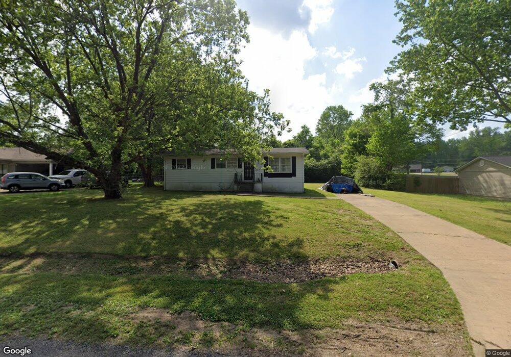
69 Allen St Munford, TN 38058
Estimated Value: $157,643 - $215,000
--
Bed
2
Baths
1,056
Sq Ft
$182/Sq Ft
Est. Value
About This Home
This home is located at 69 Allen St, Munford, TN 38058 and is currently estimated at $192,411, approximately $182 per square foot. 69 Allen St is a home located in Tipton County with nearby schools including Munford Elementary School, Munford Middle School, and Munford High School.
Ownership History
Date
Name
Owned For
Owner Type
Purchase Details
Closed on
Feb 23, 2022
Sold by
Combs John G
Bought by
Combs John G
Current Estimated Value
Purchase Details
Closed on
Jul 17, 1992
Bought by
Combs John G and Combs Carolyn P
Purchase Details
Closed on
Apr 2, 1992
Purchase Details
Closed on
Jan 24, 1992
Purchase Details
Closed on
Apr 28, 1989
Bought by
Crawford Buford Lee and Pennie Ann
Purchase Details
Closed on
Sep 15, 1987
Purchase Details
Closed on
Jan 1, 1984
Bought by
Mccullough Richard L
Purchase Details
Closed on
Jul 30, 1977
Create a Home Valuation Report for This Property
The Home Valuation Report is an in-depth analysis detailing your home's value as well as a comparison with similar homes in the area
Home Values in the Area
Average Home Value in this Area
Purchase History
| Date | Buyer | Sale Price | Title Company |
|---|---|---|---|
| Combs John G | $3,243 | None Listed On Document | |
| Combs John G | $30,100 | -- | |
| -- | -- | -- | |
| -- | -- | -- | |
| Crawford Buford Lee | $46,200 | -- | |
| -- | $42,000 | -- | |
| Mccullough Richard L | $34,900 | -- | |
| -- | -- | -- |
Source: Public Records
Tax History Compared to Growth
Tax History
| Year | Tax Paid | Tax Assessment Tax Assessment Total Assessment is a certain percentage of the fair market value that is determined by local assessors to be the total taxable value of land and additions on the property. | Land | Improvement |
|---|---|---|---|---|
| 2024 | $647 | $27,250 | $7,150 | $20,100 |
| 2023 | $232 | $27,250 | $7,150 | $20,100 |
| 2022 | $618 | $19,275 | $5,250 | $14,025 |
| 2021 | $619 | $19,275 | $5,250 | $14,025 |
| 2020 | $618 | $19,275 | $5,250 | $14,025 |
| 2019 | $507 | $13,175 | $4,050 | $9,125 |
| 2018 | $481 | $13,175 | $4,050 | $9,125 |
| 2017 | $481 | $13,175 | $4,050 | $9,125 |
| 2016 | $481 | $13,175 | $4,050 | $9,125 |
| 2015 | $480 | $13,175 | $4,050 | $9,125 |
| 2014 | $446 | $13,151 | $0 | $0 |
Source: Public Records
Map
Nearby Homes
- 308 Colonial Heights Dr
- 212 Barnes St
- 434 West Dr
- 76 Christie Ave
- 129 Boardwalk St
- 144 Park St
- 94 Karen St
- 16 W Main St
- 56 S Bigham Cove
- 106 Wiley Dr
- 372 Beaver Rd
- 215 Pritchett Cove
- 310 Wooten Oaks Cir
- 17 Center Ave
- 152 Pritchett Cove
- 110 Pritchett Cove
- 0 Hwy 51 Hwy S Unit 10206150
- 131 Pritchett Cove
- 113 Forsyth Ln
- 44 Pritchett Cove