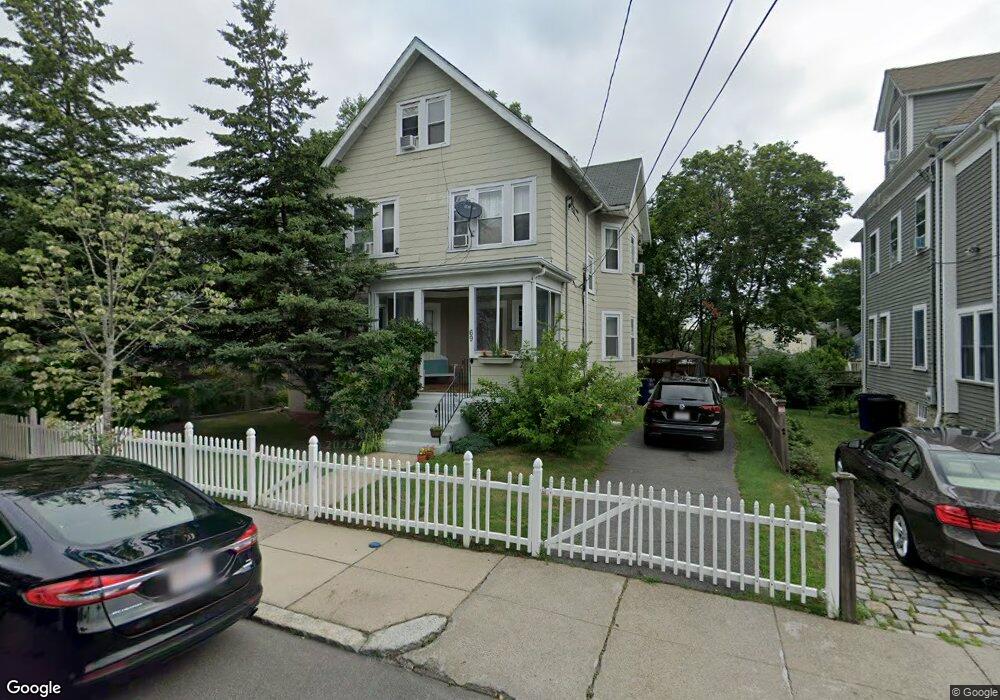
69 Averton St Unit 1 Roslindale, MA 02131
Roslindale NeighborhoodEstimated Value: $883,000 - $1,066,919
2
Beds
1
Bath
99,999
Sq Ft
$10/Sq Ft
Est. Value
About This Home
This home is located at 69 Averton St Unit 1, Roslindale, MA 02131 and is currently estimated at $958,230, approximately $9 per square foot. 69 Averton St Unit 1 is a home located in Suffolk County with nearby schools including Brooke Charter School Roslindale, Sacred Heart STEM School, and Holy Name Parish School.
Ownership History
Date
Name
Owned For
Owner Type
Purchase Details
Closed on
Apr 8, 2025
Sold by
Segura Axel E and Segura Sonia M
Bought by
Segura Ft and Segura
Current Estimated Value
Purchase Details
Closed on
Sep 1, 1995
Sold by
Cairns Joseph J and Adams Maureen
Bought by
Segura-Martinez Rm and Segura Aida V
Home Financials for this Owner
Home Financials are based on the most recent Mortgage that was taken out on this home.
Original Mortgage
$116,350
Interest Rate
7.61%
Mortgage Type
Purchase Money Mortgage
Create a Home Valuation Report for This Property
The Home Valuation Report is an in-depth analysis detailing your home's value as well as a comparison with similar homes in the area
Home Values in the Area
Average Home Value in this Area
Purchase History
| Date | Buyer | Sale Price | Title Company |
|---|---|---|---|
| Segura Ft | -- | None Available | |
| Segura-Martinez Rm | $122,500 | -- | |
| Segura-Martinez Rm | $122,500 | -- | |
| Segura-Martinez Rm | $122,500 | -- |
Source: Public Records
Mortgage History
| Date | Status | Borrower | Loan Amount |
|---|---|---|---|
| Previous Owner | Segura-Martinez Rm | $116,350 |
Source: Public Records
Tax History Compared to Growth
Tax History
| Year | Tax Paid | Tax Assessment Tax Assessment Total Assessment is a certain percentage of the fair market value that is determined by local assessors to be the total taxable value of land and additions on the property. | Land | Improvement |
|---|---|---|---|---|
| 2025 | $10,632 | $918,100 | $288,300 | $629,800 |
| 2024 | $8,832 | $810,300 | $250,300 | $560,000 |
| 2023 | $8,210 | $764,400 | $236,100 | $528,300 |
| 2022 | $7,627 | $701,000 | $216,500 | $484,500 |
| 2021 | $7,193 | $674,100 | $208,200 | $465,900 |
| 2020 | $6,989 | $661,800 | $194,700 | $467,100 |
| 2019 | $6,580 | $624,300 | $151,700 | $472,600 |
| 2018 | $5,948 | $567,600 | $151,700 | $415,900 |
| 2017 | $5,951 | $561,900 | $151,700 | $410,200 |
| 2016 | $5,671 | $515,500 | $151,700 | $363,800 |
| 2015 | $5,125 | $423,200 | $149,400 | $273,800 |
| 2014 | $5,042 | $400,800 | $149,400 | $251,400 |
Source: Public Records
Map
Nearby Homes
- 0 Averton St
- 34 Averton St
- 276 Cornell St
- 112 Roslindale Ave Unit 2
- 142 Birch St
- 142 Birch St Unit 1
- 142 Birch St Unit 2
- 17 Metcalf St
- 80 Roslindale Ave Unit 3
- 95 Newburg St
- 55 Metropolitan Ave
- 15 Newburg St Unit 1
- 69 Metropolitan Ave
- 103 Belgrade Ave Unit 2
- 242 Belgrade Ave
- 295 Kittredge St
- 5 7 Hemman St
- 79 Robert St Unit 3
- 26 Bradfield Ave Unit 3
- 124 Glendower Rd Unit 2
- 69 Averton St
- 65 Averton St
- 126 Walworth St
- 163 Roslindale Ave Unit 21
- 163 Roslindale Ave Unit 2
- 163 Roslindale Ave
- 61 Averton St
- 130 Walworth St
- 159 Roslindale Ave
- 122 Walworth St
- 11 Alder St
- 132 Walworth St
- 155 Roslindale Ave
- 120 Walworth St
- 120 Walworth St Unit 1
- 155 Roslindale Ave Unit 1
- 134 Walworth St
- 134 Walworth St Unit 1
- 118 Walworth St
- 129 Walworth St