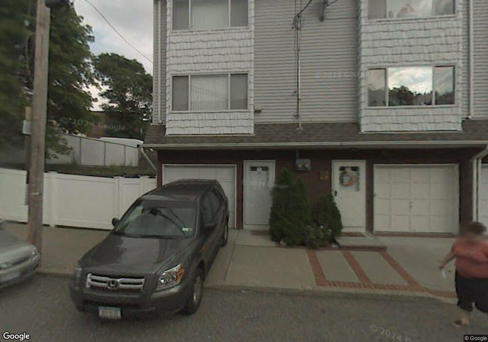
69 Avon Ln Staten Island, NY 10314
Westerleigh NeighborhoodEstimated Value: $587,000 - $660,000
2
Beds
2
Baths
1,400
Sq Ft
$434/Sq Ft
Est. Value
About This Home
This home is located at 69 Avon Ln, Staten Island, NY 10314 and is currently estimated at $607,135, approximately $433 per square foot. 69 Avon Ln is a home located in Richmond County with nearby schools including P.S. 30 Westerleigh, I.S. 51 Edwin Markham, and Port Richmond High School.
Ownership History
Date
Name
Owned For
Owner Type
Purchase Details
Closed on
Sep 12, 2007
Sold by
Scotti Michael and Scotti Lisa
Bought by
Windsor Lynne T
Current Estimated Value
Home Financials for this Owner
Home Financials are based on the most recent Mortgage that was taken out on this home.
Original Mortgage
$292,000
Interest Rate
6.39%
Mortgage Type
Purchase Money Mortgage
Purchase Details
Closed on
Apr 24, 2001
Sold by
Forchette Bruce and Forchette Katsy K
Bought by
Scotti Michael and Ciminelli Lisa
Home Financials for this Owner
Home Financials are based on the most recent Mortgage that was taken out on this home.
Original Mortgage
$188,000
Interest Rate
6.88%
Create a Home Valuation Report for This Property
The Home Valuation Report is an in-depth analysis detailing your home's value as well as a comparison with similar homes in the area
Home Values in the Area
Average Home Value in this Area
Purchase History
| Date | Buyer | Sale Price | Title Company |
|---|---|---|---|
| Windsor Lynne T | $373,000 | None Available | |
| Scotti Michael | $198,000 | Lawyers Title Insurance Corp |
Source: Public Records
Mortgage History
| Date | Status | Borrower | Loan Amount |
|---|---|---|---|
| Previous Owner | Windsor Lynne T | $292,000 | |
| Previous Owner | Scotti Michael | $188,000 |
Source: Public Records
Tax History Compared to Growth
Tax History
| Year | Tax Paid | Tax Assessment Tax Assessment Total Assessment is a certain percentage of the fair market value that is determined by local assessors to be the total taxable value of land and additions on the property. | Land | Improvement |
|---|---|---|---|---|
| 2025 | $5,116 | $31,020 | $10,633 | $20,387 |
| 2024 | $5,128 | $31,920 | $9,748 | $22,172 |
| 2023 | $4,945 | $25,747 | $8,672 | $17,075 |
| 2022 | $4,771 | $27,960 | $11,580 | $16,380 |
| 2021 | $4,728 | $27,900 | $11,580 | $16,320 |
| 2020 | $4,728 | $26,160 | $11,580 | $14,580 |
| 2019 | $4,391 | $26,820 | $11,580 | $15,240 |
| 2018 | $4,076 | $21,456 | $9,243 | $12,213 |
| 2017 | $4,005 | $21,115 | $11,226 | $9,889 |
| 2016 | $3,672 | $19,920 | $11,580 | $8,340 |
| 2015 | $3,276 | $19,779 | $12,788 | $6,991 |
| 2014 | $3,276 | $18,660 | $12,840 | $5,820 |
Source: Public Records
Map
Nearby Homes
- 63 Avon Ln
- 27 Frederick St
- 26 Iowa Place
- 202 Watchogue Rd
- 366 Neal Dow Ave
- 307 Clinton B Fiske Ave
- 307 Fiske Ave
- 2 Smith Ct
- 282 Willard Ave
- 48 Markham Place
- 279 Saint John Ave
- 2111 Victory Blvd
- 251 Saint John Ave
- 284 Bidwell Ave
- 124 Byrne Ave
- 14 Leonard Ave
- 249 Dickie Ave
- 183 Goodwin Ave
- 0 Willard Ave
- 36 Carmel Ave
- 67 Avon Ln
- 65 Avon Ln
- 152-154 Watchogue Rd
- 156 Watchogue Rd
- 31 Avon Ln
- 70 Avon Ln
- 68 Avon Ln
- 66 Avon Ln
- 152 Watchogue Rd
- 152 Watchogue Rd Unit 15254
- 162 Watchogue Rd
- 64 Avon Ln
- 62 Avon Ln
- 134 Watchogue Rd Unit Srore 1
- 134 Watchogue Rd
- 124 Watchogue Rd
- 128 Watchogue Rd
- 60 Avon Ln
- 130 Watchogue Rd
- 166 Watchogue Rd