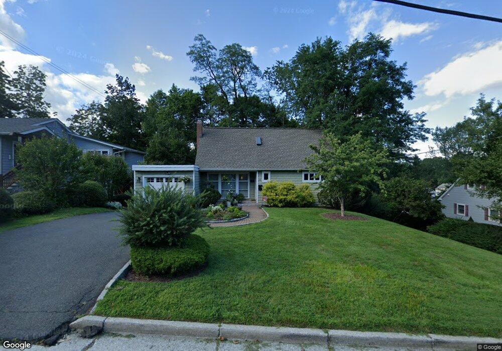
69 Barnes Rd Tarrytown, NY 10591
Estimated Value: $1,029,000 - $1,072,000
--
Bed
--
Bath
--
Sq Ft
7,405
Sq Ft Lot
About This Home
This home is located at 69 Barnes Rd, Tarrytown, NY 10591 and is currently estimated at $1,043,885. 69 Barnes Rd is a home located in Westchester County with nearby schools including Washington Irving Interm School, John Paulding School, and W L Morse School.
Ownership History
Date
Name
Owned For
Owner Type
Purchase Details
Closed on
Aug 28, 2001
Sold by
Alhqvist Patricia and Ahlqvist Johan S
Bought by
Dino Luanna F
Current Estimated Value
Home Financials for this Owner
Home Financials are based on the most recent Mortgage that was taken out on this home.
Original Mortgage
$135,000
Interest Rate
6.7%
Mortgage Type
Unknown
Purchase Details
Closed on
Jul 12, 1995
Sold by
Brunner Richard and Cooper Virginia
Bought by
Alqvist Johan S and Ahlqvist Patricia G
Create a Home Valuation Report for This Property
The Home Valuation Report is an in-depth analysis detailing your home's value as well as a comparison with similar homes in the area
Home Values in the Area
Average Home Value in this Area
Purchase History
| Date | Buyer | Sale Price | Title Company |
|---|---|---|---|
| Dino Luanna F | $476,000 | Stewart Title | |
| Alqvist Johan S | $191,000 | -- |
Source: Public Records
Mortgage History
| Date | Status | Borrower | Loan Amount |
|---|---|---|---|
| Previous Owner | Dino Luanna F | $135,000 |
Source: Public Records
Tax History Compared to Growth
Tax History
| Year | Tax Paid | Tax Assessment Tax Assessment Total Assessment is a certain percentage of the fair market value that is determined by local assessors to be the total taxable value of land and additions on the property. | Land | Improvement |
|---|---|---|---|---|
| 2024 | $20,358 | $809,800 | $280,900 | $528,900 |
| 2023 | $18,756 | $642,700 | $248,600 | $394,100 |
| 2022 | $18,144 | $593,700 | $248,600 | $345,100 |
| 2021 | $16,078 | $539,300 | $248,600 | $290,700 |
| 2020 | $15,971 | $463,600 | $248,600 | $215,000 |
| 2019 | $15,458 | $463,600 | $248,600 | $215,000 |
| 2018 | $11,165 | $455,200 | $248,600 | $206,600 |
| 2017 | $7,073 | $434,300 | $248,600 | $185,700 |
| 2016 | $308,828 | $417,600 | $248,600 | $169,000 |
| 2015 | -- | $15,000 | $2,100 | $12,900 |
| 2014 | -- | $15,000 | $2,100 | $12,900 |
| 2013 | $9,560 | $15,000 | $2,100 | $12,900 |
Source: Public Records
Map
Nearby Homes
- 94 Barnes Rd
- 43 Putnam Ave
- 497 Martling Ave
- 14 Croton Ave
- 102 Legend Dr Unit 101
- 18 N Broadway Unit 411
- 19 S Broadway Unit 4A
- 93 Carrollwood Dr Unit 93
- 29 Woodland Ave
- 20 Benedict Ave
- 443 Benedict Ave
- 410 Benedict Ave Unit 5E
- 412 Benedict Ave Unit 5H
- 25 Glen Hill Ln
- 154 Martling Ave Unit 5-J6
- 7 Glen Hill Ln
- 29 Dixon St
- 46 Trailhead Ln
- 57 Cobb Ln
- 12 Hendrick Ln Unit 43E