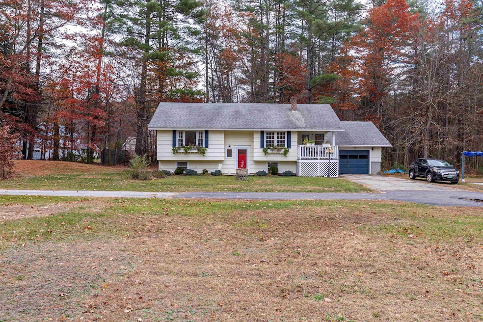
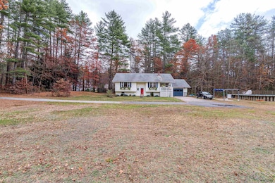
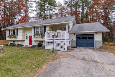
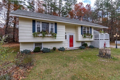
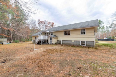

69 Bean Rd MerriMacK, NH 03054
Estimated payment $3,691/month
Highlights
- Heated Floors
- 15.49 Acre Lot
- Wooded Lot
- Reeds Ferry School Rated 9+
- Deck
- 1 Car Attached Garage
About This Home
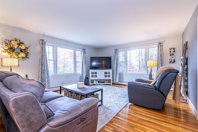
Looking for a home that has some land? You just found it. Come view this remodeled and updated 2 bedroom, 2 bath home situated on a 15 acre lot. Lots of natural light. Open concept kitchen, dining and living room. Gorgeous kitchen with granite counters, stainless steel appliances, recessed lighting, and breakfast bar. Hardwood floors in living room. Primary bath features granite counter and heated tile floor. 1st floor laundry room. Additional living space potential in the unfinished basement. There are daylight windows and it already has heat. Large 1 car attached garage. Covered porch to the front and deck to the rear. 16 x 20 heated above ground pool. The property also abuts a couple town owned vacant lots for more exploration and hiking. Showings start on Saturday November 15th
Home Details
Home Type
- Single Family
Est. Annual Taxes
- $7,885
Year Built
- Built in 1966
Lot Details
- 15.49 Acre Lot
- Wooded Lot
Parking
- 1 Car Attached Garage
- Automatic Garage Door Opener
- Driveway
- 1 to 5 Parking Spaces
Home Design
- Split Foyer
- Wood Siding
- Shake Siding
Interior Spaces
- Property has 1 Level
- Recessed Lighting
- Blinds
- Living Room
- Combination Kitchen and Dining Room
- Basement
- Interior Basement Entry
Kitchen
- Range Hood
- Microwave
- Dishwasher
Flooring
- Wood
- Carpet
- Heated Floors
- Tile
- Vinyl Plank
Bedrooms and Bathrooms
- 2 Bedrooms
- En-Suite Bathroom
Laundry
- Laundry Room
- Dryer
- Washer
Home Security
- Carbon Monoxide Detectors
- Fire and Smoke Detector
Outdoor Features
- Deck
- Shed
Schools
- Reeds Ferry Elementary School
- Merrimack Middle School
- Merrimack High School
Utilities
- Window Unit Cooling System
- Vented Exhaust Fan
- Hot Water Heating System
- Programmable Thermostat
- Generator Hookup
- Leach Field
Listing and Financial Details
- Tax Lot 141
- Assessor Parcel Number 6B
Map
Home Values in the Area
Average Home Value in this Area
Tax History
| Year | Tax Paid | Tax Assessment Tax Assessment Total Assessment is a certain percentage of the fair market value that is determined by local assessors to be the total taxable value of land and additions on the property. | Land | Improvement |
|---|---|---|---|---|
| 2024 | $7,379 | $356,649 | $207,449 | $149,200 |
| 2023 | $6,939 | $356,750 | $207,550 | $149,200 |
| 2022 | $6,204 | $356,971 | $207,771 | $149,200 |
| 2021 | $6,365 | $370,721 | $224,021 | $146,700 |
| 2020 | $6,503 | $270,300 | $164,900 | $105,400 |
| 2019 | $6,524 | $270,369 | $164,969 | $105,400 |
| 2018 | $6,523 | $270,447 | $165,047 | $105,400 |
| 2017 | $6,290 | $269,143 | $165,043 | $104,100 |
| 2016 | $6,134 | $269,155 | $165,055 | $104,100 |
| 2015 | $5,980 | $241,926 | $148,426 | $93,500 |
| 2014 | $5,828 | $241,926 | $148,426 | $93,500 |
| 2013 | $5,790 | $242,175 | $149,775 | $92,400 |
Property History
| Date | Event | Price | List to Sale | Price per Sq Ft |
|---|---|---|---|---|
| 11/11/2025 11/11/25 | For Sale | $574,500 | -- | $447 / Sq Ft |
Purchase History
| Date | Type | Sale Price | Title Company |
|---|---|---|---|
| Quit Claim Deed | $195,600 | None Available | |
| Quit Claim Deed | -- | None Available | |
| Warranty Deed | $220,000 | -- | |
| Quit Claim Deed | -- | -- | |
| Quit Claim Deed | -- | -- | |
| Deed | -- | -- |
Mortgage History
| Date | Status | Loan Amount | Loan Type |
|---|---|---|---|
| Previous Owner | $178,000 | New Conventional | |
| Previous Owner | $176,000 | New Conventional |
Source: PrimeMLS
MLS Number: 5069226
APN: MRMK-000006B-000141
Disclaimer: Certain information contained herein is derived from information provided by parties other than Homes.com. All information provided is deemed reliable, but is not guaranteed to be accurate and should be independently verified.
![]() Copyright 2025 PrimeMLS, Inc. All rights reserved. This information is deemed reliable, but not guaranteed. The data relating to real estate displayed on this display comes in part from the IDX Program of PrimeMLS. The information being provided is for consumers’ personal, non-commercial use and may not be used for any purpose other than to identify prospective properties consumers may be interested in purchasing.
Copyright 2025 PrimeMLS, Inc. All rights reserved. This information is deemed reliable, but not guaranteed. The data relating to real estate displayed on this display comes in part from the IDX Program of PrimeMLS. The information being provided is for consumers’ personal, non-commercial use and may not be used for any purpose other than to identify prospective properties consumers may be interested in purchasing.
- 17 Powderhouse Rd
- 185 Indian Rock Rd
- 4 Twin Bridge Rd
- 10 Center St
- 19A Loop Rd
- 3 Gilbert Dr
- 360 Daniel Webster Hwy
- 19 Mason Rd
- 1 Vanderbilt Dr
- 2 Executive Park Dr
- 3 Maple Ridge Dr Unit 221
- 2 Bow Ln
- 66 Horace Greeley Rd Unit AD
- 6 Dutch Dr
- 540 Charles Bancroft Hwy Unit 4Belg
- 246 Daniel Webster Hwy
- 3 Lexington Ct
- 15 Iron Horse Dr
- 216 County Rd
- 49 Technology Dr
