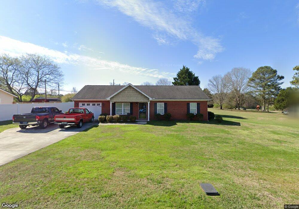
69 Bell Rd La Fayette, GA 30728
Noble NeighborhoodEstimated Value: $205,050 - $240,000
--
Bed
2
Baths
1,092
Sq Ft
$204/Sq Ft
Est. Value
About This Home
This home is located at 69 Bell Rd, La Fayette, GA 30728 and is currently estimated at $222,263, approximately $203 per square foot. 69 Bell Rd is a home located in Walker County with nearby schools including Rock Spring Elementary School and Lafayette High School.
Ownership History
Date
Name
Owned For
Owner Type
Purchase Details
Closed on
Jul 5, 2011
Sold by
Best Land Investments Llc
Bought by
Coulter Carol
Current Estimated Value
Purchase Details
Closed on
May 30, 2008
Sold by
Whitmire Construction Llc
Bought by
Best Land Investments Llc
Purchase Details
Closed on
Aug 1, 2002
Sold by
Borders Mary Elizabeth
Bought by
Whitmire Construction Llc
Purchase Details
Closed on
Dec 7, 1981
Bought by
Borders Mary Elizabeth
Create a Home Valuation Report for This Property
The Home Valuation Report is an in-depth analysis detailing your home's value as well as a comparison with similar homes in the area
Home Values in the Area
Average Home Value in this Area
Purchase History
| Date | Buyer | Sale Price | Title Company |
|---|---|---|---|
| Coulter Carol | $85,000 | -- | |
| Best Land Investments Llc | -- | -- | |
| Whitmire Construction Llc | $6,900 | -- | |
| Borders Mary Elizabeth | -- | -- |
Source: Public Records
Tax History Compared to Growth
Tax History
| Year | Tax Paid | Tax Assessment Tax Assessment Total Assessment is a certain percentage of the fair market value that is determined by local assessors to be the total taxable value of land and additions on the property. | Land | Improvement |
|---|---|---|---|---|
| 2024 | $1,830 | $82,578 | $5,525 | $77,053 |
| 2023 | $1,756 | $77,390 | $4,385 | $73,005 |
| 2022 | $1,657 | $66,633 | $3,801 | $62,832 |
| 2021 | $1,270 | $45,126 | $3,801 | $41,325 |
| 2020 | $1,074 | $36,165 | $3,801 | $32,364 |
| 2019 | $1,094 | $36,165 | $3,801 | $32,364 |
| 2018 | $957 | $36,165 | $3,801 | $32,364 |
| 2017 | $1,193 | $36,165 | $3,801 | $32,364 |
| 2016 | $1,015 | $36,165 | $3,801 | $32,364 |
| 2015 | $1,031 | $34,581 | $2,604 | $31,977 |
| 2014 | $937 | $34,581 | $2,604 | $31,977 |
| 2013 | -- | $34,581 | $2,604 | $31,977 |
Source: Public Records
Map
Nearby Homes
- 0 Veeler Rd Unit 1522679
- 0 Veeler Rd Unit 10628696
- 23 Willow Cir
- 16 Willow Cir
- 11 Willow Cir
- The Pearson Plan at Laurel Ridge
- The Benson II Plan at Laurel Ridge
- The Langford Plan at Laurel Ridge
- The Lawson Plan at Laurel Ridge
- The Piedmont Plan at Laurel Ridge
- The Coleman Plan at Laurel Ridge
- The McGinnis Plan at Laurel Ridge
- The Caldwell Plan at Laurel Ridge
- 15 Willow Cir
- 329 Lynn Trail
- 10180 Us Highway 27
- 1003 Highway N Old 27
- 1370 Old Highway 27
- 701 Bicentennial Trail
- 4654 Us Highway 27
- 59 Bell Rd
- 59 Bell Rd
- 6111 Us Highway 27
- 6111 N Highway 27
- 46 Bell Rd
- 46 Bell Rd Unit 1
- 56 Bell Rd
- 6091 N Highway 27
- 0 Bell Rd Unit 1163667
- 0 Bell Rd Unit 1101770
- 0 Bell Rd Unit 1079964
- 0 Bell Rd Unit 1021094
- 0 Bell Rd Unit 1097409
- 0 Bell Rd Unit 1233634
- 0 Bell Rd Unit 1366261
- 0 Bell Rd Unit 1051527
- 0 Bell Rd Unit 1217132
- 0 Bell Rd Unit 1088506
- 0 Bell Rd Unit 12,13 1079964
- 0 Bell Rd Unit 1012800