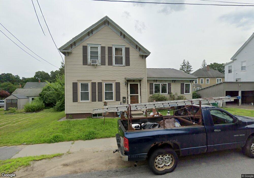
69 Birch St Clinton, MA 01510
Estimated Value: $371,000 - $447,000
3
Beds
1
Bath
1,260
Sq Ft
$326/Sq Ft
Est. Value
About This Home
This home is located at 69 Birch St, Clinton, MA 01510 and is currently estimated at $410,340, approximately $325 per square foot. 69 Birch St is a home located in Worcester County with nearby schools including Clinton Elementary School, Clinton Senior High School, and Clinton Middle School.
Ownership History
Date
Name
Owned For
Owner Type
Purchase Details
Closed on
Apr 12, 2021
Sold by
Strong Joanne M
Bought by
Strong Joanne M and Hasselman Terry F
Current Estimated Value
Purchase Details
Closed on
Oct 26, 1978
Bought by
Hasselmann Francis P and Hasselmann Joanne M
Create a Home Valuation Report for This Property
The Home Valuation Report is an in-depth analysis detailing your home's value as well as a comparison with similar homes in the area
Home Values in the Area
Average Home Value in this Area
Purchase History
| Date | Buyer | Sale Price | Title Company |
|---|---|---|---|
| Strong Joanne M | -- | None Available | |
| Hasselmann Francis P | $24,000 | -- |
Source: Public Records
Mortgage History
| Date | Status | Borrower | Loan Amount |
|---|---|---|---|
| Previous Owner | Hasselmann Francis P | $25,000 | |
| Previous Owner | Hasselmann Francis P | $44,800 | |
| Previous Owner | Hasselmann Francis P | $7,005 | |
| Previous Owner | Hasselmann Francis P | $1,311 |
Source: Public Records
Tax History
| Year | Tax Paid | Tax Assessment Tax Assessment Total Assessment is a certain percentage of the fair market value that is determined by local assessors to be the total taxable value of land and additions on the property. | Land | Improvement |
|---|---|---|---|---|
| 2025 | $4,733 | $355,900 | $101,300 | $254,600 |
| 2024 | $4,381 | $333,400 | $101,300 | $232,100 |
| 2023 | $4,102 | $306,800 | $92,100 | $214,700 |
| 2022 | $4,082 | $273,800 | $83,700 | $190,100 |
| 2021 | $3,692 | $231,600 | $79,700 | $151,900 |
| 2020 | $3,587 | $231,600 | $79,700 | $151,900 |
| 2019 | $3,390 | $212,800 | $77,400 | $135,400 |
| 2018 | $3,542 | $208,600 | $77,400 | $131,200 |
| 2017 | $3,140 | $177,700 | $77,400 | $100,300 |
| 2016 | $3,185 | $184,400 | $77,400 | $107,000 |
| 2015 | $3,082 | $185,000 | $75,100 | $109,900 |
| 2014 | $2,988 | $185,000 | $75,100 | $109,900 |
Source: Public Records
Map
Nearby Homes
- 155 Cedar St
- 30 Henry St Unit 30B
- 101 Woodruff Rd
- 25 Pearl St
- 115117 Mechanic St Unit 4
- 115117 Mechanic St Unit 3
- 93 Forest St
- 459 High St
- 43 Berlin St Unit 411
- 15 Bufton Farm Rd
- 23 Ash St
- 308 Ridgefield Cir Unit C
- 508 High St
- 23 Coyne St
- 57 Clark St
- 109 Oak St
- 2 Eagle Nest Unit B6-2
- 18 Sargent Rd
- 719 Main St
- 46 Woodruff Rd
- 65 Birch St
- 75 Birch St
- 10 Spruce St Unit 2
- 10 Spruce St Unit 1
- 70 Birch St
- 37 Larch St
- 37 Larch St Unit 37
- 85 Birch St
- 85 Birch St Unit 1
- 85 Birch St Unit 2
- 7 Spruce St Unit 2
- 5 Spruce St Unit 1
- 5 Spruce St Unit 2
- 80 Birch St
- 15 Spruce St Unit 2
- 15 Spruce St Unit 1
- 13-15 Spruce St
- 84 Birch St
- 48 Birch St
- 13 Spruce St Unit 1
Your Personal Tour Guide
Ask me questions while you tour the home.